My BlogGing
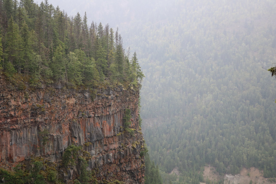
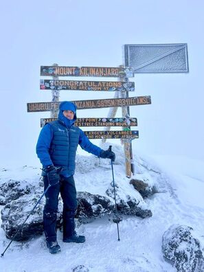 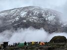 Mission accomplished. Just back from Summiting Mt Kilimanjaro. I’ve included in this post my best memories out of all my pics as well as a daily summary for those interested. If you’d like to see all the daily summaries and pictures feel free to look at on my personal feed. Enjoy! . DAY 1: LEMOSHO GATE – BIG TREE CAMP ON JANUARY 14/2024 We arrived at the main check in area. There were lots of groups present as January is the best month to Summit Mt Kilimanjaro. Both myself and my new friend Godfrey 29 years old a local Tanzanian climbing the mountain his first time proceeded to the lunch area. Our team prepared an amazing hot meal and served us way too much food. Can you say food coma? My lady Nikki knows what I mean. Ha ha! It was an amazing first meal at the mountain before we started. See all the food pics. . As I sat there with Godfrey I started to get to know him as a local young 29 year old man from Tanzania right in Moshi. A accountant trained in university for his familes business. A local hotel I’m actually staying at as well as a hardware store/electronics store and of course a local farm. . Our first leg of the trek was up to Big Tree Camp. Our Guides Onesmow and Gewa led us up a trail meandering through a very lush green rainforest. Maintianing an acclimatization pace. The rain forest was full of birds sounds. It was only 5 km’s so it went by very quickly and we were done in two hours and then we arrived at Big Tree Camp and our porters had set up the camp before we got there. I’m amazed on how fast our porters are carrying two times if not three times the weight of us with great ease it seems and always with a smile on their face when you say Jambo Jambo! (Hello hello) Thing is even with the 30lb pack I had on I still wouldn’t be able to keep their pace. These men and some women too are incredibly strong and fit. . We were not far from camp when a young Tanzanian man came asking both myself and Godfrey for our backpacks. Our guide Onesomow said it’s Tofilli he’s come to make it easier for us to reach camp. That was so nice I thought. Blown away. If anyone knows me I have to do it on my own under my power. I thanked him much and said it is ok I must do under my own power as you guys are already carrying my other gear. . The one thing about Big Tree Camp we found out right away was there are a lot of big black ants and small ants as well that like to climb and bite. So if you ever come make sure your pants are tucked into your socks, or you have gators on and so forth tight so they don’t get in your pants and up your legs and bite. Literally if you stand still for a moment or two, they will be right on you. They were nests all over the place. See the video for both mine and Godfrey’s ant dance. . They got me a few times, but I got them very quickly and that was the end of them. You had to make sure your door was closed to your tent as well or they’d will get in. When I came back to my tent after dinner, everything looked really good, and I started to get changed and so forth and sat down on my mattress And took off my shorts and changed into my pyjamas and noticed there was a huge black ant with huge pinchers attached to the back of my shorts. I tried to pull them off and it was very difficult but I did manage eventually to break him free. LOL Also take note when you put your pants on in the morning. Make sure you give them a good shake. I didn’t do that and then next thing you knew I had a biting sensation on my leg right away that I felt and I grabbed my pants and squeezed real hard and got him. That was the end of that. I did a real good job, shaking my shoes out. When I put them on outside of my tent, the coast was clear, and we were off on the next leg of the adventure. . No rain Exertion level 3/10 30lb pack Trekking Time: 2 hours Distance: 5 km (1 Abby Grind rough equivalent distance and elevation for those that have done it I always gauge everything against the Abby Grind.) Altitude Gain: 454 m. . DAY 2: FROM BIG TREE CAMP TO SHIRA HUT 1 FOR LUNCH THEN SHIRA 2 FOR CAMP JANUARY 15/2024 In the morning first thing at 600am Simon our waiter greets me at my tent with fresh coffee. Just the way I like it. He knows already how I take it strong with honey. From there we pack up our personal items and are sent off after a big breakfast. See my picture for the meals. They are amazing! Definitely 5 star. . Leaving the forest from Big Tree Camp we spotted a Blue Monkey right away. We were on the trail and he was 5’ off the trail eating. See my video. . The trail gets steeper as it enters the moorland zone towards the valley. A gentle grade walk takes you across the high altitude Shira Caldera past Shira Cave (views of Arrow glacier) at 3500 m and then gently downwards to Shira Hut 1 located near a stream on the Shira Plateau. Walking now on high moorland, the landscape changes the entire character of the trek. Yes I’d agree day 2 is a challenging one as you are competing 2 legs of the trek at once when doing the 7 day Lemosho trek. The 8 day Lemosho Trek would be much less strenuous for those that are inquiring. That’s a suggestion. . As we approached camp once again there was Tofilli with a big smile on his face asking for my pack. I said thank you but please take my guides pack Onesmow’s. He did so. I was happy as Onesmow was carrying a few things of mine from the start as he didn’t want me to burn out. He then guided us to our camp as sometimes it can be hard to find. I then nick named him Camp Guide. He smiled and loved it. . No rain Level of exertion 7/10 still had some fuel in the tank. But I was glad it was over. LOL. Trekking Time: 8 hours Distance: 15 km (3 Abby Grind’s roughly equivalent distance) Altitude Gain: 1230 m . DAY 3: FROM SHIRA HUT 2 TO LAVA TOWER 7km’s FOR HOT LUNCH THEN TO BARRANCO CAMP JANUARY 16/2024 Traverse the southwest side of Kilimanjaro, passing underneath the Lava Tower and the final section of the Western Breach to reach Barranco camp (3900 m). It was a slow steady climb to Lava Tower to acclimate. Which was fine for me. Much nicer than the prior day. . We had a nice lunch at Lava Tower served by our waiter Saimon a very gentle soft young man. Looks like our Chef Mathew outdid himself again. Every meal we are served is amazing for being out on a mountain. . The day has been spent at altitude (up to 4600 m), but we have followed the mountaineering code of “walk high, sleep low” to avoid altitude sickness by aiding our bodies in acclimatization. Walking now on high moorland, the landscape changes the entire character of the trek. Traverse the southwest side of Kilimanjaro, passing underneath the Lava Tower and the final section of the Western Breach to reach Barranco camp (3900 m). The day has been spent at altitude (up to 4600 m), but we have followed the mountaineering code of “walk high, sleep low” to avoid altitude sickness by aiding your bodies in acclimatization. . We approached camp and there again was Tofilli asking for our packs. We had actually just reached the Ranger station to sign in so I said it is ok and I gave him my pack. He took mine and Godfrey’s. After we signed in we walked about 200 meters to our camp over technical rocky terrain. . When we arrived at camp our team had finished setting up everything so I had Godfrey assist me in giving out 18 Coffee Crisps and a bunch of dark chocolate to the team to enjoy. They were so happy and appreciative. Such humble and hardworking people. I recognized Tofilli and gave him 2 extra Coffee Crisps he smiled big and put them in his pocket. . 30 mins light rain Felt great at a level of exertion for 3/10. Also so far I was happy no altitude sickness. Our guides were happy. It’s a good indicator for the coming days when we go up to 5895m or 19,341 ft. Trekking Time: 6hrs Distance: 10 km (Just under 2 Abby Grind’s equivalent elevation) Altitude Gain: 724m DAY 4 BARRANCO CAMP- KARANGA VALLEY JANUARY 17/2024 We started the day by descending into the start of the Great Barranco, a big ravine. Crossing over a nice stream then a bridge with more rushing water before the climb. There was some traffic but nothing too serious. It was a very fun climb. Porters would be passing us often using the main trail and also using some side more technical routes. I’d keep seeing the other routes I’d like to climb and mention to Onesmow and Gewa our guides. That is the white mans route I’d say. We go there. They laughed and said dad we stay safe and stay on the main trail. I’m like but man that is what we do in Canada we pick a line and scramble up. It is good. Ha ha. I kept them on their toes a lot as I was full of energy. But they liked it. They played along. They also loved all my questions. I often kept pointing to faint paths white mans route. Sometimes they obliged me other times not so much. . Then we exited steeply, up what has been termed the Breakfast Wall, which divides you from the southeastern slopes of Kibo. It is a climb over rocks, although not technical. Passing underneath the Heim and Kersten glaciers, head ingtowards the Karanga Valley (4000 m) overnight. When we arrived to the fast easy climb sections and we were behind some folks and he looked at me I’d motion that way that way. Ha ha! When I did run in front of Gewa to tease him I’d stop and give him and Godfrey as well as Onesmow some energy gummies. They liked it. We arrived at noon to camp and relaxed the rest of the afternoon and had a nice lunch. . At the end of the night we had our nightly briefing as usual. They take turns each night. Gewa did his usual serious opening and I just busted out laughing hysterically non stop then shortly everyone just couldn’t stop laughing. It was after that both Gewa and Onesmow said to us we have been their most fun and enjoyable clients ever. . 60 mins rain while we rested in our tents Exertion lever 1/10 Trekking Time: 4 hours Distance: 5 km (1 Abby Grind rough equivalent elevation) Altitude Gain: 440m DAY 5: KARANGA VALLEY - BARAFU CAMP ON JANUARY 18/2024 The day is characterized by a short 4km 620m alpine hike on terrain formed by scree to get to base camp. Walkthrough arid land towards Barafu Camp (4600 m), where we had the entire afternoon to rest before ascending towards the summit starting around midnight. . Take notice in the base camp photos the angle of many of the tents. Getting a flat spot for your tent to sleep on is becoming harder and harder. . Once the team was settled in I went around gave them all popcorn one of my favourite snacks back home as my lady Nikki will tell you. They all loved the popcorn. I am finally starting to memorize all 12 of the teams names. Takes a bit. . The team is all so strong at carrying the weight and speed they go. I’ve been watching them. I selected the 2 strongest guys and led them to the dining tent and we sat down one by one and we arm wrested. (Watch the vids for the outcome.). After that my lead guide said he wants me to rest even though more of the team wanted to arm wrestle the white man. LOL. Tomorrow Tofilli and Onesmow want there chance. . 30 mins moderate rain while we rested in our tents. Exertion level 1/10 Trekking Time: 3 hours Distance: 4 km (1 Abby Grind rough equivalent distance/elevation 1.5x) Altitude Gain: 628 m. DAY 6: BARAFU CAMP - UHURU PEAK - MILLENNIUM CAMP ON JANUARY 19/2024 We avoid walking too long in the heat of the sun today by starting around midnight, walking steeply upwards to the summit glaciers. We spent 5 to 6 hours climbing scree gaining incredible height over a short distance. We were 2kms in of 5kms up and I was finding it very easy. Then shortly thereafter my body started breaking down as we climbed higher and higher I needed more breaks to catch my breath. Coupled with the blizzard we were going through and the extreme cold it was still cutting through my 7 lavers over my core and getting to me. We finally reached Stella Point (5750m) after that it was only 1 km but that would be another hour at altitude. normally I’d run that in 5 mins. Hard to comprehend but until you experience it, it can be hard to explain. I slowly made the final trek in with my guides encouraging me like it was nothing for them. They had already switched out one set of batteries out of my gloves to keep my hands warm as they froze because I lent my expedition down gloves to Godfrey who didn’t have the correct gloves at all. I couldn’t have that. By doing that my hands froze in the short time it took me to get them from my bag and take his and put them on him with hot shots. . We finally reached the summit had a quick celebration and a few quick pictures then we journeyed back. Uhuru (5896 m), the highest point; Uhuru means freedom in Swahili. From there once we approached Stella Point the views were spectacular. Spectacular ice cliffs within the Crater surround you, and the views to Mawenzi peak and beyond are breathtaking. . Heading back down the mountain was fast at 2.5 hours. Crazy but myself and Gewa were quite quick going down the snow and loose gravel/dirt/sand. Lots of sliding surprisingly we kept our balance and didn’t fall. I forgot my Microspikes back at camp. But I had my hiking poles and that was enough for me. . When we arrived back at camp my body was already shutting down as I had expelled all my energy to get to the top and then back down. I collapsed into my tent and Dola one of the team came over and insisted on taking my boots off me and 2 of my 3 layers of pants I had on so I could go to sleep for a few hours before we packed up and were to go down to a lower camp. . Siamon came to my tent 3x waking me up to pack up and each time I couldn’t move. Finally unwillingly I slowly packed up and got my things together to make the descent. My guides Onesimo and Gewa knew I had no energy so they carried my back pack down as well as their own. I was spent it was very humbling for me to need help carrying my pack but I didn’t have energy. It’s normal for me after a big hike my body usually shuts down as it’s burnt out so it didn’t surprise me. It was another 4kms to the next came through technical downhill terrain. The team knew I was shot so as soon as they got to camp they set my tent up right away and I crashed in my tent and again Dola was right there helping me. I told the crew no dinner for me tonight. I’ll see you in 12 hours. It was about 400pm. They checked in on me a few times and offered me hot tea and pineapple which I ate over the course between wake ups. . When I woke up in the morning I felt like a new man and I was ready to hammer out the last 12kms out to the main gate. The whole team was surprised how I bounced back after a good rest. Trekking Time: 13 hour day Distance: 11 km (Abby Grind rough equivalent/elevation 3x) Altitude Gain: 1296 m MILLENNIUM CAMP – MOSHI ON 20TH JANUARY 2024 A gentle trek takes you down through the rainforest to the Mweka Gate where you will complete park formalities, you will be met by our vehicles, and receive your certificate of ascent courtesy of the Kilimanjaro National Park Authority. After that, drive back to Moshi, where you can treat yourself to a well-earned shower and a cold beer or two. . We had a very technical and muddy descent. There were literally a 1000 opportunities to hurt yourself on the descent. Very tricky. As I was much faster going downhill our guides broke us up and Gewa indulged me and we went porter speed. Which was much faster than what people typically do. We were passing many people on the way down including porters. Of course they were carrying more weight than myself but we still gave it our all. Porters were smiling as we went and our team cheered us on. . We finished up at the park gate 1hr and 45 mins ahead of the rest of our group. It was a great workout. My guide Gewa took my boots as they were just coated in mud and he had them cleaned by the local boot washers. They came back looking brand new. I was even happier. I looked them over and they were perfect. . Our bus came and we were all happy as the driver pounded some great music. We all sang as we grooved! Was much fun with the new family on the mountain. I thanked them all for helping us reach our goals and showed much appreciation. Both myself and Godfrey aka Jr. . Exertion 2/10 Trekking Time: 3 hrs Distance: 12km Altitude Loss: 2000m If you have any questions about this hike, reach out to Daniel Fedosenko. Thanks for reading... and thanks to Daniel for his guest blog post!
0 Comments
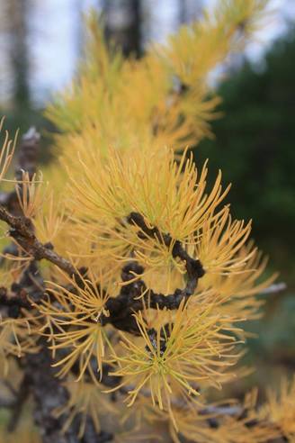
I'm still no pro, but I fell in love with hiking pre-marriage. The hobby then went by the wayside what with a couple of kids to look after, a husband who was out of town a lot, home renos, a recreational property, and so on. Sometimes life just gets busy! After my divorce, I was fortunate enough to meet my BFF — whom I met coming off a hiking trail. She kicked my butt and had me hiking everyday all summer and into the fall with the occasional winter hike. We hiked like mad women! Small hikes, big hikes, crazy hikes, bushwhacking…we hiked almost daily and clocked many, many kilometers. Two things that I’ve always known about myself are that I have a fear of heights and struggle with anxiety; regardless, I go and do as much as I can! Sometimes I reach the summit and sometimes I don’t. It’s never been about the destination for me but rather about the journey. Yesterday I was excited to be invited out to hike Elk Mountain in Chilliwack. I had hiked Elk in the summer a few times and even in the dark for a sunrise hike, so I thought, “Great, I’m in!” Of course, everyone advised that I should bring spikes since the trail was icy and, since my spikes had served me well on previous icy hikes, I thought I was prepared. Little did I know that the ice on Elk was unlike any ice I had encountered on a trail. About 1/4 of the way into the hike, the trail turned to sheer ice. At first I was OK, but as we hiked on, I realized that my spikes were not holding up as well as the crampons that everyone else had on. They did not dig down deep enough into the ice to provide me with the traction that I needed to navigate the slippery slopes. I kept on trucking thinking that maybe it was just my mind that was getting the better of me. I managed to make it almost to the top. If this had been just another summer hike, I would have emerged out of the forest near the top to find a little goat trail with firmly packed dirt that I could use to skip my way up to the false summit and basically consider the hike to be completed. However, as I made my way out of the forest on this particular winter day, I found that the ground was covered in snow and that once dirt goat trail was slick with ice and snow; my heart started racing. As many others do, I find snow to be unpredictable. Not only did the sight of the trail creep me out, but I quickly glanced back and saw the steep hill behind me and began to panic. I couldn’t help but think, ‘How can I navigate this trail with a steep drop off and how will I get back down the mountain if my spikes have not been the best?” I felt trapped. This (picture) was the viewpoint on Elk that I had reached. I snapped a quick picture, and then my mind started racing with fearful thoughts. My breathing was becoming labored, and I had to make an executive decision to turn around before I got too much farther up the goat trail. I had experienced panic attacks on other hikes, and I was able to identify this one before it became too severe. I knew that I should encourage the others in my party to continue to the summit while I turned back. Once I got back into the forest to a safe point, I sat and drank my coffee, had a bite to eat, took a deep breath, and then began my descent down the mountain. I had to stay off the trail as it was a sheet of ice and, as mentioned, my inadequate spikes were of little use at this point. Gravity was against me, and I ended up sliding on my bum a few times which left me wondering how I would stop if I gained enough speed. I dug my heels in, got up, and carried on. I slipped and fell a couple more times, which afforded me some lovely bruises the next day. Many on the trail offered help in several ways, and I’ll be forever grateful to them. I’m thankful for the kindness of strangers who saw someone in need and stopped to see how I was doing. I continued to go slowly and saw that I was making progress. As much as I tried not to, I got in my own head a few times and shed a few tears about the fact that I didn’t make it to the top but still did the hike as best as I could. I was embarrassed but proud of myself at the same time. After slipping and sliding my way down for quite some time, I entered a part of the forest where the trail turned from ice back into dirt. At this point, I knew I was safe as I was almost all the way down, and I could take all the time I needed to safely return to the parking lot and the warmth of my car. Hiking Elk in the winter Is a whole new ball game, which I learned the hard way. I wanted to encourage other hikers, whether beginner or pro, to know your limits and be prepared (bring really good spikes, unlike me - lol!) Sometimes you will have to turn back before reaching your destination, but remember that if you get out and only make it part of the hike... you’ve already won! Heather  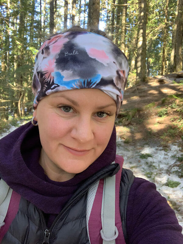 I'm far from an expert when it comes to hiking. However, I have a few years under my belt and what I know is you must respect nature and never take her for granted. I am also not one for hiking alone but these days hiking with friends seems to be a bit confusing with should I should I not due to our Covid restrictions. So I hiked alone today. Well sort of. I brought my big scary husky dog. I felt safe with her. So these are the things you should do while hiking alone: 1) Complete a trip report. www.adventuresmart.ca/tripplanning/tripplan_a.htm 2) Carry your ten essentials. Including extra batteries for your head lamp, good shoes, layers, extra food & your phone with a battery pack ++. 3) Choose a popular trail that you know well. 4) Check the weather forecast before you set out. 5) I never tell anyone I am alone on the trail. If asked I say my group is ahead. Today was my second time on the trail alone. I probably wouldn't do it on just any ole' trail. So I choose one I have done many times and one that I know is loaded with people. I just knew I had to get outdoors. These are trying times for all of us around the world. For me I need nature time. It is vital for my mental health. I am safe and always think of our Search and Rescue volunteers. I am no way encouraging you to hike alone. If you do decide it's for you then follow the steps above. Safe hiking always... 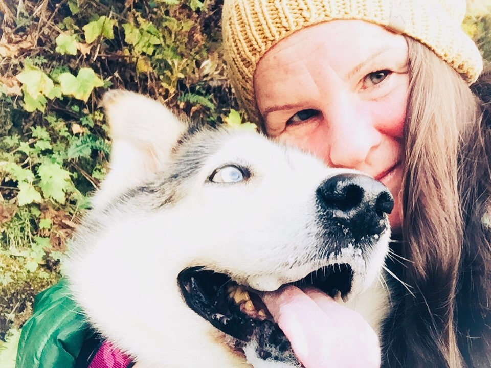 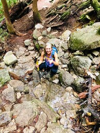 Since I was a child I remember having a fear of heights. It was who I was; I thought to myself, guess I’m stuck with it! Well true, I was stuck with it until I had no choice but to push that plunging fear of heights directly off a cliff and say I’m done with this BS. The fear of heights gradually became worse as the years went on into adulthood and especially after I developed anxiety from a traumatic divorce. What topped it off and brought it to now a fear of driving over bridges, was a trip to beautiful Hawaii with my Mom. You’re probably wondering why relaxing in Hawaii would cause me to become worse....Have you ever heard of The Road to Hana?? It’s a long road that stretches miles along a cliff with breathtaking views of the plunging ocean below. It’s also one of the most dangerous roads in the world. So I decided to rent a Jeep with my Mom and drive the coast with the music playing and wind in our hair. Well that was until my anxiety and fear of heights got the better of me and I passed out driving and nearly drove us off a cliff. My Mom was quick with her reflexes and she managed to pull the emergency brake. So this brings us to present day. How the hell can I be a hiker in BC with all these mountains? It paralyzed me. I couldn’t be where my heart and spirit needed to heal, which was on top of a mountain with those beautiful views and freedom. When I met my boyfriend who is the most patient man I know, he never stopped encouraging me and believing in me. It was the determination in him that made me fight like hell to conquer this fear. If he could believe in me than why couldn’t I believe in myself. So I started climbing those mountains again slowly but never getting too close to the edge. Until one day something snapped inside me while hiking, The Chief in Squamish. I was determined to climb all 3 peaks and I wasn’t taking the easy way either. My boyfriend could see me shaking my head saying, “no f**king way” and he didn’t think at that point I was going to climb that ladder and chains but I couldn’t let him or myself down. I marched right up and I started climbing, I didn’t stop, I didn’t look down or to the side, I cried silently while I did it and I made it to the top. It was at that moment that I broke down crying with so many emotions. I was so proud of myself, so thankful he didn’t give up on me, so thankful I didn’t give up on myself. It was at that moment that I knew that this is only in my head and I’m a prisoner if I allow these fears or any fear define how I am going to live my life. It’s quite ironic that I HAD a fear of heights but my favourite place in the world is on top of a mountain. We all have fears that are keeping us from being who we really are or who we are meant to be. It’s time to face them head on. Be brave. Be courageous. Don’t give up on yourself because you’re amazing and you can do it!! It's Almost that golden time...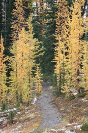 Larches 2018 Frosty Mtn Manning Park Larches 2018 Frosty Mtn Manning Park One of my most favorite times of the year is seeing the Golden Larches. It's eye dropping beauty. What's a Golden Larch? Picture this...Blue skies, mountain air and trees draped in gold. These trees are part of the Pine Tree family but are found high on top of some mountains. They are 2000 years old. The trees needles change colour each season for a short time before falling off and leaving the ground in a rich gold carpet. You could even say a bright yellow. It is one of the most beautiful trees to see. Each year I make the time to see these trees and each year they take my breath away. So do you wanna see these trees? Here's two great spots. Frosty Mountain-Manning Park: 16 km's return/800 m elevation Park at Lightning Lakes, walk past the pit toilets and cross the dam bridge. You will see the trail to Mt. Frosty. It is a gentle constant climb as you zig-zag and switchback your way for the first 2 km. There are a few glimpses of Lightning Lakes down below. For the next 2 Km's the trail is on a 45 degree angle, is skinny at times and one side is wide open. Once at the 4 km's mark it becomes quite flat through the Wilderness Camp. There's a pit toilet at the camp and a few areas to rest. Have lunch or a snack and the Whiskey Jacks will gladly share your lunch. After the camp it's about 10 minutes to the Frosty Mountain sign post and its here as your turn the corner and you'll be treated with your very first Golden Larch. They just keep coming. Keep walking through the meadows to the 8 km's mark. On your right side there are valley views and Frosty inviting you for a summit. It's only 2 km's more to the top. The wind whistled, rocks tumbled down the valley and the Larches were magical. This hike is best done on a snow, frost free & blue sky day. Timing is everything but if you miss The Larches there's always next year. Blue Lake: Northern Cascades, USA-2.2 miles/ 7 km's/1100 ft/320 m elevation Start off on a wooded bridge with Blue Jays chirping you on. Dirt path followed by a wood bridge. Along a twisted path to another wood bridge. Again on a dirt path. Boardwalk and wood bridge dirt path. Series of boardwalks and in between dirt paths Just keep going as the trail passes rocks and then to an open view with Larches on the slopes don't forget to turn around as you look st the snow covered peaks. Once back in the forest the trail continues on dirt. Soon one Larch appears and then two and three along a rocky area. Larches like rocks and slopes. Soon after the views pop open with tons of mountain views. If it has snowed yu may need MICROspikes as the trail gets icy and there are some spots where you could fall down the slope. The lake comes into view. You can stay right for an upper lake view or go left and sit on the rock where Whiskey Jacks and little chipmunks come to visit. Don't forget to check out the tired old cabin at the entrance to the lake. 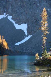 Larches: Blue Lake, USA The hike up Frosty Mountain is a little longer and steeper but closer to get to. There's also the option to carry onto the summit of Frosty Mtn for an additional 4 km's return. The hike at Blue Lake is a little easier but a longer drive. A very beautiful drive through the Northern Cascades. You'll need a passport. You also have the option to drive a short distance to a lookout after that pretty stunning. Whichever hike you choose make sure you go. It's my favorite time of the year. The air is crisp and the colours are ah-mazing! Soon the Larches will turn and your window will about about three weeks to see them. Watch for my posts, it's almost Larch time. Happy & safe hiking. Other Larch hikes in B.C. www.hellobc.com/stories/finding-golden-larch-british-columbia
Winter hiking can be the most beautiful place to be. The snow glistens and sparkles, there’s frozen waterfalls and icicles and my most favorite are Seussical looking trees from the heavy snow. Yes, winter hiking/snowshoeing is magical, but the mountains are unforgiving, and you should be prepared. The ten essentials should always be in your pack.
Hiking & snowshoeing should be fun but always respect nature. 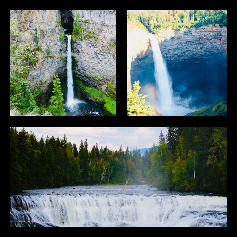 If you could go anywhere I would highly recommend Wells Gray Provincial Park. It was a fantastic road trip. We packed up my boyfriends truck with all our gear in totes in the back. With the seats folded down it made a nice bed area for my two Huskies. Starting from the Vancouver we made our 451 km journey along the Trans Canada Highway (#1) and branched off to Highway 5 (Coq Highway) passing through many sights to see. We arrived in Kamloops and made our way to the Wells Gray Provincial Park. The first set of falls are well before the official park gates which are at 35.8 k. Stop in town at the Visitor Center to grab maps of the park area. Top left: (10.8 km's) Spahats Falls are the first Falls you’ll see. It’s a 5 minute walk but there are trails around to make it a little longer. They are 141 meters high by 23 m wide. They are sitting deep in the canyon. Can you lean on the gates to get a good look at the canyon far below? Bottom: (40.8) Dawson Falls is a 10 minute easy walk. It drops only 18 m but it’s impressive 107 m wide and is what draws you to its beauty. Don't forget to check out two viewpoints and walk the trail loops around it. Top right: Hemcken Falls is a 2 minute walk. They were my most favourite falls in Wells Gray. These falls cascaded an impressive 73 m high by 8 m wide. You could barely hear them crash down. It was truly stunning. There is also a loop to complete here. Make sure you go to the wooden view point to get a closer look. Don’t forget to check the many falls along the way. First, Second and Third Canyons which are found on some of the bridges you cross. There are also many hikes you can do within the park. There’s two camp grounds and a FSR you can stay at. The camp grounds range in prices and the FSR is free. The day areas are not for camping and roadside is crown land so no resting there. It’s a beautiful park. I highly recommend it. We drove from The Vancouver area via the Coq Highway to Kamloops, Barriere, Little Fort & Clearwater. We came back through Clearwater, Little Fort, Barriere, Lillooet, Lytton, Boston Bar, Spuzzum, Yale, Hope and home. It made the trip back a little different and we saw tons of beauty. It was a fun 2 day road trip. There are tons of trails to explore in Wells Gray Provincial Park. Here's a few: -Trophy Mountain: 45 minute hike into the meadows. -Moul Falls: Roundtrip 5 km -Ray Farm: 3.9 km loop -Bailey's Chute: 4.1 km loop We will return next year to fully explore this stunning park. 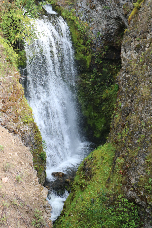 Third Canyon Do you want to get healthy and fit? Do you keep saying next month…next year? This is your year, your ‘me’ time to get healthy. Commit yourself to a mile a day each day by walking, riding a bike, snowshoeing, hiking or cross-country skiing. Spending time outdoors has been proven to boost your energy while improving your mood, self-esteem and lowering your stress levels. It’ll be super easy with a bunch of new friends to encourage you throughout the year. Here’s some benefits to joining the challenge:
This is an amazing community of uplifting people who are encouraging and will help you reach this goal. You feel better about yourself and the health benefits will alone be worth it. Make 2018 your year to take time for yourself. Do it for you, I call it self-care. It all starts January 1st. Let’s lace up our boots or runners together and stroll our way to the 365 mile finish line. For more info and to sign up, click here: hikelikeawoman.net/product/365-mile-challenge-membership/ 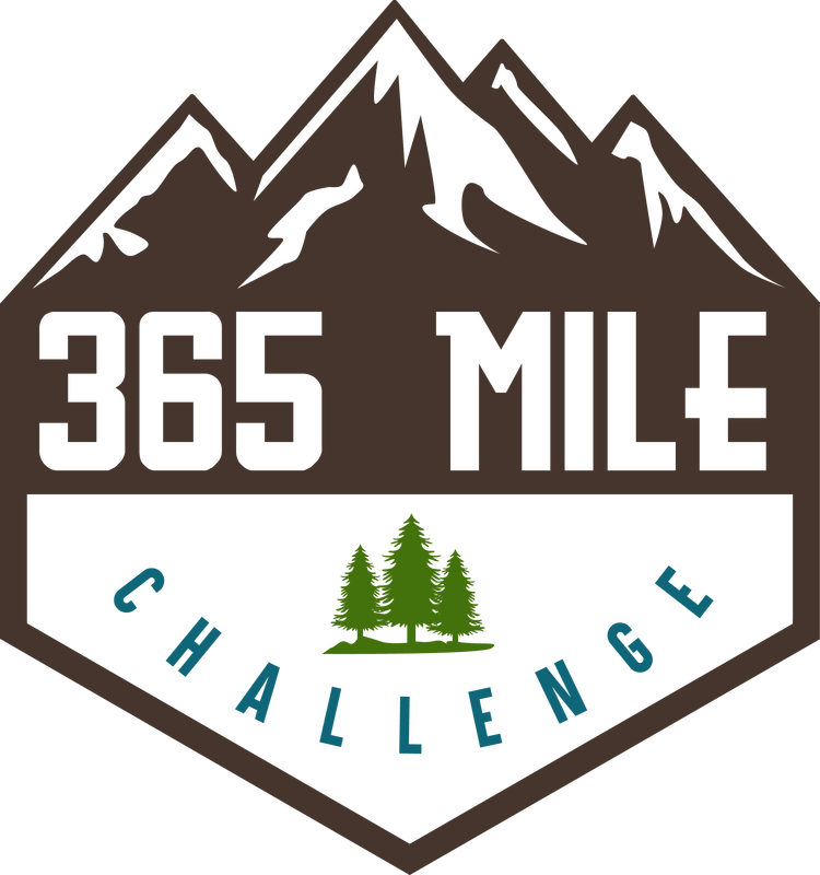 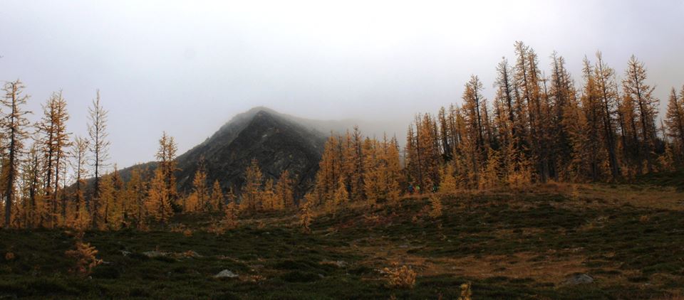 Have you ever seen a tree so golden in colour; so spectacular that you go back each year to see it all over again? Fall colours in the mountains are quite dramatic; oranges, red’s and yellow’s. Vibrant and amazing colors and with cooler temperatures and less bugs it makes fall a perfect time to hike. My all-time favorite autumn hike is the Golden Larches. Their preferred location is dry, high, rocky and cold so each year I climb Frosty Mountain in Manning Park, BC Canada to see these beauties. It’s a small window to see these 2000-year-old remarkable trees. If you miss it, it will be a golden carpet below your feet and you will have to wait a whole year to see them. The climb is well worth it as their beauty is a red-carpet affair. These Larches are conifers and part of the Pine family. The alpine Larches, found 2000 meters high in the mountain tops, are deciduous trees and each autumn they lose their needles but not before turning a bright golden colour. It’s truly a sight to see. You never know exactly when their colours will be prime. It’s usually end of September and or beginning of October. I once heard it called “Larch Madness.” During this time the trails are busy but still worth the trek. You don’t have to travel to Canada to see them though. They are found in the Cascades and Rockies too. Some of the hikes are not tough as you can drive part of the elevation. Just get out and find your own yearly Larch hike. It’s worth every single step. Lori Roberts aka Hiking for the Scaredy Cat, works in Surrey, BC Canada as an Education Assistant working with special needs students. In her spare time, she hikes & snowshoes in Whistler, Squamish, North Vancouver, Hope, Manning Park, Chilliwack and Washington and blogs her twisted trails at www.hikingforthescaredycat.com. She is also on Instagram, Twitter and FB. She has two Huskies and often takes them up the many Forest Service Roads in the lower mainland for fun adventures. “I’m really enjoying my role as an 2017/18 Ambassador for Hike Like a Woman. I’m thrilled and honored to have been one of twenty chosen out of two hundred who applied. It’s a dream come true! I look forward to the next year inspiring people to get outdoors and experience what nature has to offer. Happy & safe trails” “Delicious autumn! My very soul is wedded to it, and if I were a bird I would fly about the earth seeking the successive autumns.” George Eliot
|
Author.I work for Surrey School District as an Education Assistant. In my free time I enjoy hiking, snowshoeing, going off-road, dragon boating, writing & hanging with my huskies. Archives
March 2021
Categories |

 RSS Feed