Hiking for The Scaredy Cat: Hikes in and around Vancouver, B.C. Canada
  • Trail Information
    • The Hiking Trails & Safety Information >
      • Abby Grind: Abbotsford
      • Alder Flats: Golden Ears
      • Alouette Mtn: Golden Ears Provincial Park
      • Ancient Cedars Trail
      • Al's Habrich Ridge Trail: Sea to Sky Gondola
      • B.C.M.C. Grouse Mountain
      • Bear Mtn: Mission, BC
      • Big Cedar & Kennedy Falls: Mount Fromme
      • Blue Mountain:Coquitlam
      • Bosumarne Falls: Chilliwack, BC
      • Bowen Lookout:Cypress Mountain
      • Bridal Falls Lookout: Chilliwack-Agassiz
      • Brother's Creek: North Vancouver
      • Community Forest: Chilliwack
      • Community Forest-Gloria Lookout-Mt. Thurston-Elk Mtn-Chilliwack
      • Coquitlam Crunch: Coquitlam
      • Cheakamus Lake: Whistler
      • Crystal Falls: Coquitlam, BC
      • Dewdney Grind: Mission
      • Diez Vistas: Buntzen Lake
      • Dragon's Back: Hope, BC
      • East-West Connector Bridge Trail~Golden Ears Provincial Park
      • Eaton Lake: Hope
      • Elfin Lakes: Squamish
      • Elk Mountain: Chilliwack
      • Evan's Creek: Golden Ears Provincial Park
      • First Peak: Seymour Mountain
      • Ford Mtn: Chilliwack
      • Grouse Grind: West Vancouver
      • Garibaldi Lake: Squamish
      • Harrison Grind/Campbell Lake: Fraser Valley
      • Harrison Lookout/Fire Tower
      • Heather Trail: Manning Park
      • High Note Trail: Whistler
      • Hillkeep: Chilliwack
      • Hope Lookout Trail
      • Horne Lake Caves Provincial Park: Vancouver Island
      • Jacobson's Lake to Palmer Pond
      • Joffre Lakes: Pemberton
      • Jug Island: Belcarra Regional Park
      • Ladner Creek Train Trestle: Coquihalla Hwy
      • Killarney Lake: Bowen Island
      • Lake Lovely-Squamish
      • Larch Meadows: Manning Park
      • Levette Lake Loop: Squamish
      • Lewx Qwo:m (luhw KWOM): Chilliwack
      • Lindeman & Greendrop Lakes: Chilliwack
      • Lightning Lakes: Manning Park
      • Lindsay Lake Loop: Buntzen Lake
      • Little Douglas Lake: Coquihalla Summit
      • Lower Falls-East Canyon Parking Lot: Golden Ears
      • Lynn Loop: Lynn Headwaters Regiona Park
      • Lower Hollyburn: Cypress Mtn
      • Lynn Peak: Lynn Headwaters Regional Park
      • McKee Peak-Cliffside Caves
      • Mehatl Falls
      • Menzies: Golden Ears Provincial Park
      • Minnekhada Park: Coquitlam
      • Mount Cheam: Chilliwack
      • Mount Fromme: North Van
      • Mount Sleese to Memorial Plaque: Chiliwack
      • Mount St. Benedict: Mission
      • Mount Strachan: Mount Seymour
      • Mt. Thom: Chilliwack
      • Mt. Gardner: Bowen Island
      • Mt. Woodslide
      • Munro & Denette Lakes: Coquitlam
      • Mystery Lake: Mount Seymour
      • Needle Peak/Flatiron: Coquihalla Highway
      • Norvan Falls: Lynn Headwaters Regional Park
      • Othello Tunnels-Nicola Valley Loop
      • Parkhurst Ghost Town: Whistler
      • Panorama Ridge: Squamish
      • Petgill Lake: Howe Sound
      • Poland Lake-EC Manning Park
      • Quarry Rock: Deep Cove
      • Ravens Bluff-Mission
      • Red Mountain: Mission
      • Salmon Ridge Trail: Chilliwack, BC
      • Sandy Cove Trail: Harrison Hot Springs
      • Sasquatch Caves: Hope
      • Sea to Summit: Sea to Sky Gondola
      • Skyline: Grouse Mountain
      • Skyline 1: Manning Park
      • Spirit Caves-Yale, BC
      • St. Mark's: Cypress Mountain
      • Statlu Lake
      • The Stawamus Chief: Squamish
      • Tikwalus Trail: Spuzzum
      • Trickle Creek Treehouse
      • Thacker Mountain Trail: Hope
      • Tunnel Bluffs: Howe Sound
      • Vedder: Chilliwack
      • Watersprite Lake: Squamish
      • Wedgemont Lake: Whislter
      • Wells Peak
      • Widgeon Falls
      • Williams Peak
      • Windy Joe: Manning Park
      • Woodland Walk to Sawblade Falls
      • Zoa Peak: Coquihallia Hwy
    • The Snowshoe Trails & Safety Info >
      • Artist Point
      • Bowen Lookout
      • Dog Mountain: Day
      • Callaghan Valley
      • Dog Mountain: Night
      • Eagle Bluffs
      • Elfin Lakes to Red Heather Hut >
        • Fat Dog
        • First Pump
        • Hollyburn
        • Lightning Lakes Loop
        • Rainbow Lake
        • Sasquatch Mountain Snowshoe: Hemlock Valley
        • SS Grind
        • Stawberry Flats
        • Zoa
    • The U.S.A. Hikes >
      • Blue Lake: Northern Cascades
      • Chain Lakes
      • Damfino Lakes
      • Deception Pass State Park: Washington, USA
      • Oyster Dome
      • Yellow Aster Butte
    • The Trail Walks >
      • Aldergrove Regional Park: Aldergrove
      • Blue Heron Reserve: Chilliwack
      • Brae Island: Fort Langley
      • Burn's Bog: Delta
      • Burnaby Lake Loop: Burnaby
      • Campbell Valley: Langley
      • Cathederal Grove: MacMillian Provincial Park:
      • Delta Watershed
      • East Sector Lands: Harrison Hot Springs
      • Elgin Park: Surrey, BC
      • Green Timbers: Surrey
      • High Knoll Park: Surrey
      • Houston Trail: Fort Langley
      • Katzie Marsh Loop: Pitt Meadows
      • Lower Falls: Golden Ears: Maple Ridge
      • Lower Seymour Conservation: North Vancouver
      • Lighthouse Park: West Vancouver
      • Mud Bay: Surrey
      • Redwood Park: Surrey
      • Reifel Bird Santuary: Delta
      • Rice Lake: North Vancouver
      • Richmond Nature Park: Richmond
      • Rolley Lake: Mission
      • Ruth Johnson Park: White Rock
      • Sasamat Lake: Port Moody
      • Spirea Trail: Golden Ears
      • Sunnyside Urban Forest: Surrey
      • Serpentine Bird Santuary
      • Shoesmith East Trail Loop: Maple Ridge
      • Spirit Trail: Ladner
      • Stanley Park Seawall: Vancouver
      • Sye'xw Cho'teqw Adventure Park
      • The Jetti: Iona Beach, Richmond
      • Tynehead
      • Yew Lake
  • My Blogging
  • Jorullo Bridge Hiking Tour Puerto Vallarta, Mexico
  • Mt. Kilimanjaro
  • In the River Valley Hikes
  • West Coast Trail
  • Peru
  • Hiking Snapshots
    • Thru Hikes
    • Bears & Cougars +
    • Proper Hiking Footwear
    • Trail Etiquette
  • Blog

My  BlogGing

Picture

Liumchen/Church Range with Old Baldy Peak and Liumchen Lake

6/26/2015

0 Comments

 
Picture


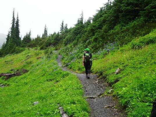
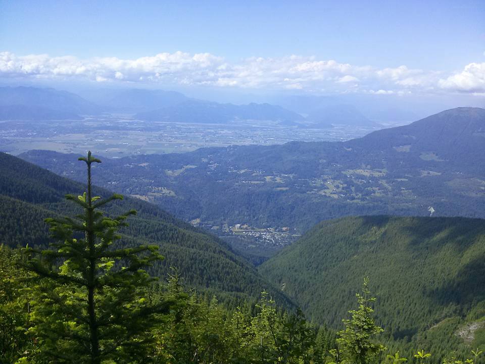
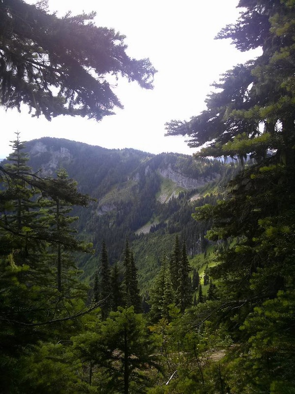
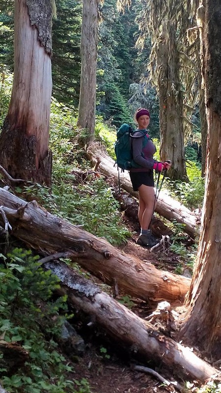
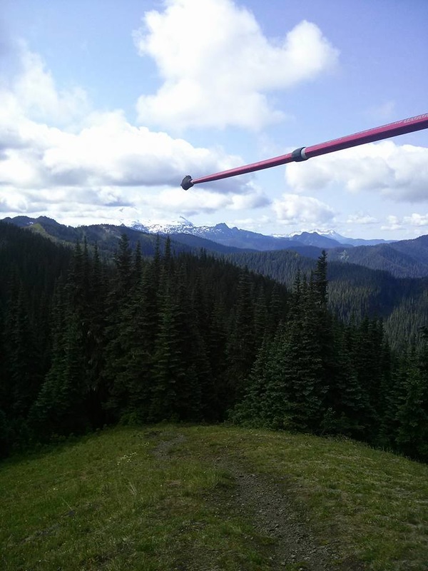
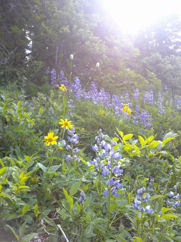
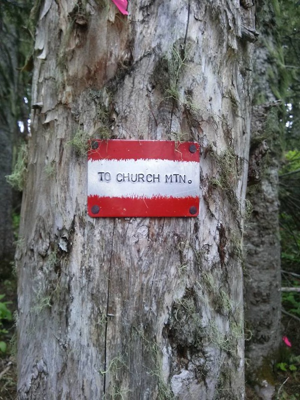
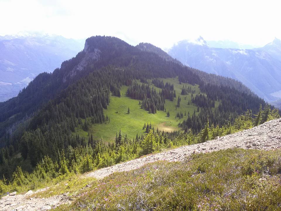
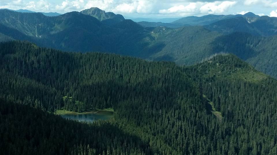
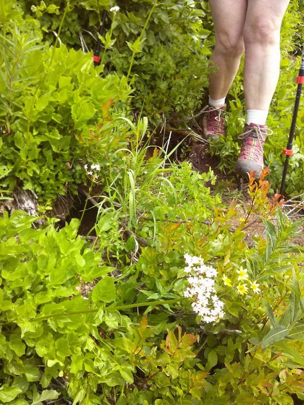
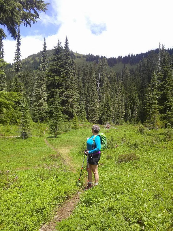
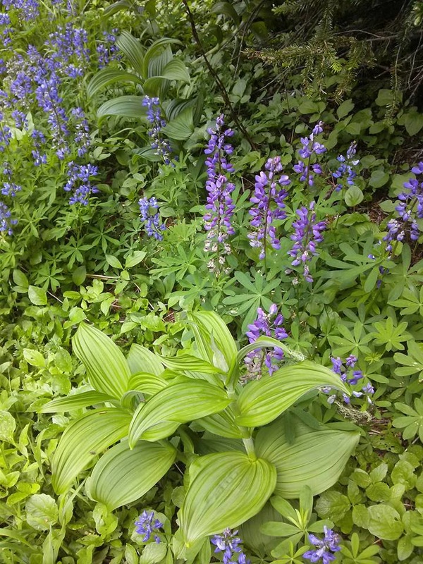
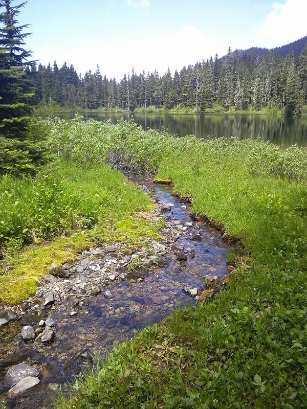
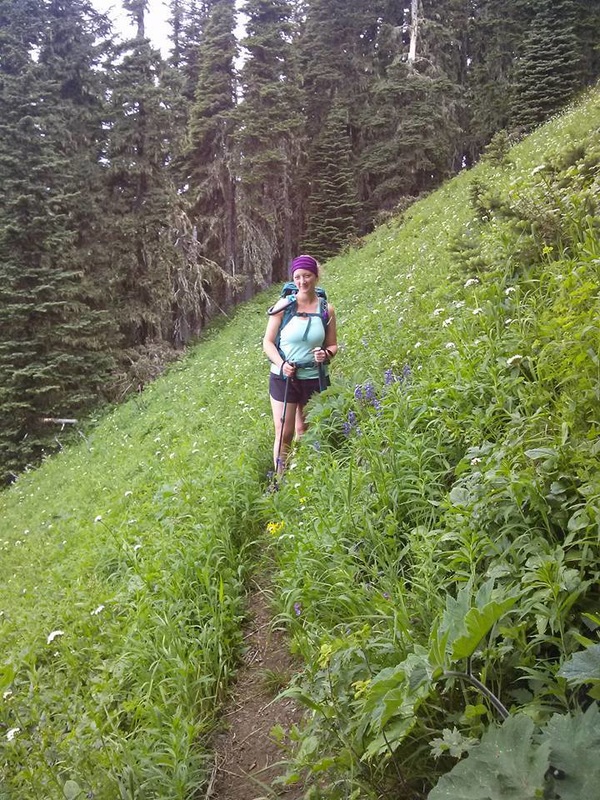
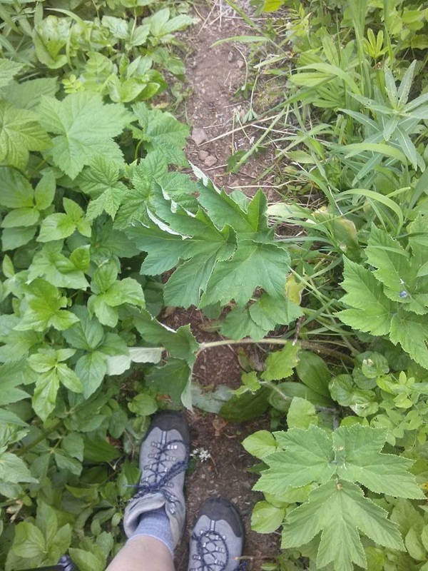
"Lover of life. Seeker of adventure. Appreciator of all things beautiful."

Emily Sayward

Emily Sayward is a single working mom. When not working you'll find her outdoors spending quality time with her son soaking in the beauty that nature offers. Look for future guest blog posts from Emily...
ROAD/DIRECTIONS:

From Chilliwack, drive towards Cultus Lake. Drive through the town, and then turn left on Sleepy Hollow Road. Set your odometer to 0 here. Sleepy Hollow Road turns into Vance Road and then into the Chilliwack-Liumchen West forest service road at .9 km.

Keep left at 4.4 km when the Chilliwack-Liumchen West FSR veers off to the right. AT 5.8 km, keep right and climb for 7.5 km. You'll have to leave your car here, or if you have a 4x4, take the right branch here and climb the last 1.9 km to an elevation of 1440 meters at the trailhead.

A friend had told me ahead of time that you need a 4x4 to get to the TH. While we were driving I kept thinking that was silly – my little Corolla could make it no problem! BUT, I now see what she meant. The last 9 km are rough. Clearance is needed without a doubt as there are deep potholes and large rocks scattered throughout the trail. The road winds up and the higher it goes, the steeper it gets. An AWD may get you there, but even at that I’d be hesitant. Take a 4x4 if you can. You won’t regret it!

The road is very narrow in places with room enough for only one vehicle. Remember that this is a heavily used ATV area so take the corners slowly and we honked as we were approaching to be extra safe smile emoticon

TRAIL:

At the end of the FSR there is a parking lot where you will find the trailhead. The first 1.5 km (45 min approx.) of this trail climbs pretty steeply. There are some beautiful views of the Chilliwack valley and range just before you head into the forest. The trail then heads into the trees and you follow switch backs up to the top of the ridge, bringing you to a lovely lookout on the first bump of the ridge called "Windy Knob" (WK) at which you will be rewarded with a breathtaking view of Mount Baker and the surrounding ranges.

From this lookout, the trail descends and leads you below the ridge (and then drops a couple hundred metres to Liumchen Lake itself if that’s where you’re headed) Allow another 1.25 hours to the lake from this point. The trail is very easy to follow but very narrow. Though it’s not difficult in terms of incline, the trail you’ll take down into the lake valley is never more than 2 feet wide. More often it’s just wide enough to get one foot in front of the other. In addition, there is significant foliage pouring over the trail which is sharp and scattered with giant hogweed and thistle, so pants or gaiters are very recommended. The trail is loose and for some of the time has a steep drop on the outside edge. Balance and sure footing is a must. Take it slow. Don’t let kids run too far ahead.

What we decided to do was follow the trail past Windy Knob and take a turnoff at the split (about 20 minutes from WK) marked “Church Mt.”. If you plan on taking this route, keep your eyes open. The marker is on a tree and is only about 4 inches wide so it’s easy to walk right past it! We followed this trail as it skirted around the base of and unnamed ridge and ascended to a beautiful exposed peak called Old Baldy. This peak is north of Mt. Liumchen, north east of Liumchen Lake, and west of Church Mt.

We hung out on the peak for awhile, taking in the views. It’s a great place to stop for lunch (and set up a camp if you want to stay over). From Old Baldy, we descended south west over the side. There was no trail so we made our own switchbacks. This was very rough terrain: I would estimate a minimum 45% grade (steeper near the peak, gradually leveling out near the base), the brush/foliage was tall (almost to waist) and was stiff and scratchy on exposed legs and arms, the ground was loose and full of marmot holes, and it was all scattered with hog weed and thistle. It took over 45 minutes to descend to the bottom of the peak and we were stiff, scratched and sore by the end of that section!

At this point we worked our way north down mid-grade switchbacks and through large meadows to eventually join the trail to the lake. We hiked the slowly descending trail to the lake. Surprisingly we were all a bit unimpressed with the lake. Though it gets great reviews, I found there was no shore to sit on and the ground was wet and boggy. The water was brownish and definitely not tempting me to jump in. The mosquitoes were bad, and we had just come across 6 large fresh piles of bear scat, so we were anxious to see the lake and then get the heck out of there smile emoticon

From the lake back to the trail head was about 2.5 hours with a slight but steady incline up to Windy Knob and then back down the switchbacks to the TH.

ADVANTAGES:

The highlight for me for this trip was the wildflowers. They are in full bloom right now! Lilies, Columbine, Daisies, Lupines, Fire weed and more! The wide expanse and views were breath-taking. It’s neat to be on top and look around at other peaks knowing I’ve been on the tops of many others. They look so different from that perspective.

This range offers such diversity: the trail is steep, then flat, wide(ish), then narrow, switchbacks, then wide open meadows, etc. I also liked that in over 7 hours of hiking we only ran into one family. That quiet and peacefulness is something you won’t find on Elk or Cheam this time of year!

STATS:

If you chose to hike straight to the Lake, allot about 6 hours for your 10km return trip. It is rated at a 3% grade (the first section is very steep but there are also large sections of flat walking so overall it’s not a steadily steep hike)

I have researched extensively and cannot find stats for the Old Baldy, Mt. Liumchen range route that we took. I would estimate 14 km from the TH to peak, to lake, finally back to TH with a higher percentage grade of incline. But again, it’s not all uphill - It’s up and down the entire time.

RECOMMENDATIONS:

- I didn’t particularly like the route we chose doing both the peak and the lake. I would recommend one or the other. If doing the peak, take more time and explore Church or further on to Liumchen Mt. (As far as I understand, there is no established trail to Liumchen Mt. peak, but not to say it’s can’t be done)

- Though I haven’t seen it myself, I hear it’s beautiful in the fall/spring with snow, though can be very windy and cold.

- This area is known for bears. Make sure you take appropriate precautions.
I will definitely do this hike again but next time will explore Church or continue on to Liumchen Mt.

- I found that the temperature changed a lot. I have never changed more often during a hike – from tank to sweater to down jacket back to tank, etc. Make sure you bring several layers!

Any other questions? You are welcome to email Emily at [email protected] and you can follow her on other adventures here:
https://instagram.com/emily_sayward/
0 Comments

Scaredy Cat's Trail of Treasures

6/1/2015

9 Comments

 
Picture

So it's a treasure you seek? What could be more fun then hiking and looking for a treasure while doing so? Similar to Geo-caching but you're taking and you don't have to give back. Pretty little gifts, for you to enjoy or give away!

This spring and summer of 2015 follow my footsteps as I give you the clues to find the different hidden treasures within the trails I've visited. Some will be easy and some tough. If you find 3 or more hidden treasures...take a picture of you and your treasures; send it to me & you will receive a Scaredy Cat buff.

Good luck! Happy & safe trails.

Clue #1:
Levette Loop: Squamish~
Walk up a snaky path...On your right giant rocks look down at you. A skinny tree with a red trail marker greets you. A crevice in the tree; where moss & leaves don't belong, is the treasure you seek!

Clue #2:
Lighthouse Park: West Vancouver~
Walk along Valley Trail to Lighthouse Lookout. From here you'll see there's no access to the beach. Walk down the rocky knoll to a path surround by park houses. There you'll see a rocky path down to West Beach. On the path, three Arbutus Trees greet you. Next to them is a tired bent tree...Here in that tired tree is a crevice and the treasure you seek!

Clue #3:
Pankhurst Ghost Town: Whistler
On the trail in the beginning you'll come to a branch...Go right down the trail and carefully cross the tracks where you'll see flagging tape. In here in a beaten cars wheel base is the treasure you seek.

Clue #4 & 5:
Ancient Cedars Trail: Whistler

#4-A snaky rocky path with elevation & tall rocks to the right...on your left is a hollow tired tree and the treasure you seek.

#5-Among the great ancient Cedars three, there's a perfect shoe size foot hole to boost you up high in the tree. In the foot hole is the treasure you seek.

Clue # 6 & 7:
Harrison Grind:Harrison

#6-A creek crossing and shortly after a 10 ft washed out trail that goes down a bit and not long after a mossy covered log on your right with a split in the middle is the treasure you seek. FOUND: May 17, 2015  

#7-At the heli pad is a soggy tired stump. Peel away the bark and deep inside is the treasure you seek.

Clue # 8:
Elk Mountain:Chilliwack

#8-At the 2.5 Km's sign post...at the base of the tree is a crevice and the treasure you seek.

Clue #9 & 10:
Tikwalus Heritage Trail: Spuzzum

#9-At the Chief Pahallak lookout...there's a knot in a nearby tree, this is where you'll find the treasure you seek.
#10-At the camp you'll see a Bluffs Route sign post. It is here where you'll find the treasure you see.

Clue #11:
Mount Fromme: North Vancouve
r
At the true south summit sits a tired ole' summit sign post nailed to a tree. It is here, attached on the nail, the treasure you seek.
*Found twice and put back both times*

Clue #12:
Cypress Bowl Lookout: West Van

A the end of the rock wall near the washroom under a large rock is the treasure you seek.
FOUND: May 18, 2015

Clue #13:
Petgill Lake: Howe Sound

At the lake's edge is a hollow tree. Deep inside covered in moss is the treasure you seek.

Clue #14:
Needle Peak/Flatiron: Coq Highway
On the last rocky outcrop before you decide on Needle Peak or Flatiron...Just before elevation begins is a cluster of trees, at the side of granite facing Flatiron is two old logs. Under those two logs is two small pieces of granite and the treasure you seek.

Clue #15:
Mt. St. Benedict: Mission

After passing two lakes you feel like you can't carry on but you mush. A quick much easier walk to the top at the summit is a sign of golf and is where your treasure awaits.

Clue #16:
Skyline 1: Manning Park

As you near the 5 km marker there's a section that is open and the grade easier. On a tree once alive now resting on its side hook to one end is the treasure you seek.

Clue #17:
Alder Flats: Golden Ears

At the Gold Creek Lookout on a stump of a base blanketed in a loose rock is the treasure you seek!

Clue #18 &19 & 20:
Joffre Lakes: Pemberton

18-At Middle Lake on a bench to rest is a funky tree. Covered in loose bark you may dig deep for the treasure you seek.
19-When approaching Upper Lake a bridge to cross with a small cascading waterfall. Under the bridge is the treasure you seek
20-At Upper Lake some go to a rocky outcrop to rest while others carry onto the campsite. A small sign points the way and beside that sign under a rock is the treasure you seek.

Clue #21& 22

Elk Mountain re-visited: Chilliwack
21-At the wind soc/the un-official summit if a Elk is a bench made of fallen materials, a funky tree tucked away is the treasure you seek.


Clue #22 & 23
Mt. Thom-Chilliwack
22-as you near Thom's peak us a sign post before you turn right. Beside the post buried in dirt is the treasure you seek. 
23-At Thom's summit as you leave us a neat tree on your left. Look here for this is where you'll find the treasure you seek.


Clue #24 & 25
Mt. Sleese Memorial Trail-Chiliwack
I felt funny about leaving treasures near or at the memorial plaque so they are along the trail, well before. 
24-A small tree with two orange trail markers is the treasure you seek.
25-Two funky logs, inside one I where a hole is deep is the treasure you seek.


Picture
9 Comments

    Author.

    I work for Surrey School District as an Education Assistant. In my free time I enjoy hiking, snowshoeing, going off-road, dragon boating, writing & hanging with my huskies.

    Archives

    March 2021
    November 2020
    October 2019
    September 2019
    March 2019
    September 2018
    December 2017
    October 2017
    September 2015
    August 2015
    June 2015
    April 2015
    March 2015
    February 2015
    January 2015
    December 2014
    November 2014
    October 2014
    August 2014
    July 2014
    June 2014
    May 2014
    April 2014
    March 2014
    October 2013
    September 2013
    July 2013
    June 2013

    Categories

    All

    RSS Feed

Proudly powered by Weebly
Photos from breyeschow, A Chilling Soul, iwona_kellie, CarbonNYC, simonov
  • Trail Information
    • The Hiking Trails & Safety Information >
      • Abby Grind: Abbotsford
      • Alder Flats: Golden Ears
      • Alouette Mtn: Golden Ears Provincial Park
      • Ancient Cedars Trail
      • Al's Habrich Ridge Trail: Sea to Sky Gondola
      • B.C.M.C. Grouse Mountain
      • Bear Mtn: Mission, BC
      • Big Cedar & Kennedy Falls: Mount Fromme
      • Blue Mountain:Coquitlam
      • Bosumarne Falls: Chilliwack, BC
      • Bowen Lookout:Cypress Mountain
      • Bridal Falls Lookout: Chilliwack-Agassiz
      • Brother's Creek: North Vancouver
      • Community Forest: Chilliwack
      • Community Forest-Gloria Lookout-Mt. Thurston-Elk Mtn-Chilliwack
      • Coquitlam Crunch: Coquitlam
      • Cheakamus Lake: Whistler
      • Crystal Falls: Coquitlam, BC
      • Dewdney Grind: Mission
      • Diez Vistas: Buntzen Lake
      • Dragon's Back: Hope, BC
      • East-West Connector Bridge Trail~Golden Ears Provincial Park
      • Eaton Lake: Hope
      • Elfin Lakes: Squamish
      • Elk Mountain: Chilliwack
      • Evan's Creek: Golden Ears Provincial Park
      • First Peak: Seymour Mountain
      • Ford Mtn: Chilliwack
      • Grouse Grind: West Vancouver
      • Garibaldi Lake: Squamish
      • Harrison Grind/Campbell Lake: Fraser Valley
      • Harrison Lookout/Fire Tower
      • Heather Trail: Manning Park
      • High Note Trail: Whistler
      • Hillkeep: Chilliwack
      • Hope Lookout Trail
      • Horne Lake Caves Provincial Park: Vancouver Island
      • Jacobson's Lake to Palmer Pond
      • Joffre Lakes: Pemberton
      • Jug Island: Belcarra Regional Park
      • Ladner Creek Train Trestle: Coquihalla Hwy
      • Killarney Lake: Bowen Island
      • Lake Lovely-Squamish
      • Larch Meadows: Manning Park
      • Levette Lake Loop: Squamish
      • Lewx Qwo:m (luhw KWOM): Chilliwack
      • Lindeman & Greendrop Lakes: Chilliwack
      • Lightning Lakes: Manning Park
      • Lindsay Lake Loop: Buntzen Lake
      • Little Douglas Lake: Coquihalla Summit
      • Lower Falls-East Canyon Parking Lot: Golden Ears
      • Lynn Loop: Lynn Headwaters Regiona Park
      • Lower Hollyburn: Cypress Mtn
      • Lynn Peak: Lynn Headwaters Regional Park
      • McKee Peak-Cliffside Caves
      • Mehatl Falls
      • Menzies: Golden Ears Provincial Park
      • Minnekhada Park: Coquitlam
      • Mount Cheam: Chilliwack
      • Mount Fromme: North Van
      • Mount Sleese to Memorial Plaque: Chiliwack
      • Mount St. Benedict: Mission
      • Mount Strachan: Mount Seymour
      • Mt. Thom: Chilliwack
      • Mt. Gardner: Bowen Island
      • Mt. Woodslide
      • Munro & Denette Lakes: Coquitlam
      • Mystery Lake: Mount Seymour
      • Needle Peak/Flatiron: Coquihalla Highway
      • Norvan Falls: Lynn Headwaters Regional Park
      • Othello Tunnels-Nicola Valley Loop
      • Parkhurst Ghost Town: Whistler
      • Panorama Ridge: Squamish
      • Petgill Lake: Howe Sound
      • Poland Lake-EC Manning Park
      • Quarry Rock: Deep Cove
      • Ravens Bluff-Mission
      • Red Mountain: Mission
      • Salmon Ridge Trail: Chilliwack, BC
      • Sandy Cove Trail: Harrison Hot Springs
      • Sasquatch Caves: Hope
      • Sea to Summit: Sea to Sky Gondola
      • Skyline: Grouse Mountain
      • Skyline 1: Manning Park
      • Spirit Caves-Yale, BC
      • St. Mark's: Cypress Mountain
      • Statlu Lake
      • The Stawamus Chief: Squamish
      • Tikwalus Trail: Spuzzum
      • Trickle Creek Treehouse
      • Thacker Mountain Trail: Hope
      • Tunnel Bluffs: Howe Sound
      • Vedder: Chilliwack
      • Watersprite Lake: Squamish
      • Wedgemont Lake: Whislter
      • Wells Peak
      • Widgeon Falls
      • Williams Peak
      • Windy Joe: Manning Park
      • Woodland Walk to Sawblade Falls
      • Zoa Peak: Coquihallia Hwy
    • The Snowshoe Trails & Safety Info >
      • Artist Point
      • Bowen Lookout
      • Dog Mountain: Day
      • Callaghan Valley
      • Dog Mountain: Night
      • Eagle Bluffs
      • Elfin Lakes to Red Heather Hut >
        • Fat Dog
        • First Pump
        • Hollyburn
        • Lightning Lakes Loop
        • Rainbow Lake
        • Sasquatch Mountain Snowshoe: Hemlock Valley
        • SS Grind
        • Stawberry Flats
        • Zoa
    • The U.S.A. Hikes >
      • Blue Lake: Northern Cascades
      • Chain Lakes
      • Damfino Lakes
      • Deception Pass State Park: Washington, USA
      • Oyster Dome
      • Yellow Aster Butte
    • The Trail Walks >
      • Aldergrove Regional Park: Aldergrove
      • Blue Heron Reserve: Chilliwack
      • Brae Island: Fort Langley
      • Burn's Bog: Delta
      • Burnaby Lake Loop: Burnaby
      • Campbell Valley: Langley
      • Cathederal Grove: MacMillian Provincial Park:
      • Delta Watershed
      • East Sector Lands: Harrison Hot Springs
      • Elgin Park: Surrey, BC
      • Green Timbers: Surrey
      • High Knoll Park: Surrey
      • Houston Trail: Fort Langley
      • Katzie Marsh Loop: Pitt Meadows
      • Lower Falls: Golden Ears: Maple Ridge
      • Lower Seymour Conservation: North Vancouver
      • Lighthouse Park: West Vancouver
      • Mud Bay: Surrey
      • Redwood Park: Surrey
      • Reifel Bird Santuary: Delta
      • Rice Lake: North Vancouver
      • Richmond Nature Park: Richmond
      • Rolley Lake: Mission
      • Ruth Johnson Park: White Rock
      • Sasamat Lake: Port Moody
      • Spirea Trail: Golden Ears
      • Sunnyside Urban Forest: Surrey
      • Serpentine Bird Santuary
      • Shoesmith East Trail Loop: Maple Ridge
      • Spirit Trail: Ladner
      • Stanley Park Seawall: Vancouver
      • Sye'xw Cho'teqw Adventure Park
      • The Jetti: Iona Beach, Richmond
      • Tynehead
      • Yew Lake
  • My Blogging
  • Jorullo Bridge Hiking Tour Puerto Vallarta, Mexico
  • Mt. Kilimanjaro
  • In the River Valley Hikes
  • West Coast Trail
  • Peru
  • Hiking Snapshots
    • Thru Hikes
    • Bears & Cougars +
    • Proper Hiking Footwear
    • Trail Etiquette
  • Blog