Directions: From Canada…Take the Mission border crossing and cross the border. Turn left after the border on highway 542. There’s one fork in the road (Starvin’ Sam’s grocery store is on the right and a gas station/store on the left), stay straight/left as going right takes you to Black Mountain Ranch and Bellingham. Go through Falls Lake and stop at the Glacier Public Service to buy your $5.00 US day parking pass or $30.00 US for the year. Turn left on Twin lakes Road. Follow it up the sometimes bumpy one lane road to the top where the trail head begins. There’s one stinky toilet free pit toilet in the parking lot. This is also the same trail head to Tommy Hoi. Tommy Hoi branches off part way up and it’s marked.
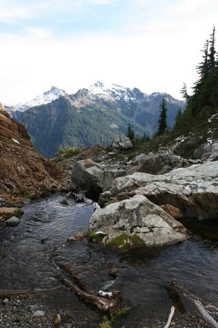
Trail: Your path starts in the forested area for a short time. It pops into the open and as it switchbacks up the mountain. There’s one tricky creek crossing. It’s small however, steep and slippery. Take your time here and decide where to put your foot as you hop over.
After this you’re back in the forest. The grade is quite easy as it climbs in a beautiful wooded sanctuary. You’ll come to a few easier creek crossings & two log crossings that were once a blow-down. They’re now a convenient sawed step. The first one is a little tricky, especially if you’re short or lack balance. With a friend’s hand easily crossed. The second one has two steps and a knob to grab onto. Left-right and hand on the knob. I thank the person who came up with that idea.
Now the trail pops into the open as it gains elevation steeply. It’s not a scary trail. The views are stunning. Soon you’ll come into the col, where there is a bigger creek crossing. Here someone kind or mother~nature has placed stepping stones to cross. There is lots of snow and ice here on a cold November day. Trying to get up this skinny trail was avoided and we decided to climb on the snow caves to by-pass the ice. I would recommend MICROspikes.
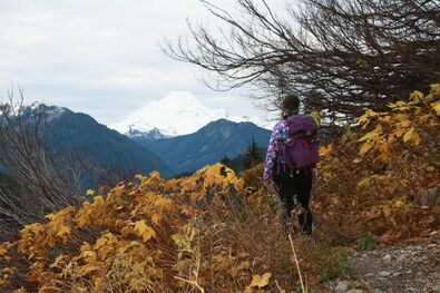
The grade is a little easy in this part as it wraps around the mountain. You'll cross a few more little creeks. Just as you near the last stretch and see Baker in her full beauty was my turn around point on this day. I was moments from the summit. If you made it to here it is a beautiful hike even without the fall colours or new life in the spring. If you go all the way to the summit it is 12 km’s/770 m elevation. If you decide to summit Yellow Aster Butte, keep in mind there’s lots of exposure and scrambling. If you have a fear of heights going to where the last stretch is completely doable with ease. Happy & safe trails.