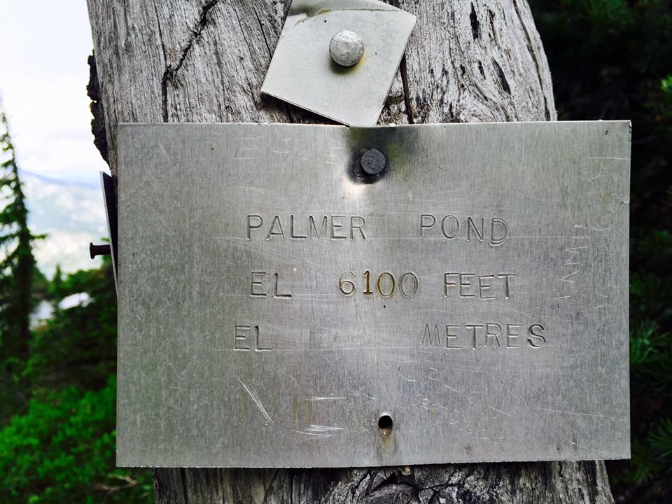
Jacobson's Lake to Palmer Pond
Trail Key: M~2~H~V~DF~KF~PT
Length: 8 Km's
Elevation: 390 meters
Dogs: Yes-leashed
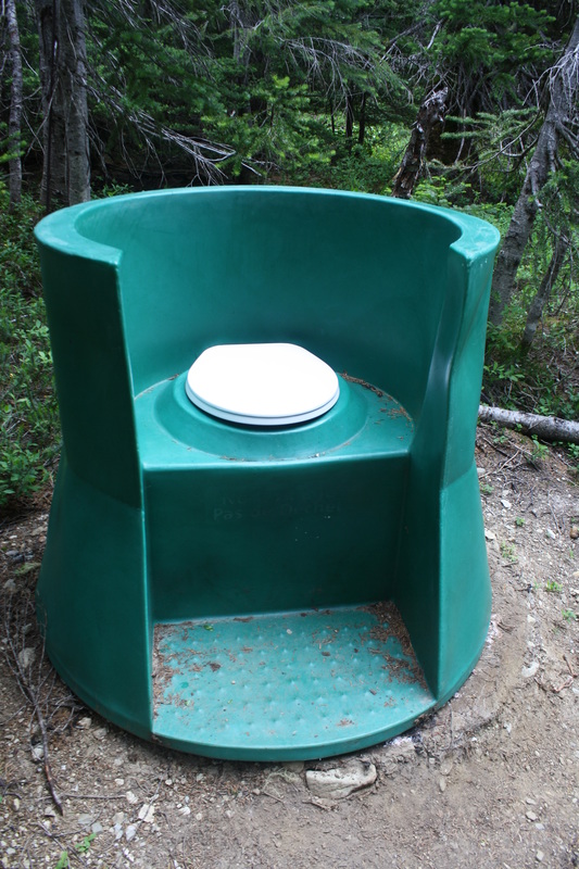
Pit Toilet: Yes-beginning & meadows
Shoes: Hiking boots (for muddy sections)
Ten Essentials: Yes
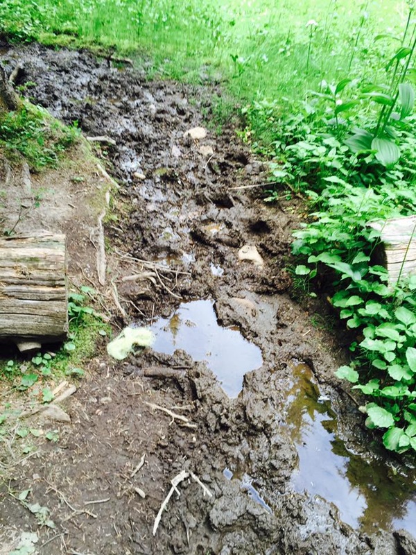
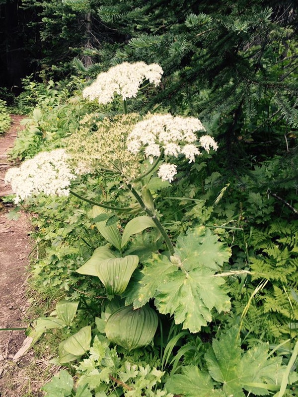
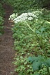
Starting behind the sign is the beginning to the trail. It's a flat muddy, grassy and possibly a wet trail. Almost immediately is Jacobson's Lake. Take a left to walk down to see the lake closer. Soon after in the muddy sections is a lot of Giant Hogweed. This lines the trail in mostly the muddy sections. These invasive plants have a sap on them and if it comes in contact with your skin and sunlight can leave burn marks on you that can last for 10 yrs.
The trail is flat and begins to descend and the it's flat and muddy again. When you come to a sign post go right...west. The trail is now snaky and now follows traditional orange markers.
Shortly after you come to a road and cross over following large TM sign posts carry on through the timber and snaky path. Soon after an easy incline and after a few hundred meters the grade eases up and it becomes rolling hills. Another incline then rolling hills. At the Y junction, stay left.
Soon the trail descends once again (elevation loss is not included in the stats).
The trail once again descends and becomes muddy once again (this was after several days without rain...) You'll cross a small bridge and the trail is now in a timber covered forest. Soon after you're walking along the creek. This next section is quite hilly as you leave the creek behind.
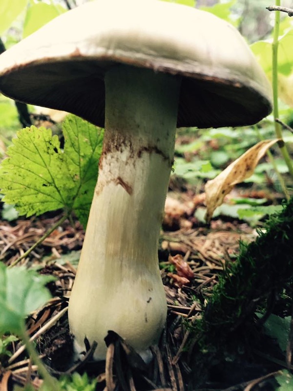
Ahead lies a flat section as you are back with the relaxing sounds of the rushing creek. Look for tons of mushrooms along the trail.
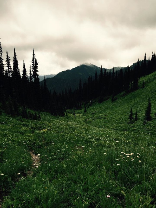
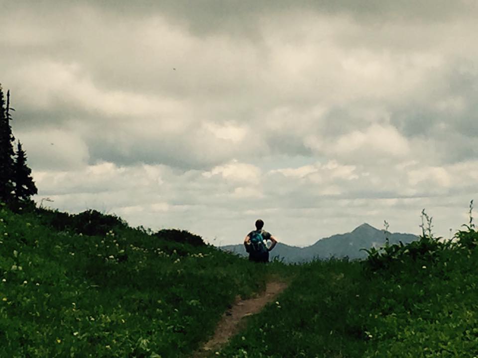
You'll descend to a small creek crossing. Another push up and the trail opens up into the meadows. It's beautiful here. Here is where the junction and a pit toilet (there are no walls at this pit toilet but lovely views). Options are to go to Palmer Pond (1k) or Grant Pond (2 k) or Sowaqua camp (6.5k ). Today Palmer Pond is our destination.
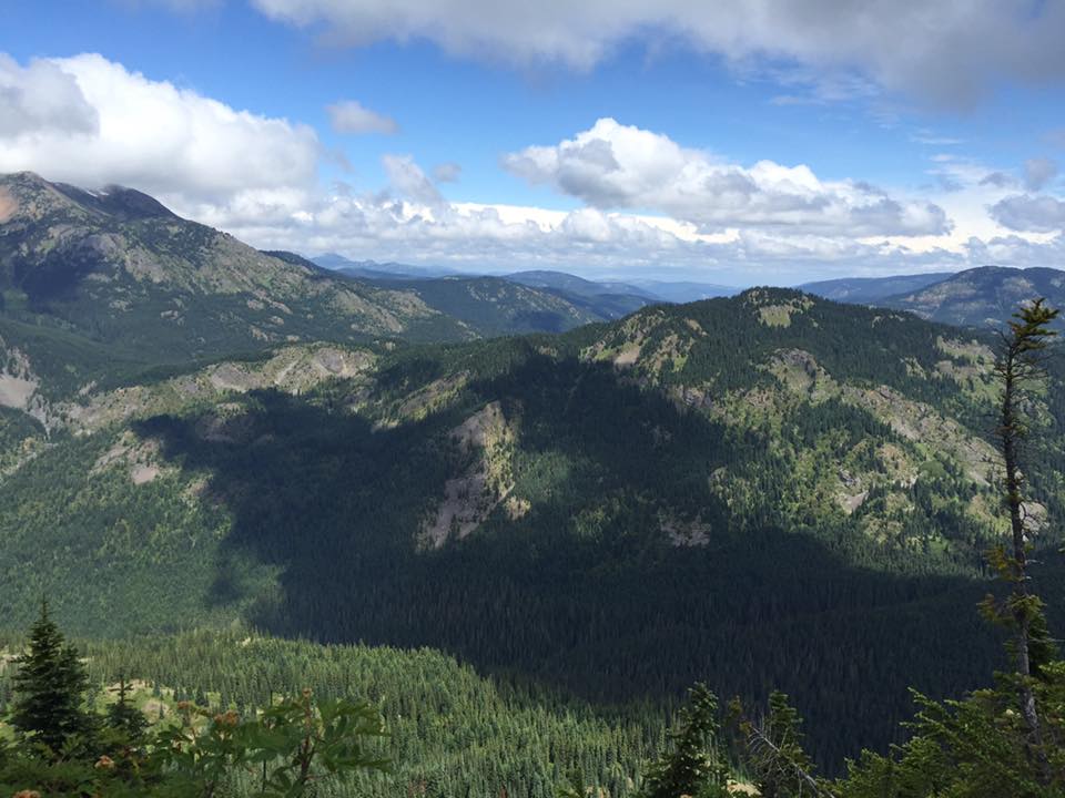
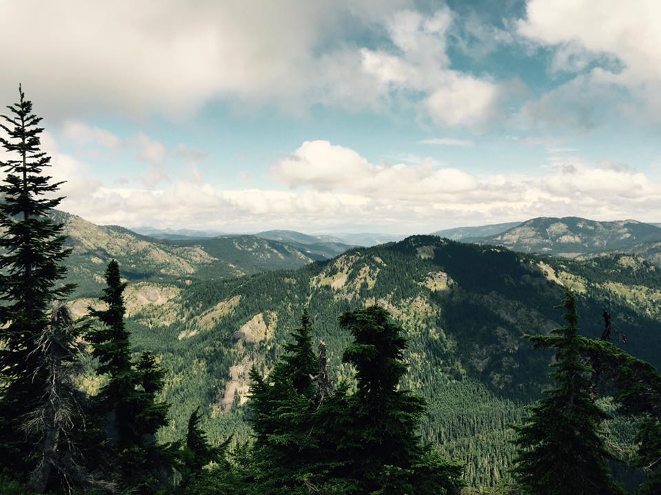
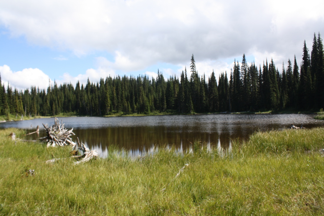
A short walk through more meadows and back on trail. Now the trail begins to climb as the sound of a creek delights your ears. Next your in the valley, at the bottom of the V, it seems like a steep section, possibly hopeless to achieve but it's a gentle incline. It's beautiful in here. Once at the top Palmer Pond comes into view. Follow the trail along the pond. It makes a nice lunch spot. On the other side is a drop off into a stunning valley. Check out the Salamanders living in Palmer Pond. This is one of my fave hikes...A hidden gem. Happy & safe trails!
Info courtesy of Trailpeak..."This aquamarine alpine pool sits like a rare jewel at the edge of a thousand foot precipice. The water's iridescent hues reflect stunted alpine fir trees, shrubbery, and sky, giving one a feeling of utmost tranquility. Best of all, few people, even locals, know where this precious gem is hidden."
Directions: Drive to the Coquihala summit, take exit #228. Drive up the Tulameen River FSR for 45.8 Km's...Park at the JL Campground.
Length: 8 Km's
Elevation: 390 meters
Dogs: Yes-leashed
Pit Toilet: Yes-beginning & meadows
Shoes: Hiking boots (for muddy sections)
Ten Essentials: Yes
Starting behind the sign is the beginning to the trail. It's a flat muddy, grassy and possibly a wet trail. Almost immediately is Jacobson's Lake. Take a left to walk down to see the lake closer. Soon after in the muddy sections is a lot of Giant Hogweed. This lines the trail in mostly the muddy sections. These invasive plants have a sap on them and if it comes in contact with your skin and sunlight can leave burn marks on you that can last for 10 yrs.
The trail is flat and begins to descend and the it's flat and muddy again. When you come to a sign post go right...west. The trail is now snaky and now follows traditional orange markers.
Shortly after you come to a road and cross over following large TM sign posts carry on through the timber and snaky path. Soon after an easy incline and after a few hundred meters the grade eases up and it becomes rolling hills. Another incline then rolling hills. At the Y junction, stay left.
Soon the trail descends once again (elevation loss is not included in the stats).
The trail once again descends and becomes muddy once again (this was after several days without rain...) You'll cross a small bridge and the trail is now in a timber covered forest. Soon after you're walking along the creek. This next section is quite hilly as you leave the creek behind.
Ahead lies a flat section as you are back with the relaxing sounds of the rushing creek. Look for tons of mushrooms along the trail.
You'll descend to a small creek crossing. Another push up and the trail opens up into the meadows. It's beautiful here. Here is where the junction and a pit toilet (there are no walls at this pit toilet but lovely views). Options are to go to Palmer Pond (1k) or Grant Pond (2 k) or Sowaqua camp (6.5k ). Today Palmer Pond is our destination.
A short walk through more meadows and back on trail. Now the trail begins to climb as the sound of a creek delights your ears. Next your in the valley, at the bottom of the V, it seems like a steep section, possibly hopeless to achieve but it's a gentle incline. It's beautiful in here. Once at the top Palmer Pond comes into view. Follow the trail along the pond. It makes a nice lunch spot. On the other side is a drop off into a stunning valley. Check out the Salamanders living in Palmer Pond. This is one of my fave hikes...A hidden gem. Happy & safe trails!
Info courtesy of Trailpeak..."This aquamarine alpine pool sits like a rare jewel at the edge of a thousand foot precipice. The water's iridescent hues reflect stunted alpine fir trees, shrubbery, and sky, giving one a feeling of utmost tranquility. Best of all, few people, even locals, know where this precious gem is hidden."
Directions: Drive to the Coquihala summit, take exit #228. Drive up the Tulameen River FSR for 45.8 Km's...Park at the JL Campground.