Hiking for The Scaredy Cat: Hikes in and around Vancouver, B.C. Canada
  • Trail Information
    • The Hiking Trails & Safety Information >
      • Abby Grind: Abbotsford
      • Alder Flats: Golden Ears
      • Alouette Mtn: Golden Ears Provincial Park
      • Ancient Cedars Trail
      • Al's Habrich Ridge Trail: Sea to Sky Gondola
      • B.C.M.C. Grouse Mountain
      • Bear Mtn: Mission, BC
      • Big Cedar & Kennedy Falls: Mount Fromme
      • Blue Mountain:Coquitlam
      • Bosumarne Falls: Chilliwack, BC
      • Bowen Lookout:Cypress Mountain
      • Bridal Falls Lookout: Chilliwack-Agassiz
      • Brother's Creek: North Vancouver
      • Community Forest: Chilliwack
      • Coquitlam Crunch: Coquitlam
      • Cheakamus Lake: Whistler
      • Crystal Falls: Coquitlam, BC
      • Dewdney Grind: Mission
      • Diez Vistas: Buntzen Lake
      • Dragon's Back: Hope, BC
      • East-West Connector Bridge Trail~Golden Ears Provincial Park
      • Eaton Lake: Hope
      • Elfin Lakes: Squamish
      • Elk Mountain: Chilliwack
      • Evan's Creek: Golden Ears Provincial Park
      • First Peak: Seymour Mountain
      • Ford Mtn: Chilliwack
      • Grouse Grind: West Vancouver
      • Garibaldi Lake: Squamish
      • Harrison Grind/Campbell Lake: Fraser Valley
      • Harrison Lookout/Fire Tower
      • Heather Trail: Manning Park
      • High Note Trail: Whistler
      • Hillkeep: Chilliwack
      • Hope Lookout Trail
      • Horne Lake Caves Provincial Park: Vancouver Island
      • Jacobson's Lake to Palmer Pond
      • Joffre Lakes: Pemberton
      • Jug Island: Belcarra Regional Park
      • Ladner Creek Train Trestle: Coquihalla Hwy
      • Killarney Lake: Bowen Island
      • Lake Lovely-Squamish
      • Larch Meadows: Manning Park
      • Levette Lake Loop: Squamish
      • Lewx Qwo:m (luhw KWOM): Chilliwack
      • Lindeman & Greendrop Lakes: Chilliwack
      • Lightning Lakes: Manning Park
      • Lindsay Lake Loop: Buntzen Lake
      • Little Douglas Lake: Coquihalla Summit
      • Lower Falls-East Canyon Parking Lot: Golden Ears
      • Lynn Loop: Lynn Headwaters Regiona Park
      • Lower Hollyburn: Cypress Mtn
      • Lynn Peak: Lynn Headwaters Regional Park
      • McKee Peak-Cliffside Caves
      • Mehatl Falls
      • Menzies: Golden Ears Provincial Park
      • Minnekhada Park: Coquitlam
      • Mount Cheam: Chilliwack
      • Mount Fromme: North Van
      • Mount Sleese to Memorial Plaque: Chiliwack
      • Mount St. Benedict: Mission
      • Mount Strachan: Mount Seymour
      • Mt. Thom: Chilliwack
      • Mt. Gardner: Bowen Island
      • Mt. Woodslide
      • Munro & Denette Lakes: Coquitlam
      • Mystery Lake: Mount Seymour
      • Needle Peak/Flatiron: Coquihalla Highway
      • Norvan Falls: Lynn Headwaters Regional Park
      • Othello Tunnels-Nicola Valley Loop
      • Parkhurst Ghost Town: Whistler
      • Panorama Ridge: Squamish
      • Petgill Lake: Howe Sound
      • Poland Lake-EC Manning Park
      • Quarry Rock: Deep Cove
      • Ravens Bluff-Mission
      • Red Mountain: Mission
      • Salmon Ridge Trail: Chilliwack, BC
      • Sasquatch Caves: Hope
      • Sea to Summit: Sea to Sky Gondola
      • Skyline: Grouse Mountain
      • Skyline 1: Manning Park
      • Spirit Caves-Yale, BC
      • St. Mark's: Cypress Mountain
      • Statlu Lake
      • The Stawamus Chief: Squamish
      • Tikwalus Trail: Spuzzum
      • Trickle Creek Treehouse
      • Thacker Mountain Trail: Hope
      • Tunnel Bluffs: Howe Sound
      • Vedder: Chilliwack
      • Watersprite Lake: Squamish
      • Wedgemont Lake: Whislter
      • Wells Peak
      • Widgeon Falls
      • Williams Peak
      • Windy Joe: Manning Park
      • Woodland Walk to Sawblade Falls
      • Zoa Peak: Coquihallia Hwy
    • The Snowshoe Trails & Safety Info >
      • Artist Point
      • Bowen Lookout
      • Dog Mountain: Day
      • Callaghan Valley
      • Dog Mountain: Night
      • Eagle Bluffs
      • Elfin Lakes to Red Heather Hut >
        • Fat Dog
        • First Pump
        • Hollyburn
        • Lightning Lakes Loop
        • Rainbow Lake
        • Sasquatch Mountain Snowshoe: Hemlock Valley
        • SS Grind
        • Stawberry Flats
        • Zoa
    • The U.S.A. Hikes >
      • Blue Lake: Northern Cascades
      • Chain Lakes
      • Damfino Lakes
      • Deception Pass State Park: Washington, USA
      • Oyster Dome
      • Yellow Aster Butte
    • The Trail Walks >
      • Aldergrove Regional Park: Aldergrove
      • Blue Heron Reserve: Chilliwack
      • Brae Island: Fort Langley
      • Burn's Bog: Delta
      • Burnaby Lake Loop: Burnaby
      • Campbell Valley: Langley
      • Cathederal Grove: MacMillian Provincial Park:
      • Delta Watershed
      • East Sector Lands: Harrison Hot Springs
      • Elgin Park: Surrey, BC
      • Green Timbers: Surrey
      • High Knoll Park: Surrey
      • Houston Trail: Fort Langley
      • Katzie Marsh Loop: Pitt Meadows
      • Lower Falls: Golden Ears: Maple Ridge
      • Lower Seymour Conservation: North Vancouver
      • Lighthouse Park: West Vancouver
      • Mud Bay: Surrey
      • Redwood Park: Surrey
      • Reifel Bird Santuary: Delta
      • Rice Lake: North Vancouver
      • Richmond Nature Park: Richmond
      • Rolley Lake: Mission
      • Ruth Johnson Park: White Rock
      • Sasamat Lake: Port Moody
      • Spirea Trail: Golden Ears
      • Sunnyside Urban Forest: Surrey
      • Serpentine Bird Santuary
      • Shoesmith East Trail Loop: Maple Ridge
      • Spirit Trail: Ladner
      • Stanley Park Seawall: Vancouver
      • Sye'xw Cho'teqw Adventure Park
      • The Jetti: Iona Beach, Richmond
      • Tynehead
      • Yew Lake
  • My Blogging
  • Mt. Kilimanjaro
  • In the River Valley Hikes
  • West Coast Trail
  • Peru
  • Hiking Snapshots
    • Thru Hikes
    • Bears & Cougars +
    • Proper Hiking Footwear
    • Trail Etiquette
  • Blog

Thru Hiking

Picture
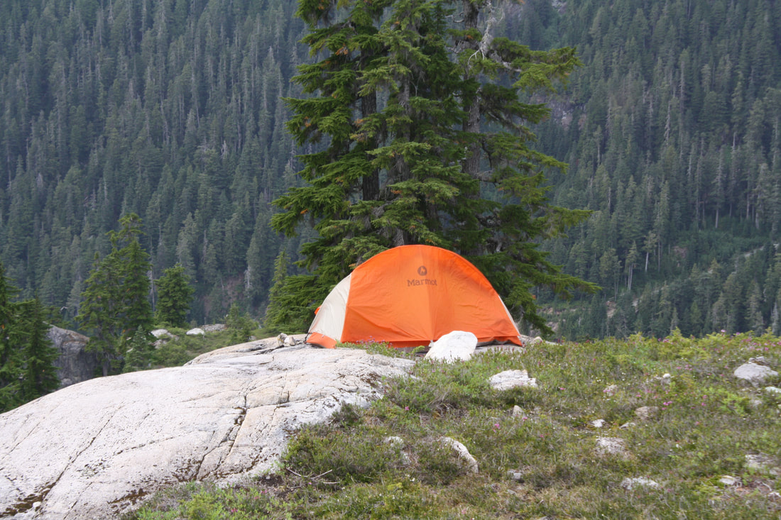
Mountain Lake Hut Hike
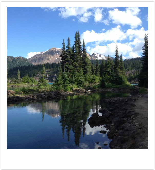
Picture
Garibaldi Lake:
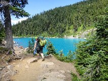
www.vancouvertrails.com/blog/camping-near-garibaldi-lake/

Joffre Lakes:
www.vancouvertrails.com/blog/camping-at-joffre-lakes-near-pemberton-bc/

What to Pack for an Overnight in the Backcountry:
www.vancouvertrails.com/blog/hiking-in-the-backcountry-and-camping-overnight/

My Hiking and Camping Blogs via Vancouver Trails

Picture
Garibaldi Lake:
Hike in & over night in the 

back-country

Backpack:
You need to have your back pack weigh no more than 1/4 of your body weight. It should be a proper pack that will rest on your hip bones. A sleeping bag should be light and in pack sack. You'll need a sleeping pad. A tent should also be lightweight and easily to put together.
Cooking:
A Pocket Rocket is great to take  in the back-country. It's compact and reasonably priced. A pot set with fork & bowl and gas are a few other items you will need in your pack. Your key is lightweight and pieces that pack together giving you more room.

Food:
I like freezing meals that are ready to be cooked, having bags of of granola or pre-mixed pancake mix so it's easy to cook. Nuts, bars and dehydrated foods. I brought along rice milk in a cardboard container for my first morning granola. Wipes are great for keeping myself clean. Adding water tablets are the safest way to drink Layer Clothing:
Clothing:
Layer, layer is the best. Extra socks and shoes to wear while at camp. It's also a good idea to have waterproof clothing and an extra puffy jacket. Check out my recent blog on puffy jackets for education: hikelikeawoman.net/2018/11/puffy-jackets-for-education/


Directions to Garibaldi Lake:
You will pass Squamish and will see a mall on your right with Starbucks, Subway etc. and sign saying 16 km to Garibaldi. Your next sign will say 2 km and the after that will say 2 km again and there will be a road, turn right. If pass this and see a dam on your right you have gone too far. Find a safe place to turn around and head up the road.  If cars are parked along the side of the road you might want to find parking as it is not a turn around lot, you will have to back out. There are forms at the enter to the trail to fill out for over night stays. Fill out the forms and put the money inside and leave it in the lock box. Part of the form goes on your dash and part stays with you for your back country pass. There are pit toilets in the parking lot and the next time you will see pit toilets are at Taylor Meadows campground (8.5 km in) or at the lake (9 km in). Leave nothing in your car as these lots are often scoped and car windows are smashed for valuables; even ones in the trunk.

The Route
You will start your hike at Rubble Creek/Black Tusk parking lot. Up, up you go with lots of & long short switchbacks. The trails are wide, dusty for the first 6.5 Km's. I enjoy the walk in nature in my own comfortable thoughts. As you come to 6.5 km you are at a junction. Going left takes you through Taylor Meadows (I recommend it either on the way in or out, it's beautiful with views of The Black Tusk, 360 degree mountain views all around. In the summer flowers dance through the meadows.
If you decide to skip the meadows and go straight you will have some rolling hills. Shortly after the junction, you will come to view point. Make sure you walk right down the skinny path as it takes you to a rocky outcrop with valley views and little Chipmunks. You will then come to two lakes that are quite blue and soon after to another junction. Going right takes you to the lake and campground, going left takes you up to Taylor Meadows. Head down to the lake, across the bridge and around to the picnic table and first of three huts. You can camp here or keep walking along the path. If you go closer to the ranger station it's quieter, the toilets smell nicer, there's a wharf to lie on and jump off into the glacier fed waters. It is best to plan for several nights and do a day hike to Helm Creek, Panorama Ridge or the lookout &/or The Black Tusk. You must store your food hanging up in the huts. When you are ready to leave don't forget to take your garbage back out with you.

Expect to have blistered feet and lots of mosquito bites, amazing pictures, meet really cool people. Have a great time. Happy & safe trails.


Proudly powered by Weebly
  • Trail Information
    • The Hiking Trails & Safety Information >
      • Abby Grind: Abbotsford
      • Alder Flats: Golden Ears
      • Alouette Mtn: Golden Ears Provincial Park
      • Ancient Cedars Trail
      • Al's Habrich Ridge Trail: Sea to Sky Gondola
      • B.C.M.C. Grouse Mountain
      • Bear Mtn: Mission, BC
      • Big Cedar & Kennedy Falls: Mount Fromme
      • Blue Mountain:Coquitlam
      • Bosumarne Falls: Chilliwack, BC
      • Bowen Lookout:Cypress Mountain
      • Bridal Falls Lookout: Chilliwack-Agassiz
      • Brother's Creek: North Vancouver
      • Community Forest: Chilliwack
      • Coquitlam Crunch: Coquitlam
      • Cheakamus Lake: Whistler
      • Crystal Falls: Coquitlam, BC
      • Dewdney Grind: Mission
      • Diez Vistas: Buntzen Lake
      • Dragon's Back: Hope, BC
      • East-West Connector Bridge Trail~Golden Ears Provincial Park
      • Eaton Lake: Hope
      • Elfin Lakes: Squamish
      • Elk Mountain: Chilliwack
      • Evan's Creek: Golden Ears Provincial Park
      • First Peak: Seymour Mountain
      • Ford Mtn: Chilliwack
      • Grouse Grind: West Vancouver
      • Garibaldi Lake: Squamish
      • Harrison Grind/Campbell Lake: Fraser Valley
      • Harrison Lookout/Fire Tower
      • Heather Trail: Manning Park
      • High Note Trail: Whistler
      • Hillkeep: Chilliwack
      • Hope Lookout Trail
      • Horne Lake Caves Provincial Park: Vancouver Island
      • Jacobson's Lake to Palmer Pond
      • Joffre Lakes: Pemberton
      • Jug Island: Belcarra Regional Park
      • Ladner Creek Train Trestle: Coquihalla Hwy
      • Killarney Lake: Bowen Island
      • Lake Lovely-Squamish
      • Larch Meadows: Manning Park
      • Levette Lake Loop: Squamish
      • Lewx Qwo:m (luhw KWOM): Chilliwack
      • Lindeman & Greendrop Lakes: Chilliwack
      • Lightning Lakes: Manning Park
      • Lindsay Lake Loop: Buntzen Lake
      • Little Douglas Lake: Coquihalla Summit
      • Lower Falls-East Canyon Parking Lot: Golden Ears
      • Lynn Loop: Lynn Headwaters Regiona Park
      • Lower Hollyburn: Cypress Mtn
      • Lynn Peak: Lynn Headwaters Regional Park
      • McKee Peak-Cliffside Caves
      • Mehatl Falls
      • Menzies: Golden Ears Provincial Park
      • Minnekhada Park: Coquitlam
      • Mount Cheam: Chilliwack
      • Mount Fromme: North Van
      • Mount Sleese to Memorial Plaque: Chiliwack
      • Mount St. Benedict: Mission
      • Mount Strachan: Mount Seymour
      • Mt. Thom: Chilliwack
      • Mt. Gardner: Bowen Island
      • Mt. Woodslide
      • Munro & Denette Lakes: Coquitlam
      • Mystery Lake: Mount Seymour
      • Needle Peak/Flatiron: Coquihalla Highway
      • Norvan Falls: Lynn Headwaters Regional Park
      • Othello Tunnels-Nicola Valley Loop
      • Parkhurst Ghost Town: Whistler
      • Panorama Ridge: Squamish
      • Petgill Lake: Howe Sound
      • Poland Lake-EC Manning Park
      • Quarry Rock: Deep Cove
      • Ravens Bluff-Mission
      • Red Mountain: Mission
      • Salmon Ridge Trail: Chilliwack, BC
      • Sasquatch Caves: Hope
      • Sea to Summit: Sea to Sky Gondola
      • Skyline: Grouse Mountain
      • Skyline 1: Manning Park
      • Spirit Caves-Yale, BC
      • St. Mark's: Cypress Mountain
      • Statlu Lake
      • The Stawamus Chief: Squamish
      • Tikwalus Trail: Spuzzum
      • Trickle Creek Treehouse
      • Thacker Mountain Trail: Hope
      • Tunnel Bluffs: Howe Sound
      • Vedder: Chilliwack
      • Watersprite Lake: Squamish
      • Wedgemont Lake: Whislter
      • Wells Peak
      • Widgeon Falls
      • Williams Peak
      • Windy Joe: Manning Park
      • Woodland Walk to Sawblade Falls
      • Zoa Peak: Coquihallia Hwy
    • The Snowshoe Trails & Safety Info >
      • Artist Point
      • Bowen Lookout
      • Dog Mountain: Day
      • Callaghan Valley
      • Dog Mountain: Night
      • Eagle Bluffs
      • Elfin Lakes to Red Heather Hut >
        • Fat Dog
        • First Pump
        • Hollyburn
        • Lightning Lakes Loop
        • Rainbow Lake
        • Sasquatch Mountain Snowshoe: Hemlock Valley
        • SS Grind
        • Stawberry Flats
        • Zoa
    • The U.S.A. Hikes >
      • Blue Lake: Northern Cascades
      • Chain Lakes
      • Damfino Lakes
      • Deception Pass State Park: Washington, USA
      • Oyster Dome
      • Yellow Aster Butte
    • The Trail Walks >
      • Aldergrove Regional Park: Aldergrove
      • Blue Heron Reserve: Chilliwack
      • Brae Island: Fort Langley
      • Burn's Bog: Delta
      • Burnaby Lake Loop: Burnaby
      • Campbell Valley: Langley
      • Cathederal Grove: MacMillian Provincial Park:
      • Delta Watershed
      • East Sector Lands: Harrison Hot Springs
      • Elgin Park: Surrey, BC
      • Green Timbers: Surrey
      • High Knoll Park: Surrey
      • Houston Trail: Fort Langley
      • Katzie Marsh Loop: Pitt Meadows
      • Lower Falls: Golden Ears: Maple Ridge
      • Lower Seymour Conservation: North Vancouver
      • Lighthouse Park: West Vancouver
      • Mud Bay: Surrey
      • Redwood Park: Surrey
      • Reifel Bird Santuary: Delta
      • Rice Lake: North Vancouver
      • Richmond Nature Park: Richmond
      • Rolley Lake: Mission
      • Ruth Johnson Park: White Rock
      • Sasamat Lake: Port Moody
      • Spirea Trail: Golden Ears
      • Sunnyside Urban Forest: Surrey
      • Serpentine Bird Santuary
      • Shoesmith East Trail Loop: Maple Ridge
      • Spirit Trail: Ladner
      • Stanley Park Seawall: Vancouver
      • Sye'xw Cho'teqw Adventure Park
      • The Jetti: Iona Beach, Richmond
      • Tynehead
      • Yew Lake
  • My Blogging
  • Mt. Kilimanjaro
  • In the River Valley Hikes
  • West Coast Trail
  • Peru
  • Hiking Snapshots
    • Thru Hikes
    • Bears & Cougars +
    • Proper Hiking Footwear
    • Trail Etiquette
  • Blog