Skyline: Grouse Mountain
Skyline: Grouse Mountain
Length: 5 Km's (return)
Elevation: 550 meters
Dogs: Yes
Pit Toilet: No
Trail Key: ST~R~CB~DF~KF~V
Directions: Cross Second Narrows Bridge/Iron Workers Memorial. Take Exit #17: Westview. Turn right onto Westview Drive and stay in the right lane. After driving straight through the lights at Queens, the street turns into Delbrooke Avenue. Continue driving up Delbrooke until you reach a 4-way stop. Turn left onto Montroyal Blvd., drive a short distance until you pass a fire-hall on your right and right away a small bridge. After the bridge, turn right onto Skyline Drive. Drive up 3 blocks and turn right onto the street that is also called Skyline Drive. Continue following the switchbacks until you get to the gravel area where you can park. Follow the metal gate up the road (not down) to the TH proper.
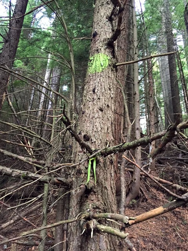
This is a trail full of history. Skyline Trail has broken pieces of a tired chairlift along the trial, it passes one old cabin that is no longer standing and is also the site of a US Airforce F-86 Sabre Jet crash that happened in 1954. The only remaining piece of the jet is an engine has been made into a memorial for the pilot, Second Lt. Lamar J. Barlow, 25, who was killed in the crash. The engine sits in a beautiful part of the forest, which is located not far from the first broken down cabin. The easiest way to find its location is about a 100 meters from the broken down cabin on your right is a trail to the right with green spray paint on a tree. Follow this trail which goes up and then turns right. Not far down to your left you'll see the plane crash site.
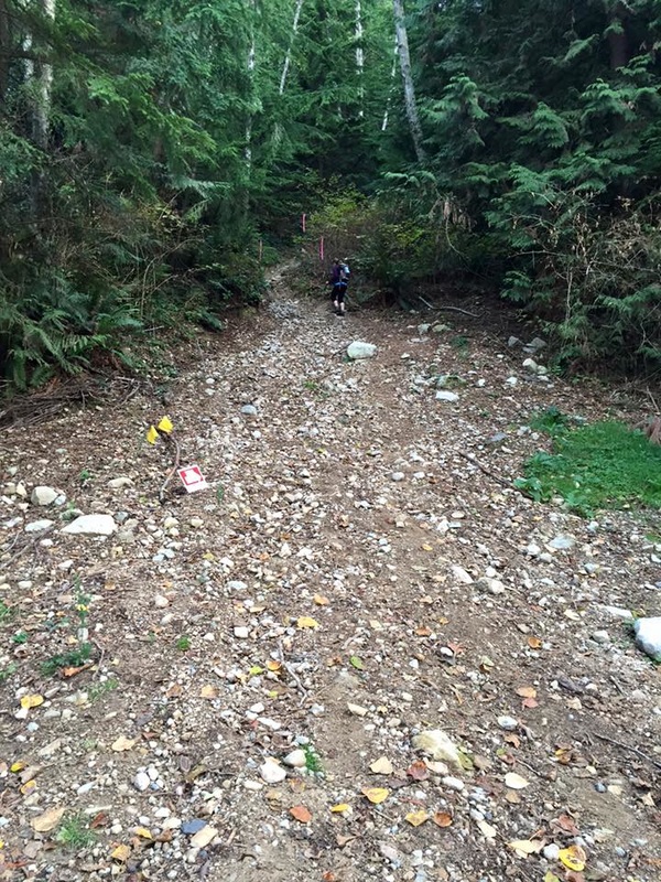
Start walking from the parking area to your right not left. Follow the road past the gate and up to the proper TH. Along the way there a few other trails. Keep going as Skyline starts to the right and it is well marked. It starts climbing right from the beginning up a rocky and sometimes rooty trail. The trail is well marked with Skyline sign posts the entire way. This trail climbs in a straight line straight up the mountain giving you not much of a rest from the beginning until the end.
The Skyline Trail ends at the bottom of the cut near a chair left.There are some views at the top of Vancouver but there are some trees in the way.
If you'd like to carry onto the Grouse Mtn Chalet to take the gondola down follow the trail to the left of the chairlift called SIMIC's trail. You can either have two cars...One at the bottom of the Gondola or once down follow the Powerline Trail. You can find this trail by going to the gravel parking lot near the Grouse Grind. Continue through the parking lot and down the hill toward a metal gate. After 40 mins it will take you back to the parking area at Skyline Dr.,Or you can just make Skyline an in-out trail...
Happy 'n' safe trails...
Length: 5 Km's (return)
Elevation: 550 meters
Dogs: Yes
Pit Toilet: No
Trail Key: ST~R~CB~DF~KF~V
Directions: Cross Second Narrows Bridge/Iron Workers Memorial. Take Exit #17: Westview. Turn right onto Westview Drive and stay in the right lane. After driving straight through the lights at Queens, the street turns into Delbrooke Avenue. Continue driving up Delbrooke until you reach a 4-way stop. Turn left onto Montroyal Blvd., drive a short distance until you pass a fire-hall on your right and right away a small bridge. After the bridge, turn right onto Skyline Drive. Drive up 3 blocks and turn right onto the street that is also called Skyline Drive. Continue following the switchbacks until you get to the gravel area where you can park. Follow the metal gate up the road (not down) to the TH proper.
This is a trail full of history. Skyline Trail has broken pieces of a tired chairlift along the trial, it passes one old cabin that is no longer standing and is also the site of a US Airforce F-86 Sabre Jet crash that happened in 1954. The only remaining piece of the jet is an engine has been made into a memorial for the pilot, Second Lt. Lamar J. Barlow, 25, who was killed in the crash. The engine sits in a beautiful part of the forest, which is located not far from the first broken down cabin. The easiest way to find its location is about a 100 meters from the broken down cabin on your right is a trail to the right with green spray paint on a tree. Follow this trail which goes up and then turns right. Not far down to your left you'll see the plane crash site.
Start walking from the parking area to your right not left. Follow the road past the gate and up to the proper TH. Along the way there a few other trails. Keep going as Skyline starts to the right and it is well marked. It starts climbing right from the beginning up a rocky and sometimes rooty trail. The trail is well marked with Skyline sign posts the entire way. This trail climbs in a straight line straight up the mountain giving you not much of a rest from the beginning until the end.
The Skyline Trail ends at the bottom of the cut near a chair left.There are some views at the top of Vancouver but there are some trees in the way.
If you'd like to carry onto the Grouse Mtn Chalet to take the gondola down follow the trail to the left of the chairlift called SIMIC's trail. You can either have two cars...One at the bottom of the Gondola or once down follow the Powerline Trail. You can find this trail by going to the gravel parking lot near the Grouse Grind. Continue through the parking lot and down the hill toward a metal gate. After 40 mins it will take you back to the parking area at Skyline Dr.,Or you can just make Skyline an in-out trail...
Happy 'n' safe trails...