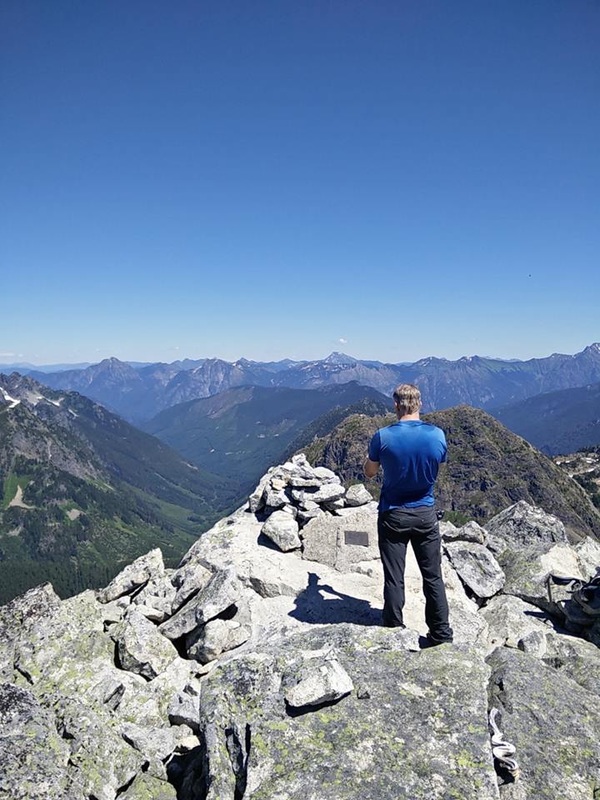
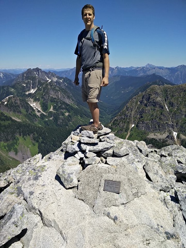
William's Peak by Aaron Jackson
|
|
Williams Peak TR:
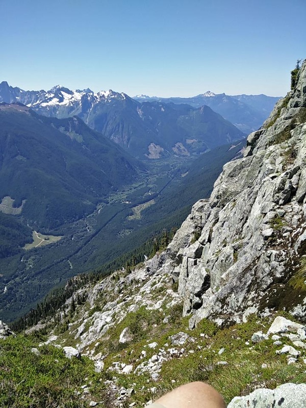
We made good use of the clear sky and sun yesterday and decided to cross Williams Peak off our lists. It was a heavy slog but very rewarding to actually make it to the peak. This was my third attempt (1st and 2nd turned back due to snow and cloud, respectively), so today it was summit or bust. I wouldn't recommend doing this hike/scramble unless you intended to go all the way to the peak. There's just much more rewarding hikes to be had for much less effort if you're not going to summit. Also note that the peak is a moderate scramble, with a little exposure.
Trail info:Time: 4.75 hrs up, 8.5 hrs total (this was at a good clip)
Length: ~18km round trip
Elevation Gain: ~1670m bottom to top, 1988m total gain (because of lots of ups and downs)
Difficulty: Moderate scramble from base of peak
Trailhead Access: 32 km up Chilliwack Lake Road, turn left at the sign marked "Williams Peak", car accessible
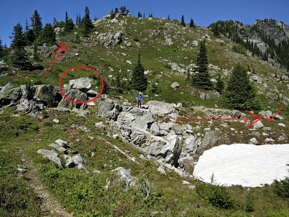
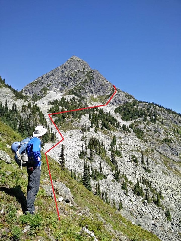
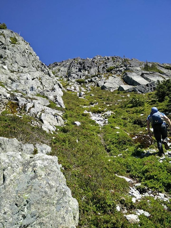
Trail Description: From trail head, follow signs along old logging road. Trail heads steeply up to ridge for 900 m elevation gain. Along this steep section, there's a few pointers to tell you how much longer to the ridge: 1st cabin is about 1/4 the way up, makeshift 'teepee' is a little more than halfway up, and the 2nd cabin is a little more than 2/3 rd's the way up. Follow ridge trail to towards Williams peak for ~3.0 km. This ridge line trail gains and loses a good amount of elevation. The ridge line eventually ends at a lookout with great vistas of Williams Peak and Chilliwack Lake. From here down climb ~30 m from the lookout into the bowl and contour left as soon as possible, side hilling along the grassy sections below the ridge line. Scramble up the boulder fields and slightly right, towards the rock ramp shown in the photos attached. Cairns and flagging tape are placed periodically and are a great help. Scramble up the rock ramp along the flagged route. The rock ramp has a lot of loose dirt and rock, but I found if I stuck to the larger rocks the footing was generally sound. Also note that the scrambling doesn't get any worse than what you experience on this rock ramp. The ramp turns into a scramble that traverses up and around for about 100 m, to a gully on your left. Follow the gully to the top.
I just want to throw in, anyone who's looking into scrambling, I very highly recommend the book "Scrambles in Southwest British Columbia" by Matt Gunn. It can be picked up from almost any outdoors store (including Mt. Waddingtons). Most of this trail information can be found in his book.
Photo credit(s): Aaron Jackson