East-West Connector Bridge Trail
Golden Ears Provincial Park
Hiking Key: E~2~CC~DF~KF~WF~V
Length: 15 K
Elevation: 300 m (not including loss)
Pit Toilet: yes/parking lots
Dogs: yes
Start at East Canyon Trail parking lot just past the yellow gate. Follow signs.
Shortly after you'll come to a Y, go left. Then you'll come to a T with a sign post, go left. Walk on an old logging road as you cross several creeks. Some deeper depending on recent rain fall. Pass a big rock slide.
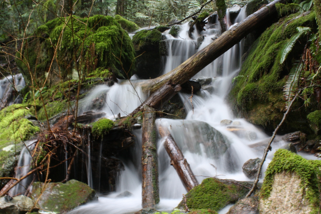
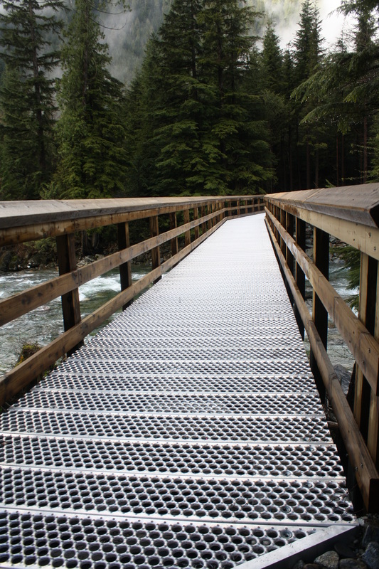
Then you'll come to a log bridge with an amazing waterfall. If you want to head down for a quick trip to Lower Falls, you can here but keep in mind it's not well marked and very steep. It's about 1 k down... Go left to connector bridge or straight for an added Km's to Hiker Beach & Viewpoint Beach. If you choose to carry on then you'll cross the new Connector Bridge...
Next sign post is to Alder Flats & Golden Ears (left) or straight down the trail to Hikers Beach (you may not be able to cross here depending on water level). If you decide to not go to Hikers Beach then you need to carry on the Alder Flats & Golden Ears way. You'll experience some elevation here. At the top go right up to Golden Ears & Alder Flats or carry on straight to West Canyon Parking Lot. Here is where you decide if you want to go up higher or carry onto the West Canyon parking lot. We carried onto the parking lot.
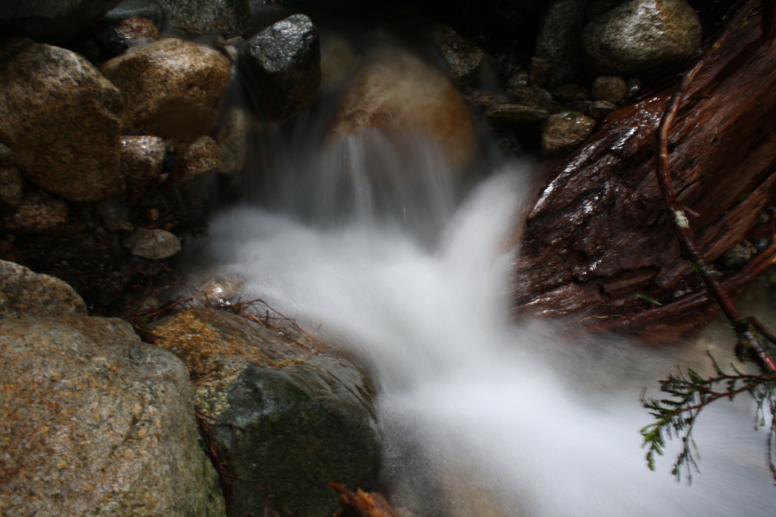
The trail is rocky and soon a tricky waterfall to cross. The trail turns into a rocky wet creek bed trail. After a few minutes a dirt trail reappears to the left. Shortly after it's a creek bed then trail.
As you walk along the somewhat rocky wet trail you'll come to Gold Creek Lookout. Carry on up the wooden stairs. Carry on the rocky trail. You'll come to Lower Falls sign for a quick side trial to see the Lower Falls but you'll have to come back up the trail to carry on as you can't cross at this point to get back to the East parking lot.
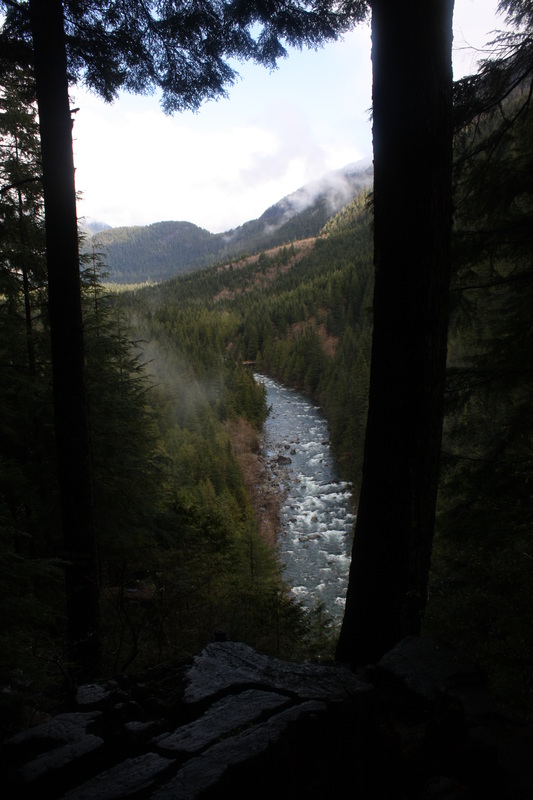
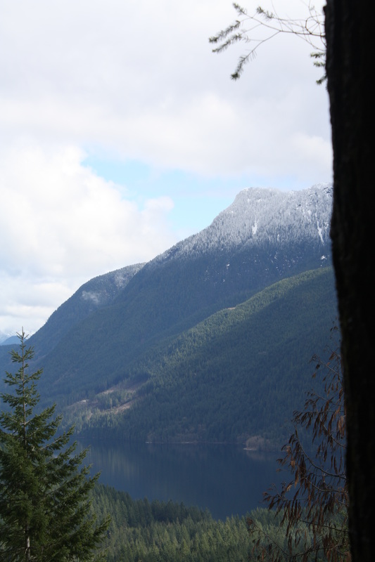
After quite sometime (2 k) you come to a big bridge and another one where once water was flowing. Keep walking down the wide dirt path on your right is a side trip to Viewpoint Trail (it's about 1.78 k to view. View is of lake and surrounding mountains). You can access Evans Peak & Alouette Mtn from this trail as well.
Once down go right and carry on to the West Canyon parking lot. We couldn't find a trail to the East parking lot so we walked down the road from the west parking lot, turned left and carefully walked along the road to The East parking lot (about 1 k) where we started this journey...Happy & safe trails.
Shortly after you'll come to a Y, go left. Then you'll come to a T with a sign post, go left. Walk on an old logging road as you cross several creeks. Some deeper depending on recent rain fall. Pass a big rock slide.
Then you'll come to a log bridge with an amazing waterfall. If you want to head down for a quick trip to Lower Falls, you can here but keep in mind it's not well marked and very steep. It's about 1 k down... Go left to connector bridge or straight for an added Km's to Hiker Beach & Viewpoint Beach. If you choose to carry on then you'll cross the new Connector Bridge...
Next sign post is to Alder Flats & Golden Ears (left) or straight down the trail to Hikers Beach (you may not be able to cross here depending on water level). If you decide to not go to Hikers Beach then you need to carry on the Alder Flats & Golden Ears way. You'll experience some elevation here. At the top go right up to Golden Ears & Alder Flats or carry on straight to West Canyon Parking Lot. Here is where you decide if you want to go up higher or carry onto the West Canyon parking lot. We carried onto the parking lot.
The trail is rocky and soon a tricky waterfall to cross. The trail turns into a rocky wet creek bed trail. After a few minutes a dirt trail reappears to the left. Shortly after it's a creek bed then trail.
As you walk along the somewhat rocky wet trail you'll come to Gold Creek Lookout. Carry on up the wooden stairs. Carry on the rocky trail. You'll come to Lower Falls sign for a quick side trial to see the Lower Falls but you'll have to come back up the trail to carry on as you can't cross at this point to get back to the East parking lot.
After quite sometime (2 k) you come to a big bridge and another one where once water was flowing. Keep walking down the wide dirt path on your right is a side trip to Viewpoint Trail (it's about 1.78 k to view. View is of lake and surrounding mountains). You can access Evans Peak & Alouette Mtn from this trail as well.
Once down go right and carry on to the West Canyon parking lot. We couldn't find a trail to the East parking lot so we walked down the road from the west parking lot, turned left and carefully walked along the road to The East parking lot (about 1 k) where we started this journey...Happy & safe trails.