Hiking for The Scaredy Cat: Hikes in and around Vancouver, B.C. Canada
  • Trail Information
    • The Hiking Trails & Safety Information >
      • Abby Grind: Abbotsford
      • Alder Flats: Golden Ears
      • Alouette Mtn: Golden Ears Provincial Park
      • Ancient Cedars Trail
      • Al's Habrich Ridge Trail: Sea to Sky Gondola
      • B.C.M.C. Grouse Mountain
      • Bear Mtn: Mission, BC
      • Big Cedar & Kennedy Falls: Mount Fromme
      • Blue Mountain:Coquitlam
      • Bosumarne Falls: Chilliwack, BC
      • Bowen Lookout:Cypress Mountain
      • Bridal Falls Lookout: Chilliwack-Agassiz
      • Brother's Creek: North Vancouver
      • Community Forest: Chilliwack
      • Coquitlam Crunch: Coquitlam
      • Cheakamus Lake: Whistler
      • Crystal Falls: Coquitlam, BC
      • Dewdney Grind: Mission
      • Diez Vistas: Buntzen Lake
      • East-West Connector Bridge Trail~Golden Ears Provincial Park
      • Eaton Lake: Hope
      • Elfin Lakes: Squamish
      • Elk Mountain: Chilliwack
      • Evan's Creek: Golden Ears Provincial Park
      • First Peak: Seymour Mountain
      • Ford Mtn: Chilliwack
      • Grouse Grind: West Vancouver
      • Garibaldi Lake: Squamish
      • Harrison Grind/Campbell Lake: Fraser Valley
      • Harrison Lookout/Fire Tower
      • Heather Trail: Manning Park
      • High Note Trail: Whistler
      • Hillkeep: Chilliwack
      • Hope Lookout Trail
      • Horne Lake Caves Provincial Park: Vancouver Island
      • Jacobson's Lake to Palmer Pond
      • Joffre Lakes: Pemberton
      • Jug Island: Belcarra Regional Park
      • Ladner Creek Train Trestle: Coquihalla Hwy
      • Killarney Lake: Bowen Island
      • Lake Lovely-Squamish
      • Larch Meadows: Manning Park
      • Levette Lake Loop: Squamish
      • Lewx Qwo:m (luhw KWOM): Chilliwack
      • Lindeman & Greendrop Lakes: Chilliwack
      • Lightning Lakes: Manning Park
      • Lindsay Lake Loop: Buntzen Lake
      • Little Douglas Lake: Coquihalla Summit
      • Lower Falls-East Canyon Parking Lot: Golden Ears
      • Lynn Loop: Lynn Headwaters Regiona Park
      • Lower Hollyburn: Cypress Mtn
      • Lynn Peak: Lynn Headwaters Regional Park
      • McKee Peak-Cliffside Caves
      • Mehatl Falls
      • Menzies: Golden Ears Provincial Park
      • Minnekhada Park: Coquitlam
      • Mount Cheam: Chilliwack
      • Mount Fromme: North Van
      • Mount Sleese to Memorial Plaque: Chiliwack
      • Mount St. Benedict: Mission
      • Mount Strachan: Mount Seymour
      • Mt. Thom: Chilliwack
      • Mt. Gardner: Bowen Island
      • Mt. Woodslide
      • Munro & Denette Lakes: Coquitlam
      • Mystery Lake: Mount Seymour
      • Needle Peak/Flatiron: Coquihalla Highway
      • Norvan Falls: Lynn Headwaters Regional Park
      • Othello Tunnels-Nicola Valley Loop
      • Parkhurst Ghost Town: Whistler
      • Panorama Ridge: Squamish
      • Petgill Lake: Howe Sound
      • Poland Lake-EC Manning Park
      • Quarry Rock: Deep Cove
      • Ravens Bluff-Mission
      • Red Mountain: Mission
      • Salmon Ridge Trail: Chilliwack, BC
      • Sasquatch Caves: Hope
      • Sea to Summit: Sea to Sky Gondola
      • Skyline: Grouse Mountain
      • Skyline 1: Manning Park
      • Spirit Caves-Yale, BC
      • St. Mark's: Cypress Mountain
      • Statlu Lake
      • The Stawamus Chief: Squamish
      • Tikwalus Trail: Spuzzum
      • Trickle Creek Treehouse
      • Thacker Mountain Trail: Hope
      • Tunnel Bluffs: Howe Sound
      • Vedder: Chilliwack
      • Watersprite Lake: Squamish
      • Wedgemont Lake: Whislter
      • Wells Peak
      • Widgeon Falls
      • Williams Peak
      • Windy Joe: Manning Park
      • Woodland Walk to Sawblade Falls
      • Zoa Peak: Coquihallia Hwy
    • The Snowshoe Trails & Safety Info >
      • Artist Point
      • Bowen Lookout
      • Dog Mountain: Day
      • Callaghan Valley
      • Dog Mountain: Night
      • Eagle Bluffs
      • Elfin Lakes to Red Heather Hut >
        • Fat Dog
        • First Pump
        • Hollyburn
        • Lightning Lakes Loop
        • Rainbow Lake
        • Sasquatch Mountain Snowshoe: Hemlock Valley
        • SS Grind
        • Stawberry Flats
        • Zoa
    • The U.S.A. Hikes >
      • Blue Lake: Northern Cascades
      • Chain Lakes
      • Damfino Lakes
      • Deception Pass State Park: Washington, USA
      • Oyster Dome
      • Yellow Aster Butte
    • The Trail Walks >
      • Aldergrove Regional Park: Aldergrove
      • Blue Heron Reserve: Chilliwack
      • Brae Island: Fort Langley
      • Burn's Bog: Delta
      • Burnaby Lake Loop: Burnaby
      • Campbell Valley: Langley
      • Cathederal Grove: MacMillian Provincial Park:
      • Delta Watershed
      • East Sector Lands: Harrison Hot Springs
      • Elgin Park: Surrey, BC
      • Green Timbers: Surrey
      • High Knoll Park: Surrey
      • Houston Trail: Fort Langley
      • Katzie Marsh Loop: Pitt Meadows
      • Lower Falls: Golden Ears: Maple Ridge
      • Lower Seymour Conservation: North Vancouver
      • Lighthouse Park: West Vancouver
      • Mud Bay: Surrey
      • Redwood Park: Surrey
      • Reifel Bird Santuary: Delta
      • Rice Lake: North Vancouver
      • Richmond Nature Park: Richmond
      • Rolley Lake: Mission
      • Ruth Johnson Park: White Rock
      • Sasamat Lake: Port Moody
      • Spirea Trail: Golden Ears
      • Sunnyside Urban Forest: Surrey
      • Serpentine Bird Santuary
      • Shoesmith East Trail Loop: Maple Ridge
      • Spirit Trail: Ladner
      • Stanley Park Seawall: Vancouver
      • Sye'xw Cho'teqw Adventure Park
      • The Jetti: Iona Beach, Richmond
      • Tynehead
      • Yew Lake
  • My Blogging
  • Mt. Kilimanjaro
  • In the River Valley Hikes
  • West Coast Trail
  • Peru
  • Hiking Snapshots
    • Thru Hikes
    • Bears & Cougars +
    • Proper Hiking Footwear
    • Trail Etiquette

Needle peak/Flatiron
Coquihalla Highway

 
Trail Key: M~2~RT~CC~R~V~KF~DF
 
Length: 13 Km's return
Elevation: To lake: 580 meters

To peak: 882 meters
Pit Toilet: No
Dogs: Yes…depending on final location & dog

Directions:
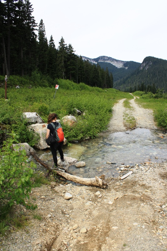
Drive north from Hope on Highway 5 (Coquihalla Highway) to exit #217 towards the rest area, turn right as though you're heading towards the nearby highway maintenance shed. Look for a small gravel service road on your right and park alongside it. The trail head is off of the pipeline service road after the small creek you’ll need to cross by foot.


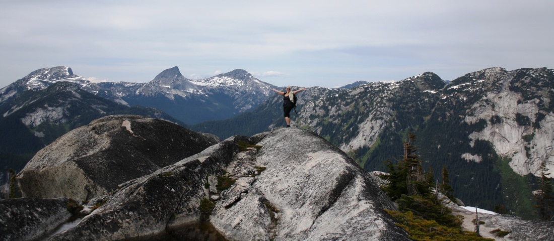
The one thing I love about this hike is there are many options for people. You can make your summit wherever you want as the views are amazing all along and only get better.

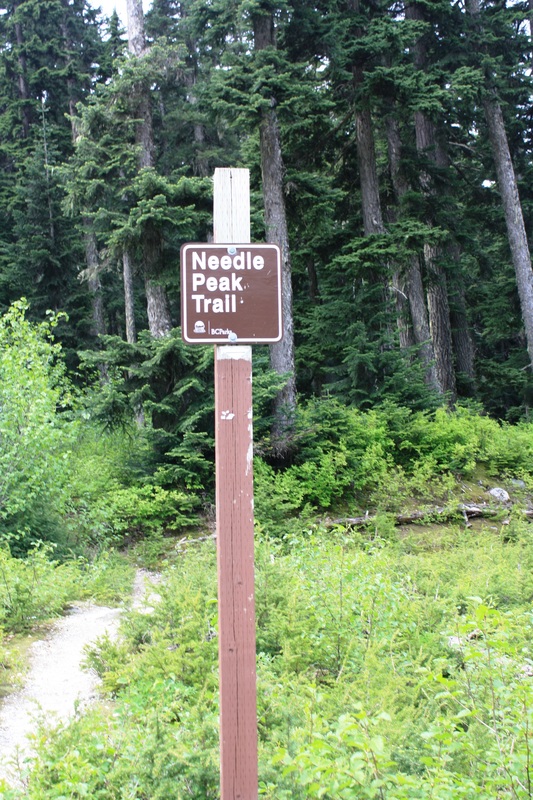
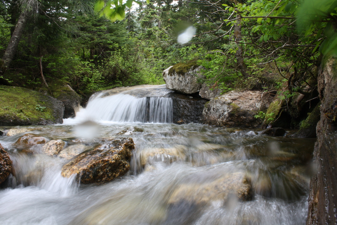
After you park walk about 100 meters to a small but deep creek crossing. Make your way across hopefully avoiding getting your feet wet. Right away you’ll see the brown Needle Peak sign on your left. It is here that your adventure starts. In the beginning there are traditional orange markers but once higher up the markers are gone and you must keep your eyes open to find where you are going.

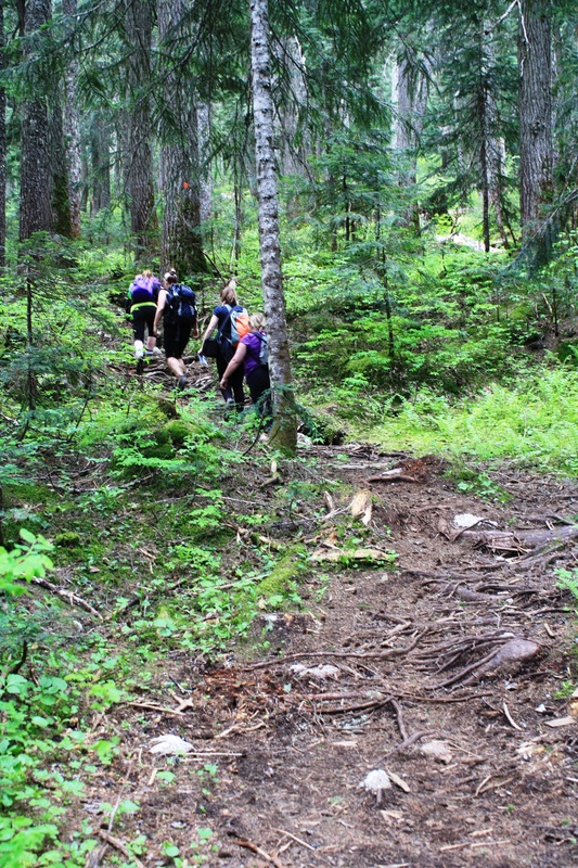
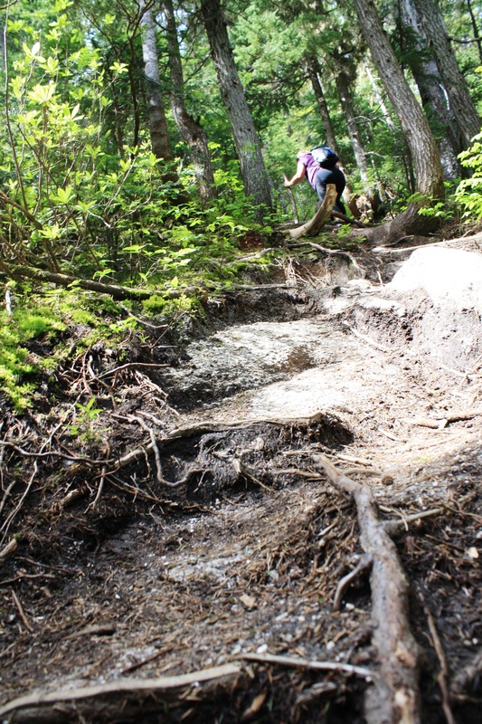
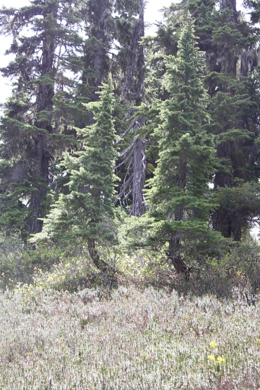
The snaky trail which is often root covered starts its way up hill. The grade is easy at this point. Soon after the trail begins to steadily climb zig zagging its way along. Roots, rocks, trees are nature's way to help assist you on this steep terrain. It’s a nice climb through the forest.

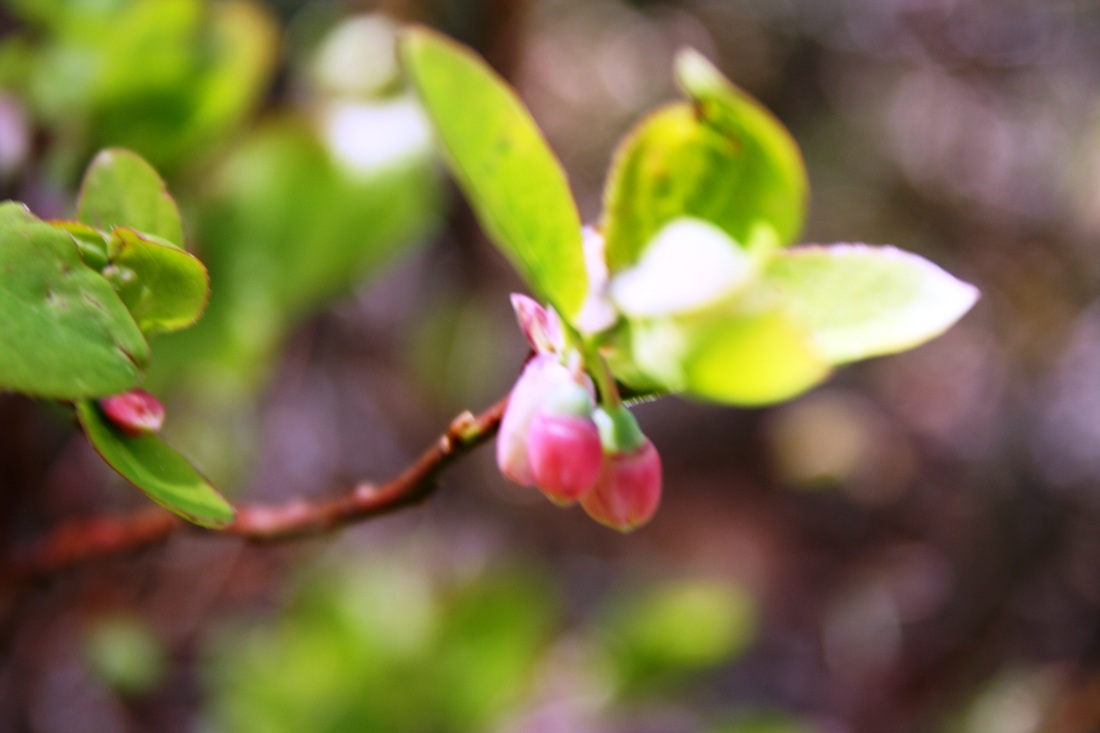
After awhile, the trail opens up lined with wild blueberries. If you’re lucky with timing it can make a nice snack as you keep climbing. The occasional glimpse shows the tip of beauty of what’s to come. The highway is far below and you can’t believe you have climbed thus far.
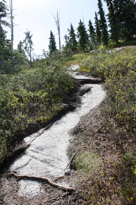
The trail switches from dirt and roots to granite rock and back to dirt and roots.On a dry day it's fine but it would be a little tricky after a rain.

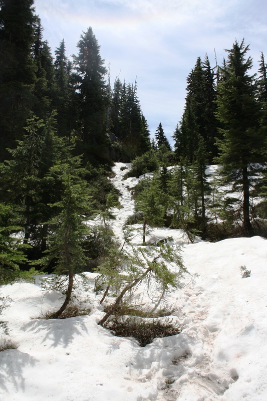
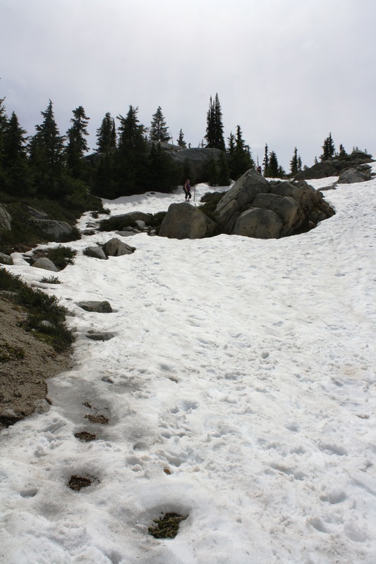
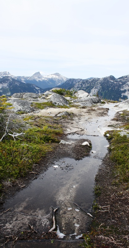
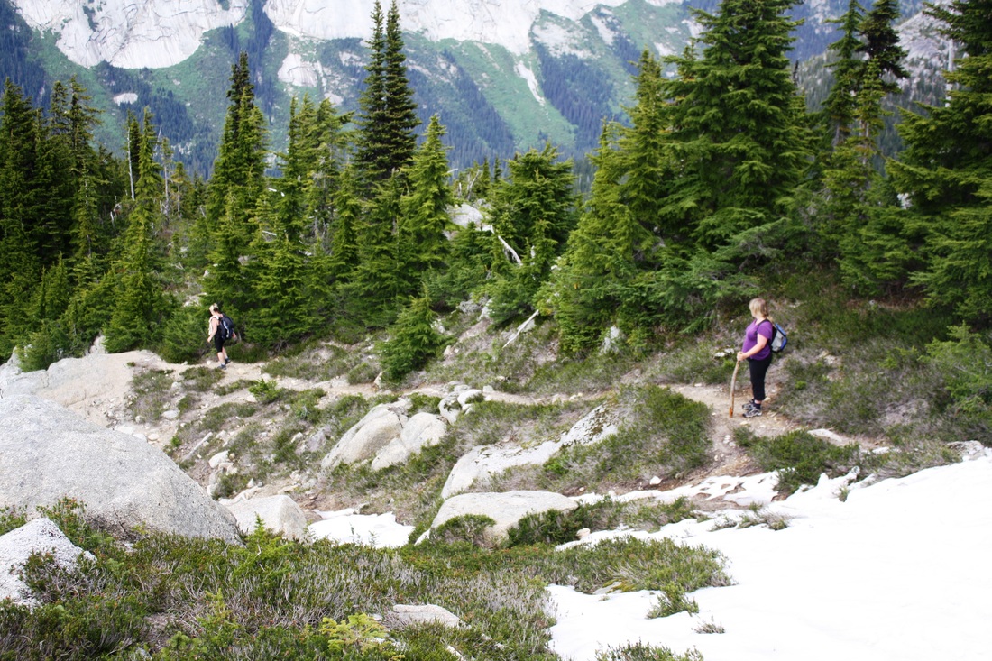
 After some time you come to a somewhat steep gully (which was snow covered in late May). Once you past this section it levels out with some ups and downs. After awhile there's another steep up and again the trail levels out.


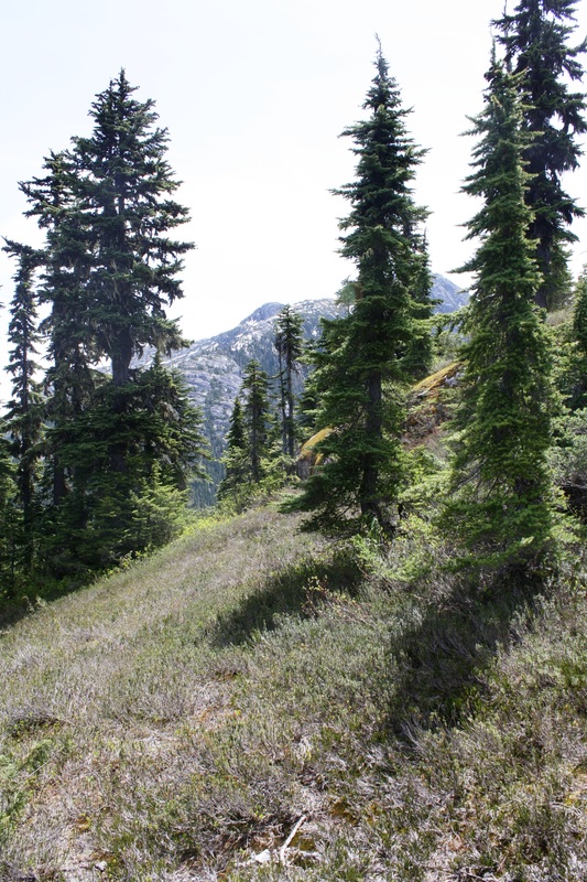
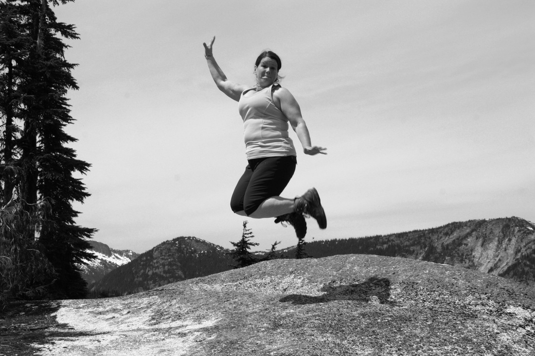
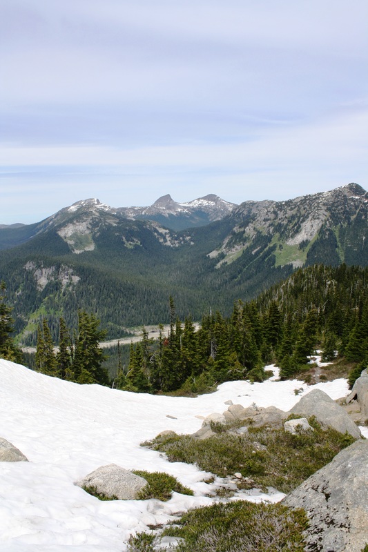
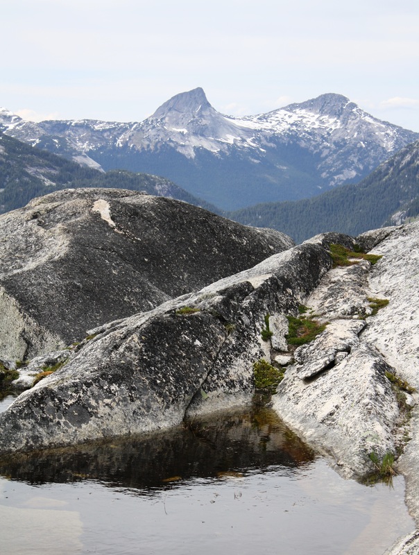
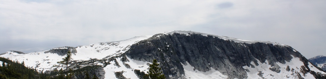
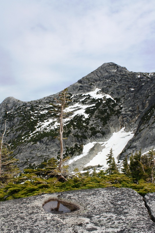
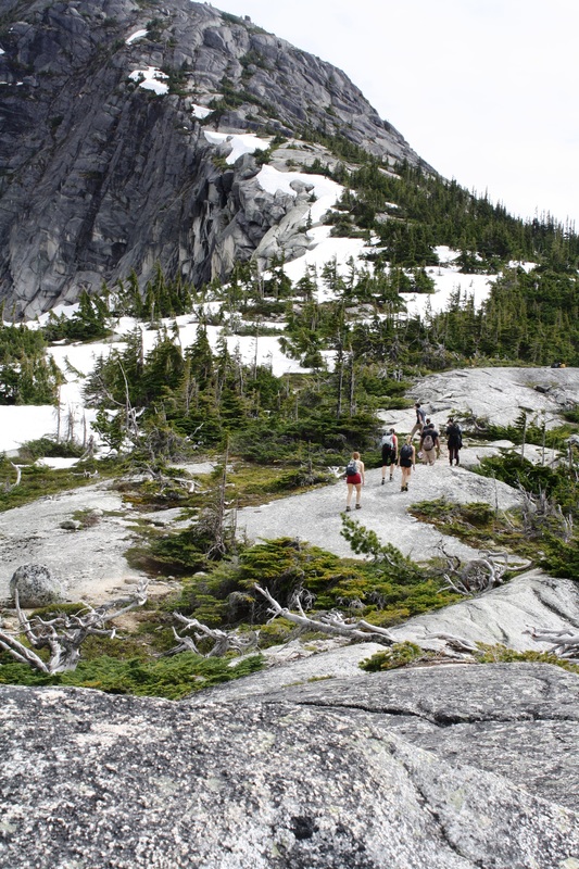
Soon the trail emerges onto a big rocky outcrop with eye candy vistas. Your destination is in sight. Needle peak is to your left and Flatiron is to your right. Or you can make this your destination. Depending on where you want to go, you have about an 45 minutes to each location. Follow the granite route up through the trees. Soon you’ll come to a branch. Make your decision on what you want to do. going left up to Needle Peak is for more experienced non Scaredy Cat peeps or going right you'll descend to a beautiful alpine lake and finally a short some what sketchy scramble up to Flatiron.  Happy & safe trails.


Proudly powered by Weebly
  • Trail Information
    • The Hiking Trails & Safety Information >
      • Abby Grind: Abbotsford
      • Alder Flats: Golden Ears
      • Alouette Mtn: Golden Ears Provincial Park
      • Ancient Cedars Trail
      • Al's Habrich Ridge Trail: Sea to Sky Gondola
      • B.C.M.C. Grouse Mountain
      • Bear Mtn: Mission, BC
      • Big Cedar & Kennedy Falls: Mount Fromme
      • Blue Mountain:Coquitlam
      • Bosumarne Falls: Chilliwack, BC
      • Bowen Lookout:Cypress Mountain
      • Bridal Falls Lookout: Chilliwack-Agassiz
      • Brother's Creek: North Vancouver
      • Community Forest: Chilliwack
      • Coquitlam Crunch: Coquitlam
      • Cheakamus Lake: Whistler
      • Crystal Falls: Coquitlam, BC
      • Dewdney Grind: Mission
      • Diez Vistas: Buntzen Lake
      • East-West Connector Bridge Trail~Golden Ears Provincial Park
      • Eaton Lake: Hope
      • Elfin Lakes: Squamish
      • Elk Mountain: Chilliwack
      • Evan's Creek: Golden Ears Provincial Park
      • First Peak: Seymour Mountain
      • Ford Mtn: Chilliwack
      • Grouse Grind: West Vancouver
      • Garibaldi Lake: Squamish
      • Harrison Grind/Campbell Lake: Fraser Valley
      • Harrison Lookout/Fire Tower
      • Heather Trail: Manning Park
      • High Note Trail: Whistler
      • Hillkeep: Chilliwack
      • Hope Lookout Trail
      • Horne Lake Caves Provincial Park: Vancouver Island
      • Jacobson's Lake to Palmer Pond
      • Joffre Lakes: Pemberton
      • Jug Island: Belcarra Regional Park
      • Ladner Creek Train Trestle: Coquihalla Hwy
      • Killarney Lake: Bowen Island
      • Lake Lovely-Squamish
      • Larch Meadows: Manning Park
      • Levette Lake Loop: Squamish
      • Lewx Qwo:m (luhw KWOM): Chilliwack
      • Lindeman & Greendrop Lakes: Chilliwack
      • Lightning Lakes: Manning Park
      • Lindsay Lake Loop: Buntzen Lake
      • Little Douglas Lake: Coquihalla Summit
      • Lower Falls-East Canyon Parking Lot: Golden Ears
      • Lynn Loop: Lynn Headwaters Regiona Park
      • Lower Hollyburn: Cypress Mtn
      • Lynn Peak: Lynn Headwaters Regional Park
      • McKee Peak-Cliffside Caves
      • Mehatl Falls
      • Menzies: Golden Ears Provincial Park
      • Minnekhada Park: Coquitlam
      • Mount Cheam: Chilliwack
      • Mount Fromme: North Van
      • Mount Sleese to Memorial Plaque: Chiliwack
      • Mount St. Benedict: Mission
      • Mount Strachan: Mount Seymour
      • Mt. Thom: Chilliwack
      • Mt. Gardner: Bowen Island
      • Mt. Woodslide
      • Munro & Denette Lakes: Coquitlam
      • Mystery Lake: Mount Seymour
      • Needle Peak/Flatiron: Coquihalla Highway
      • Norvan Falls: Lynn Headwaters Regional Park
      • Othello Tunnels-Nicola Valley Loop
      • Parkhurst Ghost Town: Whistler
      • Panorama Ridge: Squamish
      • Petgill Lake: Howe Sound
      • Poland Lake-EC Manning Park
      • Quarry Rock: Deep Cove
      • Ravens Bluff-Mission
      • Red Mountain: Mission
      • Salmon Ridge Trail: Chilliwack, BC
      • Sasquatch Caves: Hope
      • Sea to Summit: Sea to Sky Gondola
      • Skyline: Grouse Mountain
      • Skyline 1: Manning Park
      • Spirit Caves-Yale, BC
      • St. Mark's: Cypress Mountain
      • Statlu Lake
      • The Stawamus Chief: Squamish
      • Tikwalus Trail: Spuzzum
      • Trickle Creek Treehouse
      • Thacker Mountain Trail: Hope
      • Tunnel Bluffs: Howe Sound
      • Vedder: Chilliwack
      • Watersprite Lake: Squamish
      • Wedgemont Lake: Whislter
      • Wells Peak
      • Widgeon Falls
      • Williams Peak
      • Windy Joe: Manning Park
      • Woodland Walk to Sawblade Falls
      • Zoa Peak: Coquihallia Hwy
    • The Snowshoe Trails & Safety Info >
      • Artist Point
      • Bowen Lookout
      • Dog Mountain: Day
      • Callaghan Valley
      • Dog Mountain: Night
      • Eagle Bluffs
      • Elfin Lakes to Red Heather Hut >
        • Fat Dog
        • First Pump
        • Hollyburn
        • Lightning Lakes Loop
        • Rainbow Lake
        • Sasquatch Mountain Snowshoe: Hemlock Valley
        • SS Grind
        • Stawberry Flats
        • Zoa
    • The U.S.A. Hikes >
      • Blue Lake: Northern Cascades
      • Chain Lakes
      • Damfino Lakes
      • Deception Pass State Park: Washington, USA
      • Oyster Dome
      • Yellow Aster Butte
    • The Trail Walks >
      • Aldergrove Regional Park: Aldergrove
      • Blue Heron Reserve: Chilliwack
      • Brae Island: Fort Langley
      • Burn's Bog: Delta
      • Burnaby Lake Loop: Burnaby
      • Campbell Valley: Langley
      • Cathederal Grove: MacMillian Provincial Park:
      • Delta Watershed
      • East Sector Lands: Harrison Hot Springs
      • Elgin Park: Surrey, BC
      • Green Timbers: Surrey
      • High Knoll Park: Surrey
      • Houston Trail: Fort Langley
      • Katzie Marsh Loop: Pitt Meadows
      • Lower Falls: Golden Ears: Maple Ridge
      • Lower Seymour Conservation: North Vancouver
      • Lighthouse Park: West Vancouver
      • Mud Bay: Surrey
      • Redwood Park: Surrey
      • Reifel Bird Santuary: Delta
      • Rice Lake: North Vancouver
      • Richmond Nature Park: Richmond
      • Rolley Lake: Mission
      • Ruth Johnson Park: White Rock
      • Sasamat Lake: Port Moody
      • Spirea Trail: Golden Ears
      • Sunnyside Urban Forest: Surrey
      • Serpentine Bird Santuary
      • Shoesmith East Trail Loop: Maple Ridge
      • Spirit Trail: Ladner
      • Stanley Park Seawall: Vancouver
      • Sye'xw Cho'teqw Adventure Park
      • The Jetti: Iona Beach, Richmond
      • Tynehead
      • Yew Lake
  • My Blogging
  • Mt. Kilimanjaro
  • In the River Valley Hikes
  • West Coast Trail
  • Peru
  • Hiking Snapshots
    • Thru Hikes
    • Bears & Cougars +
    • Proper Hiking Footwear
    • Trail Etiquette