Tikwalus Trail (Old Brigade Trail)
Past Spuzzum, BC
Trail Key: D~2~ST~R~V~CC~KF~DF~WF~PT
Length: 12.5 Km's
Elevation: 788 meters
Pit Toilet: Yes
Dogs: Yes
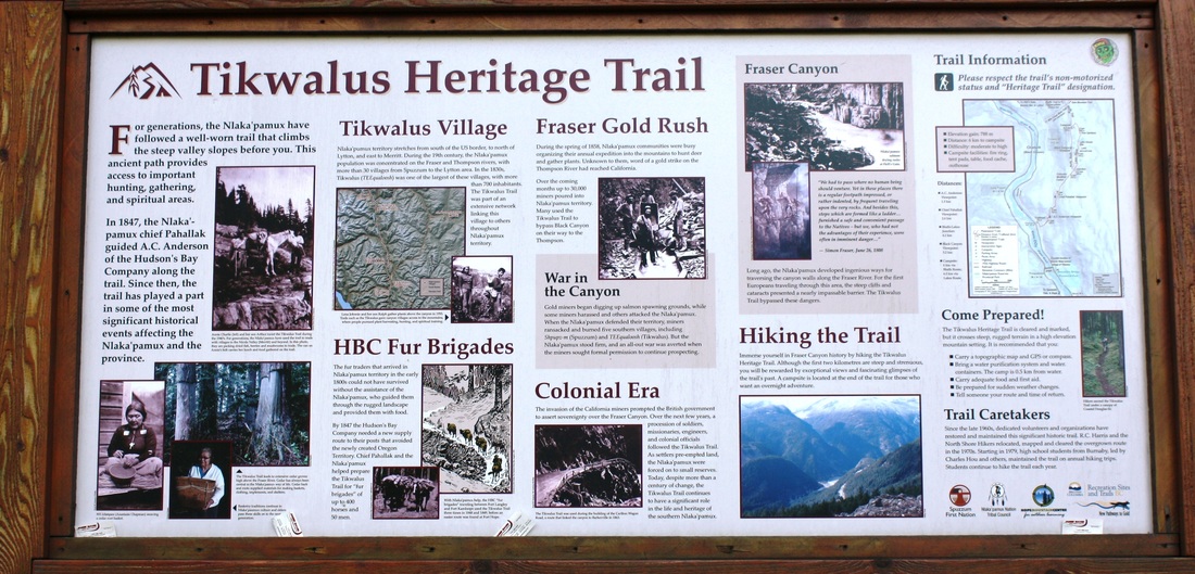
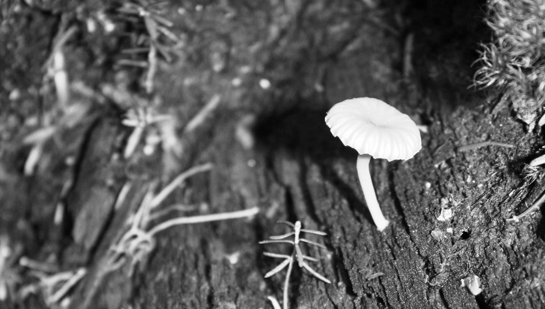
This is an amazing First Nations trail that is a steep climb to Gate Mountain. The Nlaka’pamux has travelled this ancient trail as hunting grounds, for gathering and spiritual needs. The trail was formally called The Old BrigadeTrail. It has been upgraded for us to make the trek The Nlaka’pamux did many times years ago. There are sign posts as you make your way along with history and Aboriginal stories. It’s very remarkable and I felt privileged to be allowed to make this journey. It’s a beautiful hike with forever changing surroundings. There’s a little bit of everything along the way. The trail is well marked with Km sign posts on either side of the trees as you make your way to and from. It’s an in-out trail with a loop at the top. You can choose to go to Gate Mountain but we did it as the in-out trail with the loop. Bring poles and extra water as there is only one creek to fill up your bottles.
Directions: The TH is along Highway 1, about 50 Km’s north of Hope. There’s a pullout just after the Alexandra Bridge, park here. The trail starts on the left of the sign post.
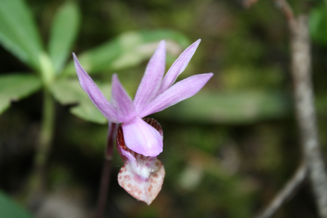
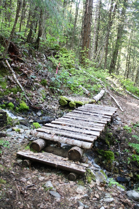
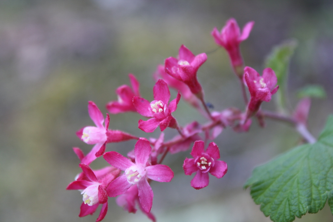
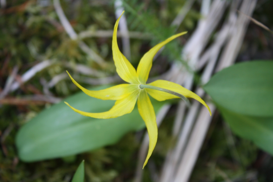
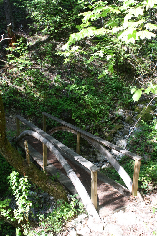
Go up and a cross a funky bridge then the trail levels out a bit. The next section is a very steep hill but quick. If the timing is right you'll see Lady Slipper’s lining the trail which is part of the Orchid family. This is the steepest part of the trail as it zig zags its way up, up and up!
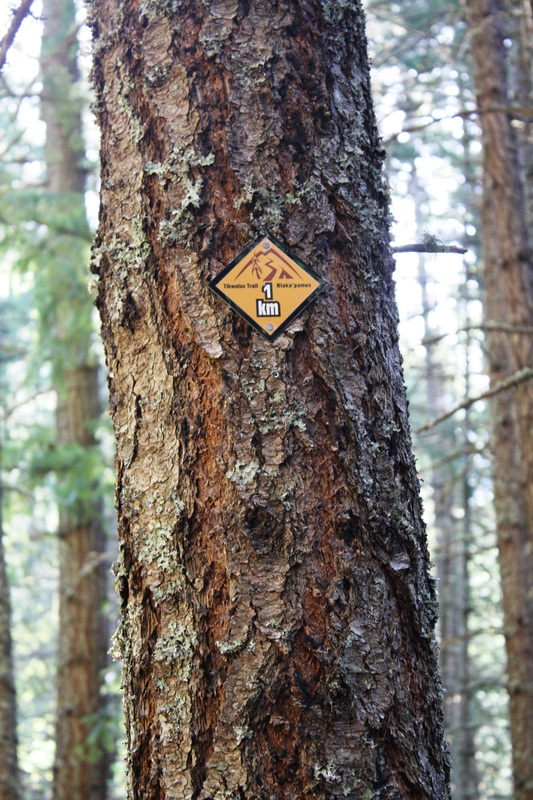
Soon you'll come to the 1 km sign post: 320 meters. Pace yourself as it's up all the way.
Shortly after the 1 km trail marker you'll come to the first lookout, AC Anderson Viewpoint. Now the grade is slightly easier with 230 meters in this section of trail but don’t think for a minute it's easy. Anyone can hike this trail but pacing yourself is key.
As you come into the light, rushing water brings delight to your ears. The vegetation changes and the 2 km sign post is there to greet you. Now the grade is some what easier with another 170 meters to travel until the next Km SP. Someone wrote that the elevation is somewhat easier from this point on however, the fittest in my group would argue as it truly never ends until you’re on your way down which then becomes a knee issue.
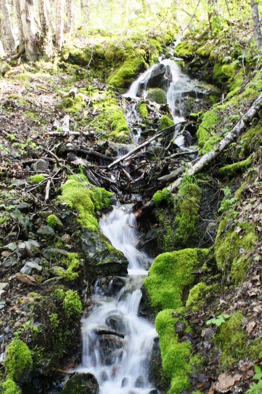
You’ll pass a cool little bridge with a rushing creek and a mossy waterfall. A rock slide is to your left and a large tree to go under as you climb to the top of this mini waterfall. The trail is a bit exposed but it's not bad. A little view to see and you’re back in woods.
The Chief Pahallak Viewpoint is here with a stunning vista. Now it's 80 meters to the 4 Km's marker.
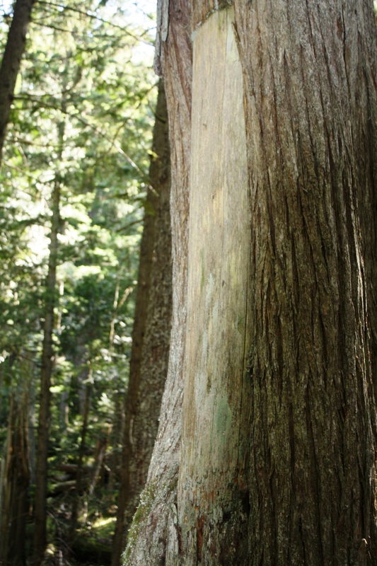
Up and down with short steep sections. Now you’re back into a tree forestry area of Culturally Modified Cedars while walking on a soft ground. Shortly there after is the marker for 4 Km's.
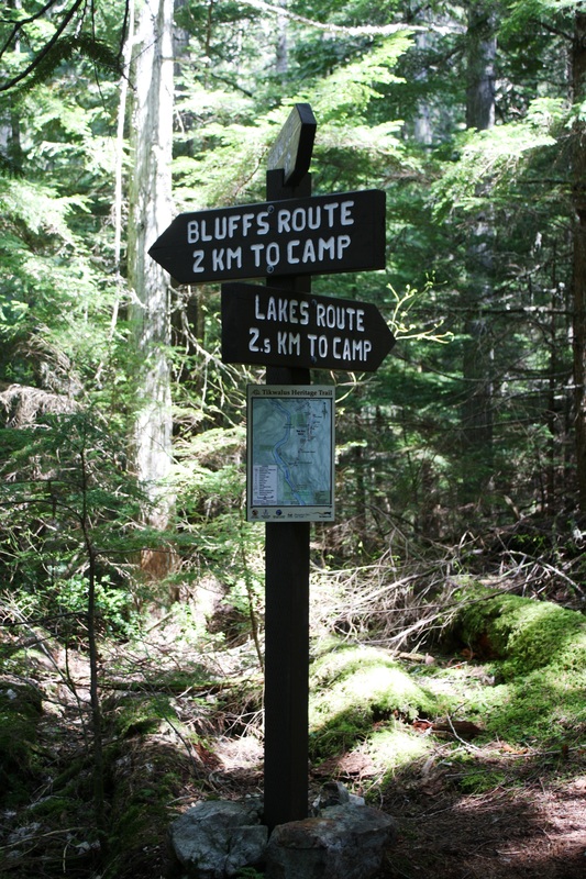
Then at around 4.2 Km's is the junction for the loop trail. Take the Lake Route. It has 60 meters of elevation and shortly
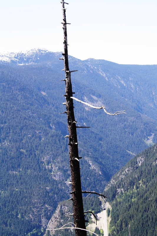
after some elevation loss and gain to the camp. In this section it's a dead forest coming back to life from a 2004 forest fire which started from a vehicle far below.
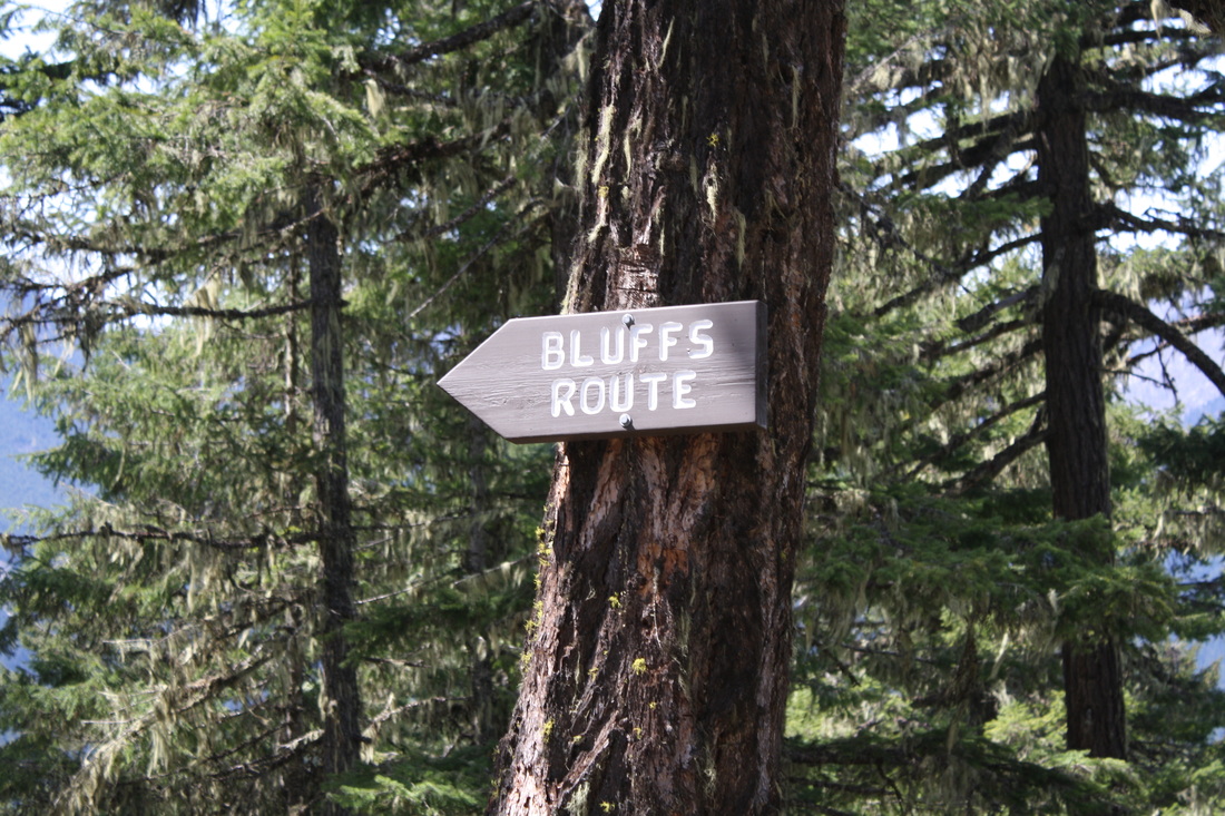
There’s a steep section down and you’ll cross a small creek. One more up and then the trail levels off and soon you see the green pit toilet (bring your own toilet paper) and the camp is steps away. Here there is a Bear Cache and a large fire pit. The views are amazing! Once you have had a snack carry onto the Bluffs Route.
Descend down to a little hill and another small creek crossing.
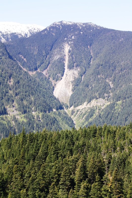
Now it’s one last grunt up a steep trail to Ch.eteik Lookout (Black Canyon). This is by far the prettiest lookout with the highway and a muddy Fraser River far below. Pat yourself on the back as you have earned this view! Once you’ve filled your camera with memories carry onto the left along the ridge for a few hundred meters and back into the forest. Go down and cross a stream and up to the loop junction. Once there, make your way back down the way you came earlier carefully navigating the steeper sections. Happy & safe trails.
Past Spuzzum, BC
Trail Key: D~2~ST~R~V~CC~KF~DF~WF~PT
Length: 12.5 Km's
Elevation: 788 meters
Pit Toilet: Yes
Dogs: Yes
This is an amazing First Nations trail that is a steep climb to Gate Mountain. The Nlaka’pamux has travelled this ancient trail as hunting grounds, for gathering and spiritual needs. The trail was formally called The Old BrigadeTrail. It has been upgraded for us to make the trek The Nlaka’pamux did many times years ago. There are sign posts as you make your way along with history and Aboriginal stories. It’s very remarkable and I felt privileged to be allowed to make this journey. It’s a beautiful hike with forever changing surroundings. There’s a little bit of everything along the way. The trail is well marked with Km sign posts on either side of the trees as you make your way to and from. It’s an in-out trail with a loop at the top. You can choose to go to Gate Mountain but we did it as the in-out trail with the loop. Bring poles and extra water as there is only one creek to fill up your bottles.
Directions: The TH is along Highway 1, about 50 Km’s north of Hope. There’s a pullout just after the Alexandra Bridge, park here. The trail starts on the left of the sign post.
Go up and a cross a funky bridge then the trail levels out a bit. The next section is a very steep hill but quick. If the timing is right you'll see Lady Slipper’s lining the trail which is part of the Orchid family. This is the steepest part of the trail as it zig zags its way up, up and up!
Soon you'll come to the 1 km sign post: 320 meters. Pace yourself as it's up all the way.
Shortly after the 1 km trail marker you'll come to the first lookout, AC Anderson Viewpoint. Now the grade is slightly easier with 230 meters in this section of trail but don’t think for a minute it's easy. Anyone can hike this trail but pacing yourself is key.
As you come into the light, rushing water brings delight to your ears. The vegetation changes and the 2 km sign post is there to greet you. Now the grade is some what easier with another 170 meters to travel until the next Km SP. Someone wrote that the elevation is somewhat easier from this point on however, the fittest in my group would argue as it truly never ends until you’re on your way down which then becomes a knee issue.
You’ll pass a cool little bridge with a rushing creek and a mossy waterfall. A rock slide is to your left and a large tree to go under as you climb to the top of this mini waterfall. The trail is a bit exposed but it's not bad. A little view to see and you’re back in woods.
The Chief Pahallak Viewpoint is here with a stunning vista. Now it's 80 meters to the 4 Km's marker.
Up and down with short steep sections. Now you’re back into a tree forestry area of Culturally Modified Cedars while walking on a soft ground. Shortly there after is the marker for 4 Km's.
Then at around 4.2 Km's is the junction for the loop trail. Take the Lake Route. It has 60 meters of elevation and shortly
after some elevation loss and gain to the camp. In this section it's a dead forest coming back to life from a 2004 forest fire which started from a vehicle far below.
There’s a steep section down and you’ll cross a small creek. One more up and then the trail levels off and soon you see the green pit toilet (bring your own toilet paper) and the camp is steps away. Here there is a Bear Cache and a large fire pit. The views are amazing! Once you have had a snack carry onto the Bluffs Route.
Descend down to a little hill and another small creek crossing.
Now it’s one last grunt up a steep trail to Ch.eteik Lookout (Black Canyon). This is by far the prettiest lookout with the highway and a muddy Fraser River far below. Pat yourself on the back as you have earned this view! Once you’ve filled your camera with memories carry onto the left along the ridge for a few hundred meters and back into the forest. Go down and cross a stream and up to the loop junction. Once there, make your way back down the way you came earlier carefully navigating the steeper sections. Happy & safe trails.