My BlogGing
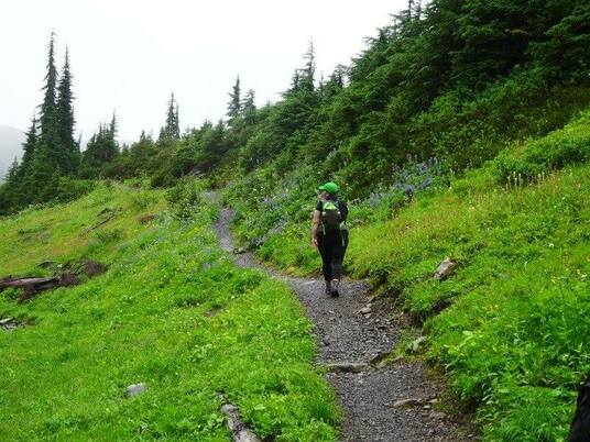
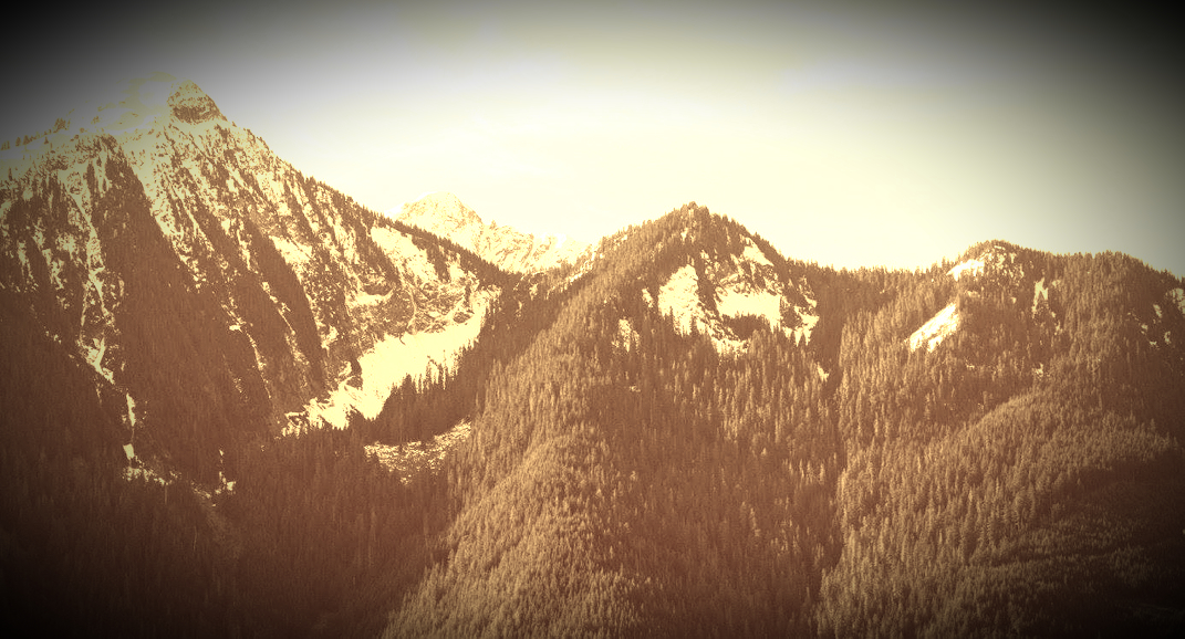
Spring is finally here. Time to hike! However, it might be dangerous to go higher up in the mountains with avalanche risks or slippery rocks & roots, but you still need your nature fix. There's nothing like a walk in the forest after it has rained. The sweet smells will make you happy that you got out. You'll release some stress and feel great. Here's some terrific walks and hikes you can do on a rainy day! ~Brae Island...a nice flat well groomed 4 km trail walk in Fort Langley that follows The Fraser River. Add Fort to Fort to make it longer. ~Menzies Trail at Golden Ears. A 9 Km's hike that can be done as a loop or an in-out trail. Expect wet feet as you'll cross many streams and one waterfall. I have a lot more trail walks to choose from: http://www.hikingforthescaredycat.com/my-trail-walks.html#.VRK-j2K9KSM Happy & safe trails! Lori aka Scaredy Cat. 
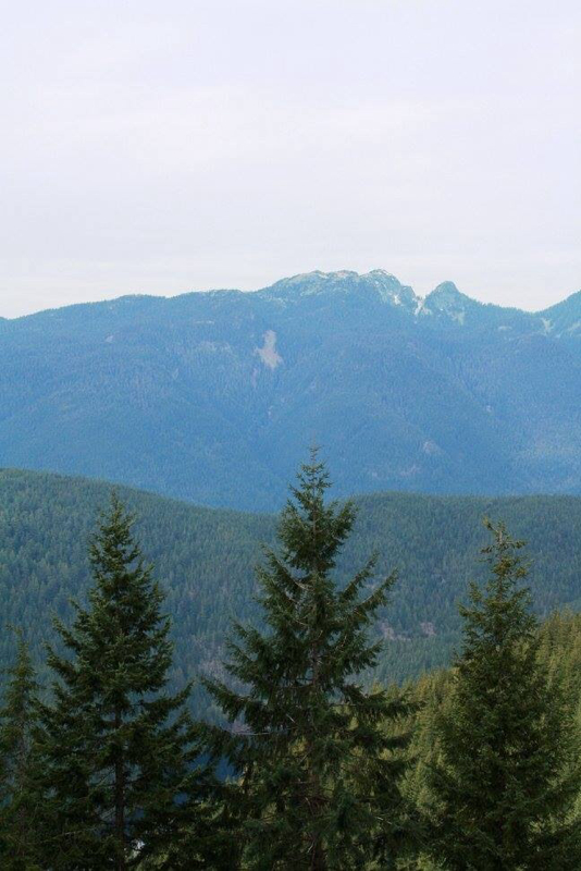
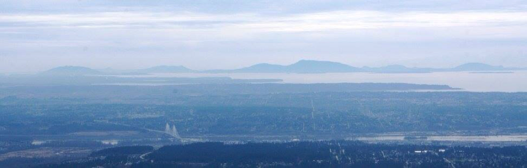
Buntzen Lake
0 Comments
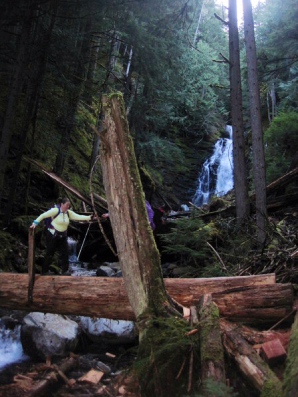
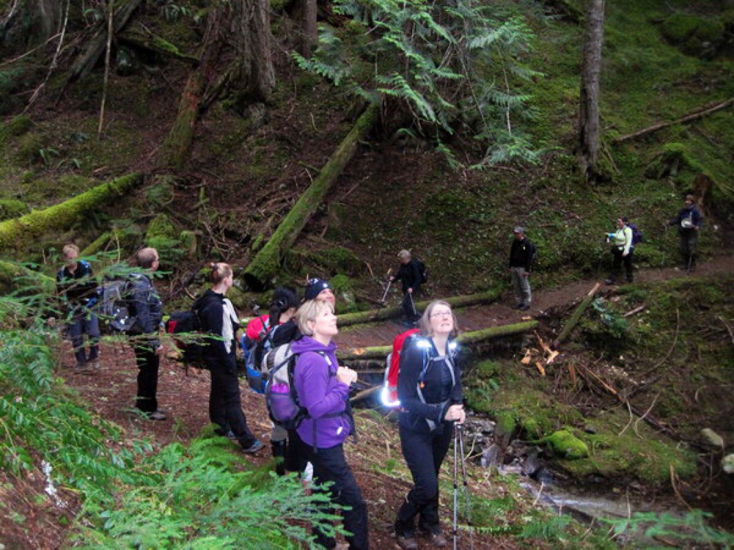
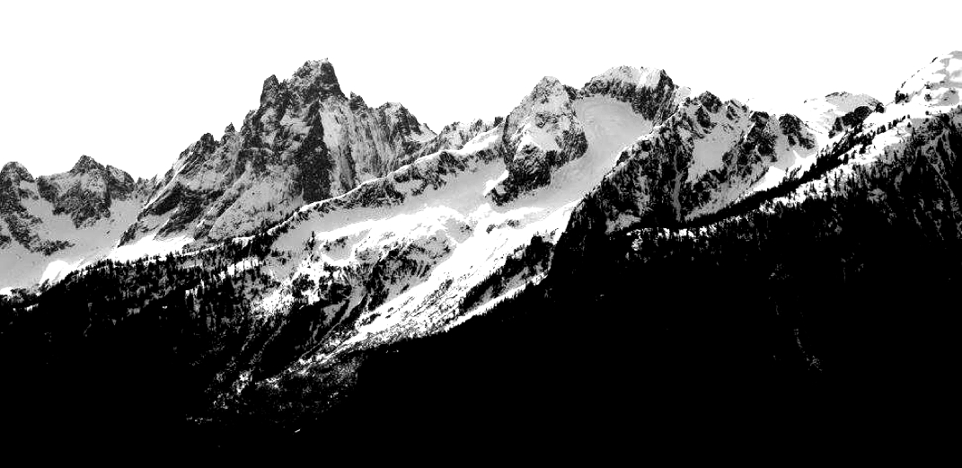
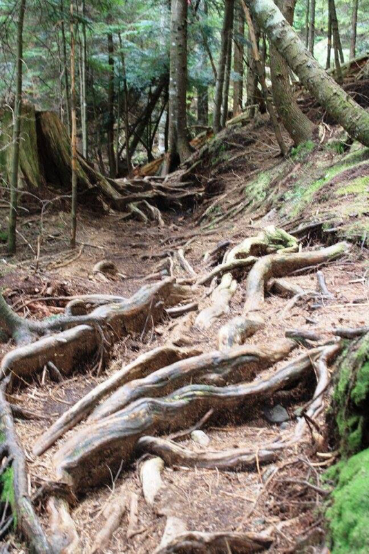
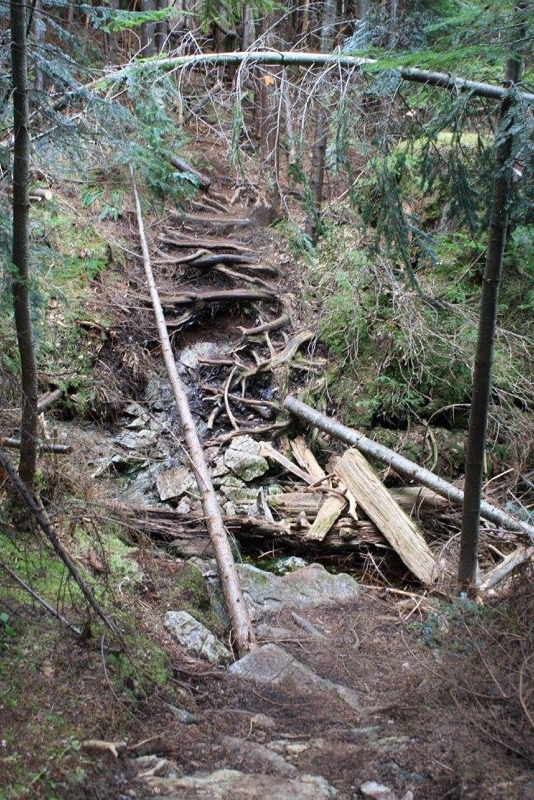
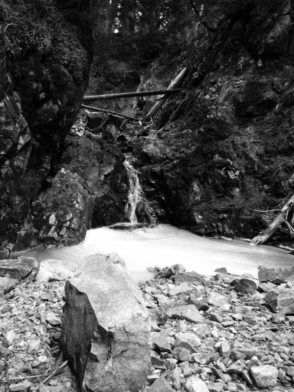
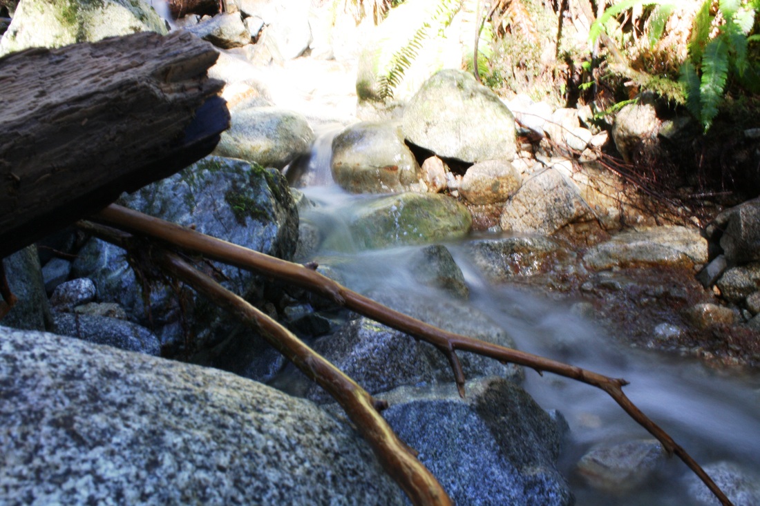
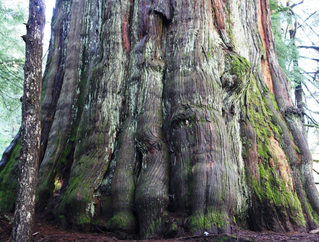
 Directions: Drive to North Vancouver and take exit 21/Mountain Highway. Stay right and follow the road to Dempsey and park on Dempsey. Parking anywhere else could result in a tow. They are planning on having a parking lot May 2015 at the trail head but for now this is your only option. Trail Head: Once parked follow road up about 5 blocks and you’ll see the first of two yellow gates. Keep walking past second yellow gate by pit toilets. This is the only washroom on the trail. This trail can be very muddy, creek crossings can be full on waterfalls depending on the latest precipitation. Good waterproof hiking boots and gators are an assets on this trail. Trail Key: M~2~RY~R~V~PT~RH 2015~Keep following the wide road to trail junction, Big Cedar Trail, go right down the rocky path. Follow it along path to trail junction, Kirkford and go right. Do not go up Kirkford. It doesn’t look like a trail but it is. It’s not marked…A few moments later you’ll cross a creek. If it has rained recently it might be a full waterfall. This trail has yellow markers in the trees but you’ll likely not see them as they are not noticeable on the way in so keep looking behind you and then you’ll know you are on the right path. The trail is also marked with pink flagging tape. There are several muddy sections and many creek crossings. The trail snakes its way here and there and soon you’ll come to a step log and right away a blow down tree. You can squeeze under or if you’re tall swing your legs over. Soon you’ll come to a steep & slippery dirt path and quite a drop off. It's a little slippery here and there are a few roots to grab onto as you make your way down. There's a couple of rope assists to help guide you as well. This is the worst part of the trail. Once at the bottom there is yet another creek crossing. A couple more downs and the first of two creek beds. The first May or may not be dry and the trail picks up on the other side slightly down the creek bed. Shortly after, you’ll come to another trail going down, another creek crossing, mud and more slippery roots. Lots of blowdown to cross over and under. A couple more ups and downs and her majesty is there in the middle of the trail to greet you, in all her glory. She is beautiful standing tall and 45 feet wide/5 meters (measured by Ron). This is the perfect spot for lunch. If you decide to go right, & down the steep switchbacks you can see Lynn Creek or go behind the cedar tree and the trail picks again and takes you to Kennedy Falls. On your way to Kennedy Falls the trail has much of what you've experienced already. It's about another hour. It's worth it to see the falls. They are amazing! Finally, you'll see the falls but keep going as the trail takes you right down beside them. On a hot summer day it would be amazing to have your lunch while listening to them roar down powerfully beside you. It is a beautiful 12 km's return trail. Expect to get wet, muddy and to have a real good time! Scaredy Cat says you won't loose any of your nine lives but be careful on the steep section and the slippery parts. Don’t forget your camera!!! Lori aka Scaredy Cat. Thanks to Karl from Outdoor Vancouver for finding this beauty! For more information check out Outdoor Vancouver's post on this trail: http://www.outdoorvancouver.ca/hiking-big-cedar-trail-kennedy-creek-falls/ 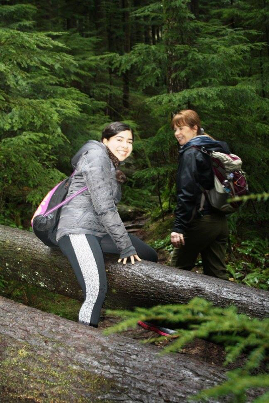 Diana's first hike, ever. She's from Mexico. She did great. Here she is crossing one of the many blowdown's. 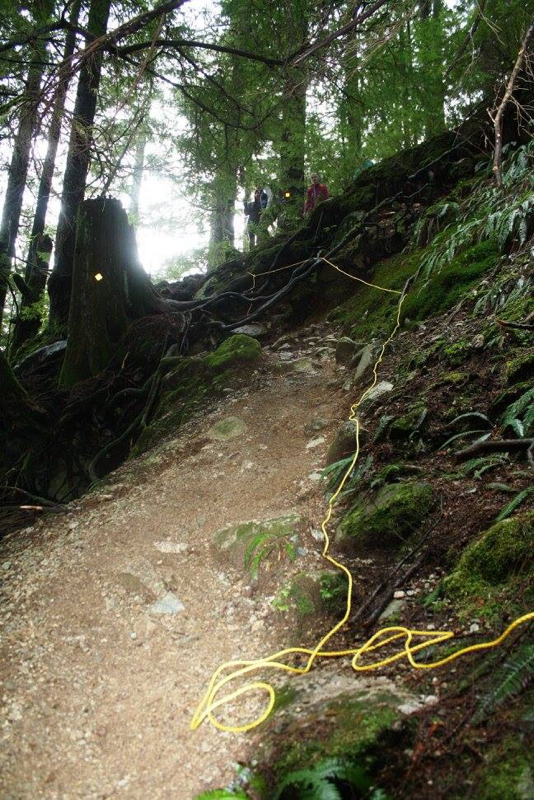 Rope assist, if you need it at the only steep section. 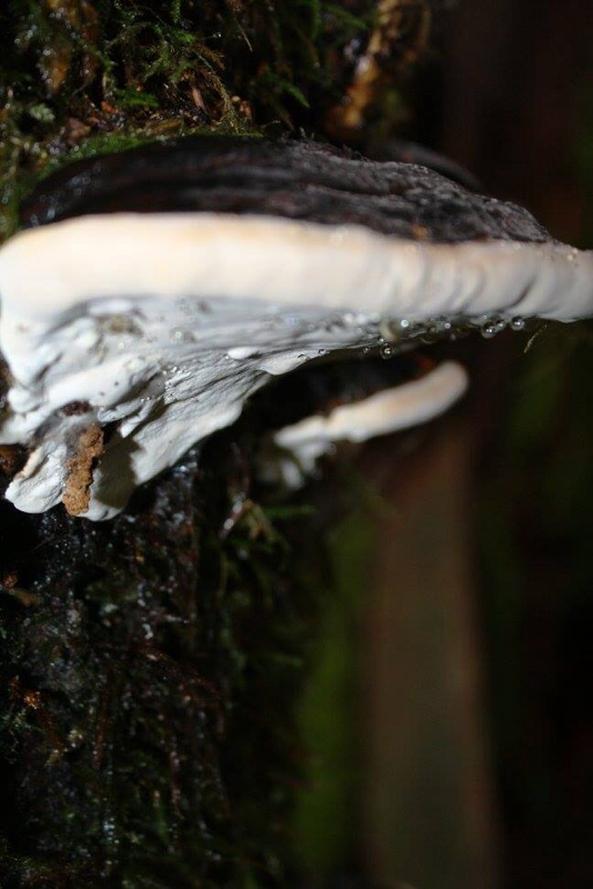 Fungi along the trail 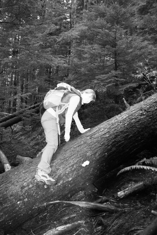 Corinne crossing the blowdown. 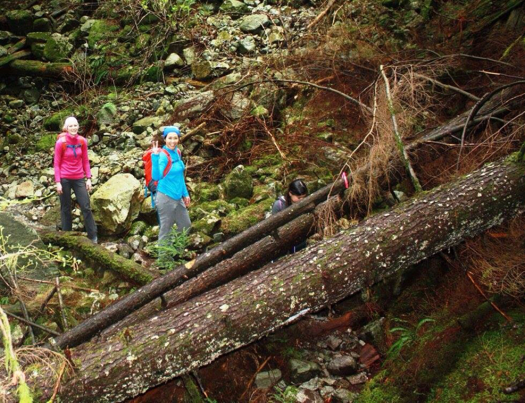 Terry & Su approaching some blowdown but still smiling. 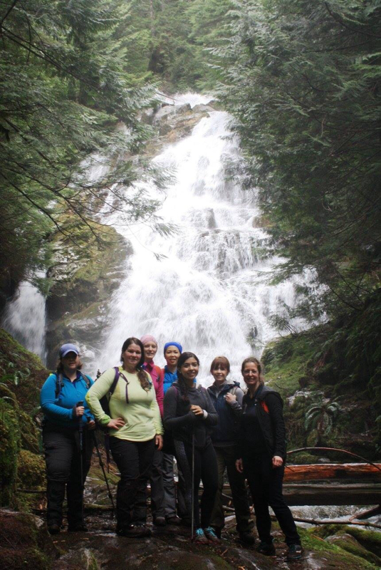 Kim, me, Su, Terry, Diana, Corinne & Wendy at Kennedy Falls. 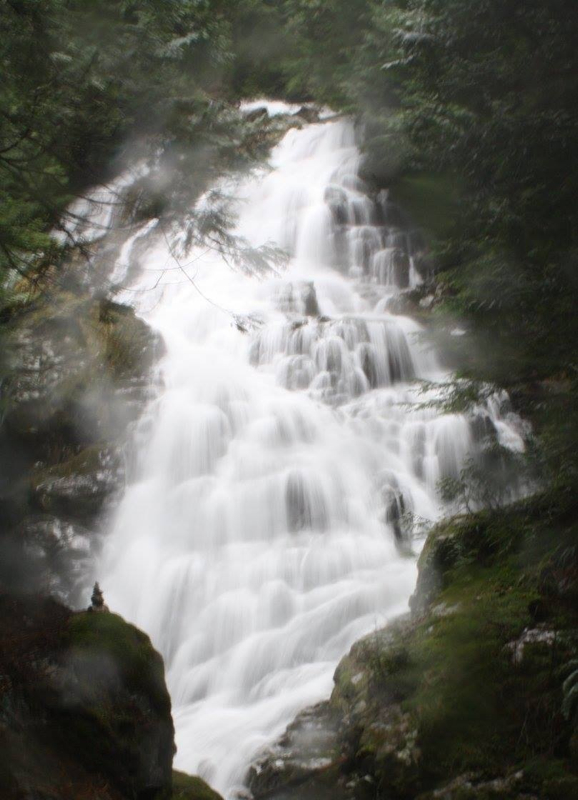 Kennedy Falls. Worth the extra hour of mud, creek crossings and blowdown. Eaton Lake to the 2nd Falls Lookout 4.5-8.5 Km's 915 meters elevation Toilet paper free pit toilet Trail Key: D~2~ST~R~RT~LC~V~DF~KF 2015~Follow a wide, rocky dirt path with a rushing creek on your right. Soon the trail becomes skinny as it snakes it's way up to a wide log bridge with grating & small railing in the middle to give you some comfort. On your left is Eaton Creek with a powerful waterfall cascading down. This is about .5 Km's. Due to the trails steepness the Km's seem longer. As you walk along the trail weaves it's way switch backing and snaking it's way in a beautiful forest. It's steep at times. And the grade levels out at times but don't get too comfortable as it soon climbs again. After awhile it dips down to a sketchy bridge crossing with a bench. The bridge is not far off the ground but needs to be replaced. This is the 1/2 way mark (about 2 km). At times along the trail there is minimal blowdown and the odd log to get over. Soon you come to the second Falls Lookout. It's a skinnier trail and a slight drop off on your left side that would take you down to the river. You can get a little closer to see the falls but it's rooty & slippery. Once you're happy you can make this the end of your hike or carry on to Eaton Lake. If you decide this is the end then a trip back to the first log bridge crossing is a great area for lunch and to snap lots of photos. If you decide to carry on, keep in mind the trail steepens through the forest. As you near the top you may encounter snow, two sketchy log crossings and a bound field to get through before Eaton Lake greets you. You might think it's a short hike but when trails become steeper, it takes longer to get to your goal. You could loose some of your nine lives on this steep trail. I would suggest to go on a dry day and to bring MICROspikes. Happy & safe trails. Directions: From Highway #1 (Trans-Canada Highway) near Hope, take exit #168. Follow Flood Hope Road east to a flashing amber light and turn right on to Silver Skagit Road. Follow the gravel road complete with many potholes. After the road's 16 km marker, turn left on to a side road marked with a sign for the Eaton Lake Trail and Eaton Creek forestry campsite. Follow the road up a short hill to the campsite area, where there is parking for approximately four cars. There's not a lot of room up there. 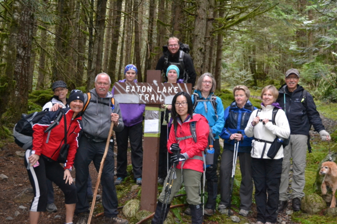
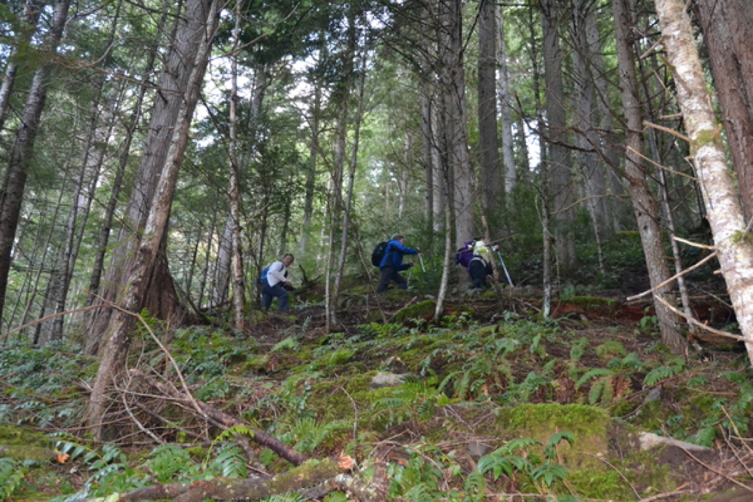
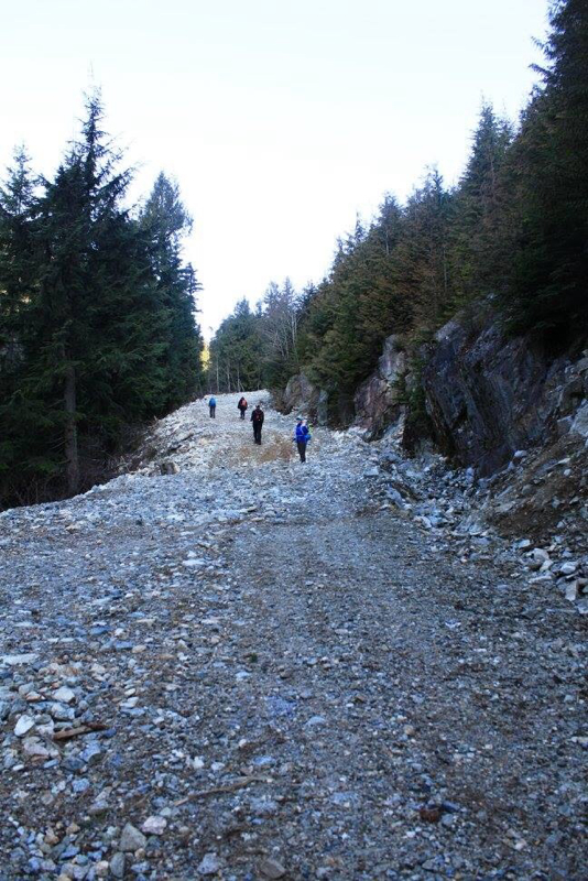
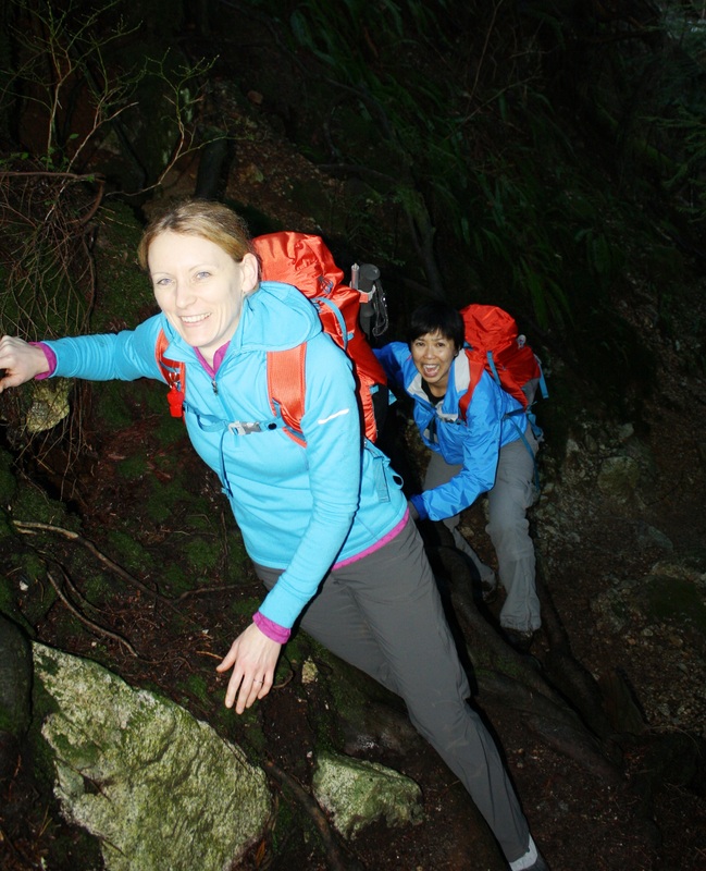
Today's hiking group
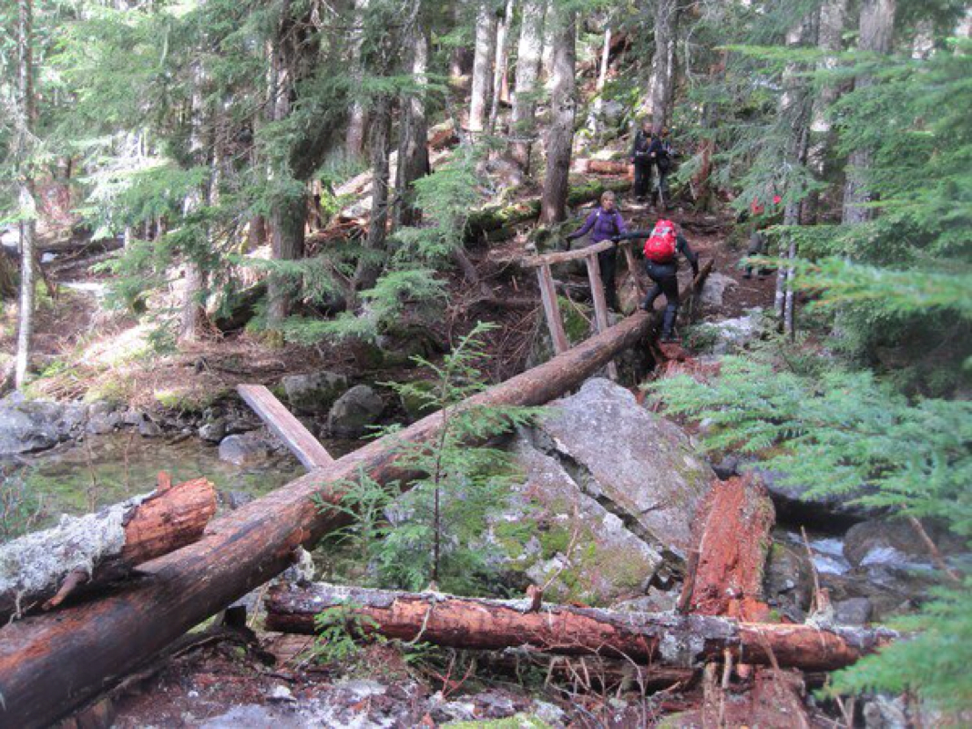
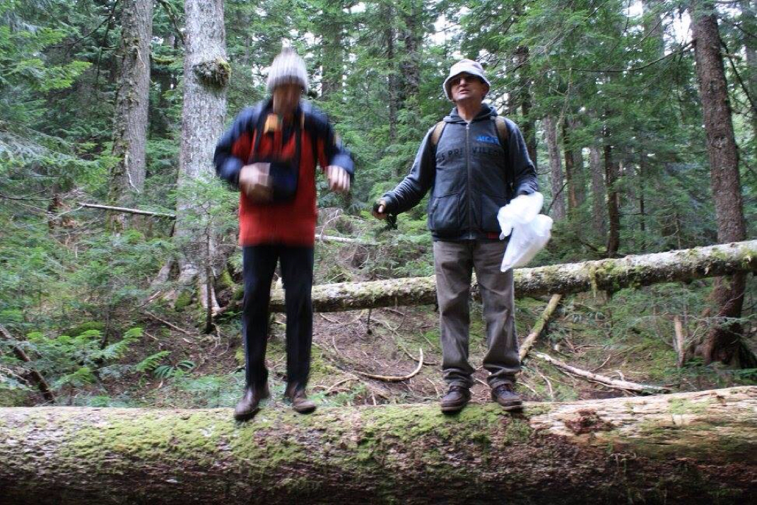
First log crossing
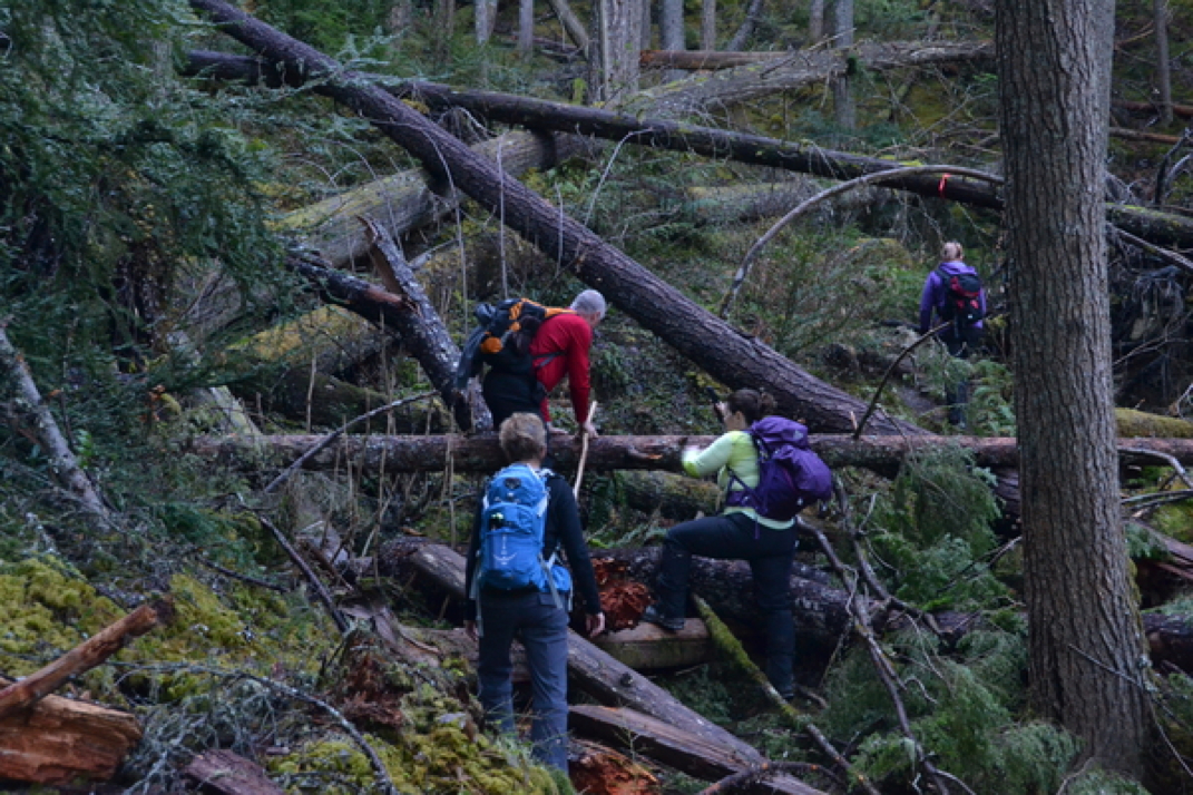
Blow down along the trail
This is considered the second crossing. It's fine but does need to be replaced.
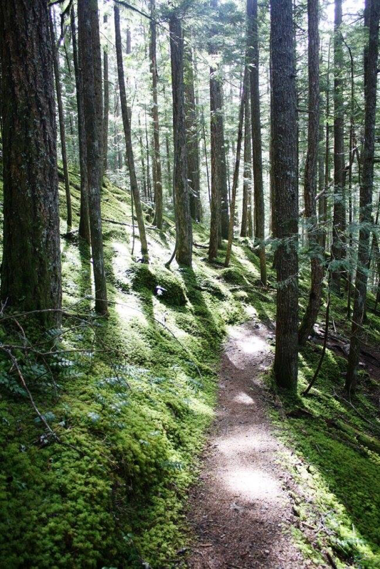
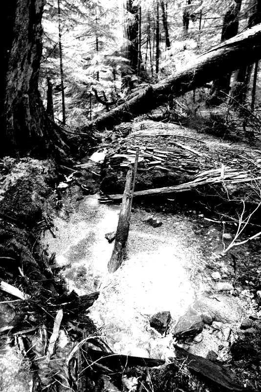
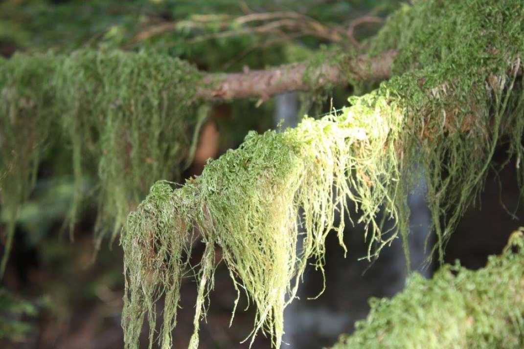
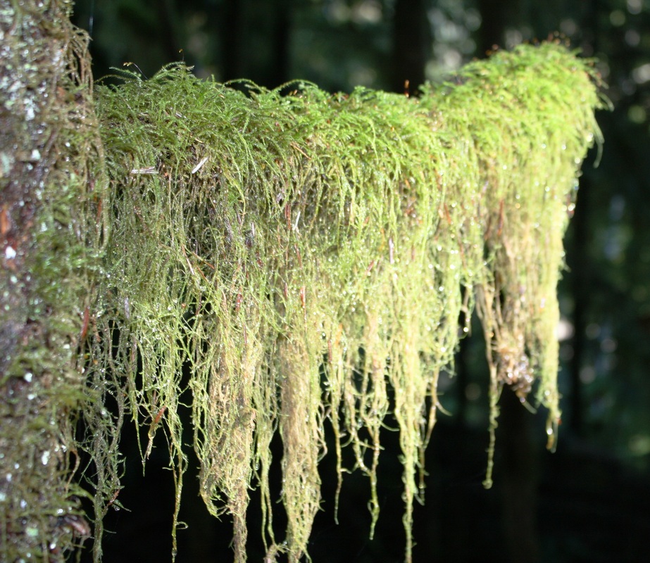
Beautiful green mossy forest
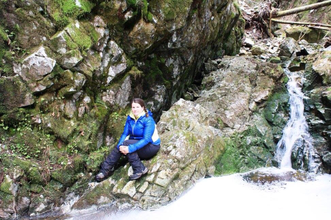
Falls Lookout cascading down
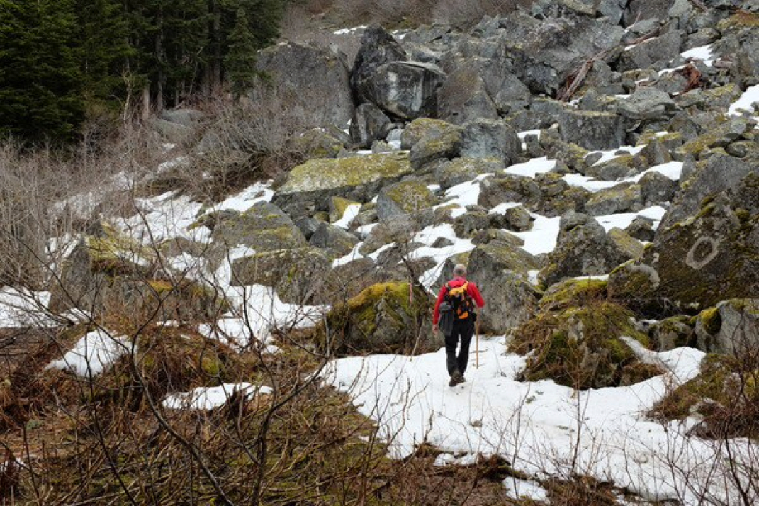
Steep almost the entire way
Sketchy log crossing...closer to the top.
Boulder crossing...closer to the too.
You never know who's watching you
A tall dude wearing a fashion favorite with an orange tattoo.
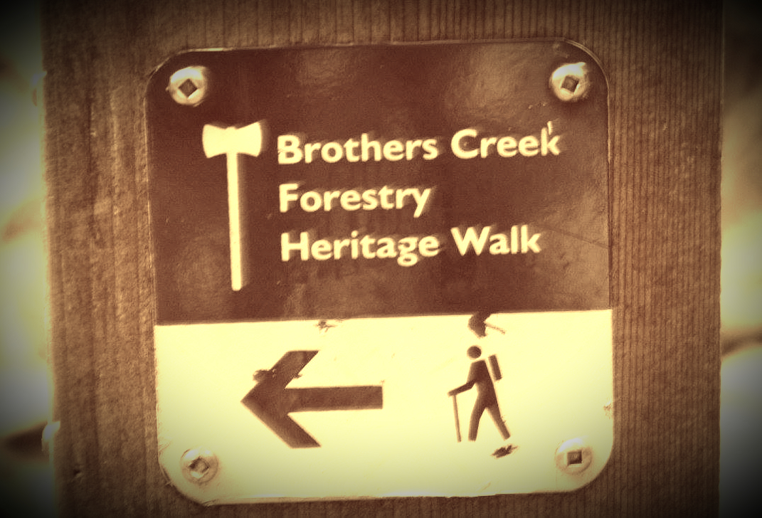
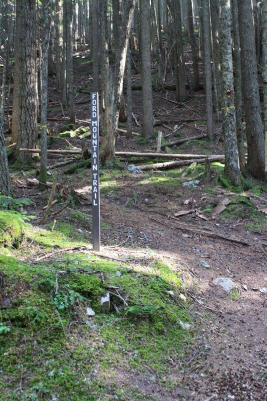
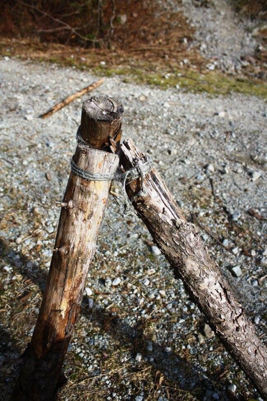
The TH you are following.
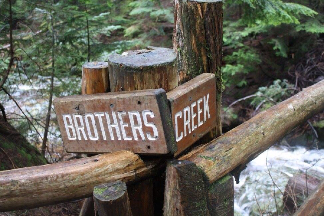
Trail Key: M~2~R~RT~V~ST~DF~KF~H 2015-The trail is well marked, you're following: Brothers Creek Forestry Walk start past a gate and rocky wide path to the second TH, go right. At the branch go left. Crossover Trail (has a picnic table)...keep going up. At the branch #5 you'll want to see the Candelabra Fir. keep going to 5 & 6. Go right at #6. Once you've seen this large Fir, then return the way you came and once out the trail continue on right. Not long after you'll come to Brothers Creek Bridge. If you go right for 485 meters for a trip to Lost Lake. It's worth it. Lost Lake can be a perfect lunch spot. Once finished return the way you came. Go right & cross the bridge. After you cross the bridge, there's a trail to the right for 1.2 Km's to view, Blue Gentian Lake. Once back on the main trail, turn right and follow the path down past two TH sign posts. Go left, down Skyline. You'll go down some nature made stairs, rocks and man made stairs. It's slippery here, take your time. Go over a bridge and a powerful waterfall is there to greet you. Continue up the stairs where it's steep. Be careful as you walk up the wet & slippery stairs. Now you're back in the forest crossing many bridges. After quite awhile in the forest go down a skinny trail to branch, go right. Follow trail down the rocky wide trail to the street where you parked earlier. Watch your footing near the stairs on the waterfall and you won't loose any if your nine lives near the waterfall. Happy & safe hiking. Directions: To get to British Properties and the trail head for Three Brothers. From Hwy one take the Taylor Way exit, you'll come to one roundabout. Turn left onto Southborough Drive and left at Highland Drive. Drive up the hill to Eyremount Drive, turn left here and right onto Crestline Road. Turn left at Henlow Road and then right on Millstream Road. You'll see the trail head at the end of the road. You can park close to the a TH or where ever you can find parking. 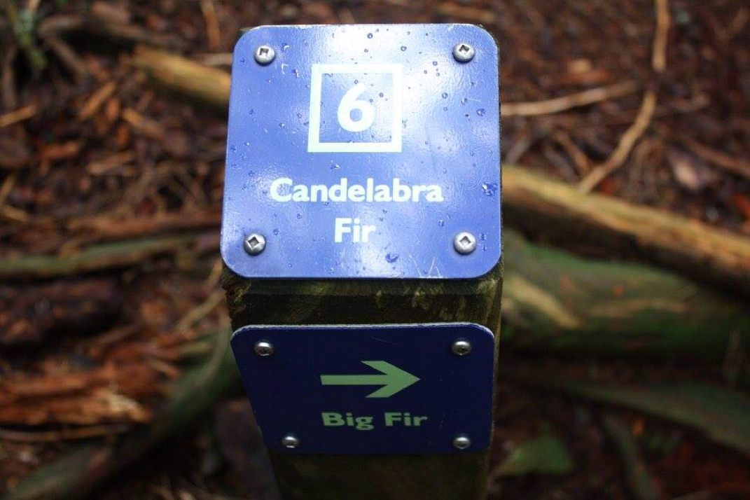
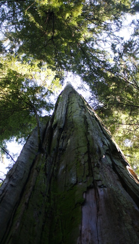
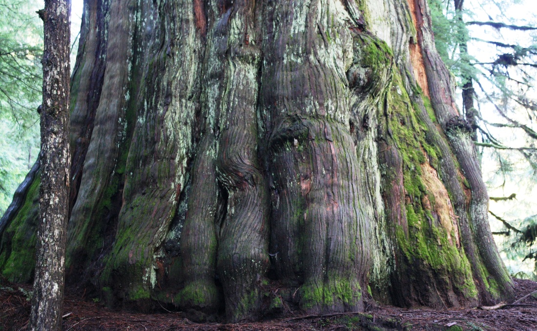
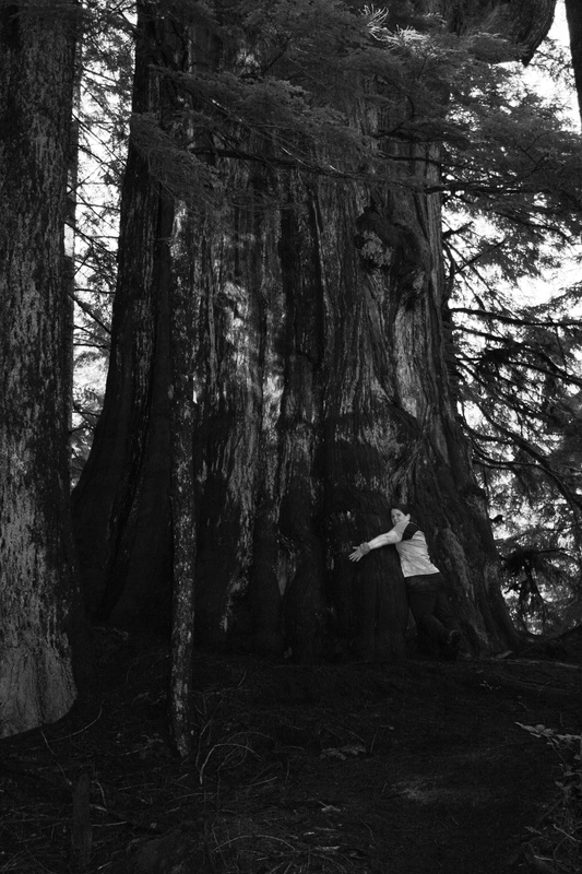
"Candelabra Fir, an old growth tree (now a dead snag) that is 60m tall and over 9m in circumference." Vancouver Trails.
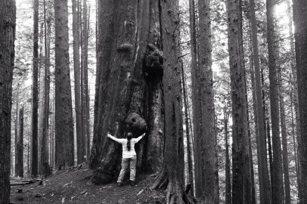
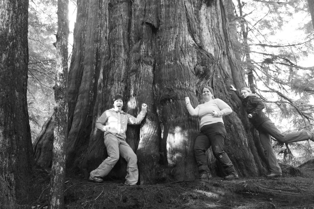
Me hugging this beauty.
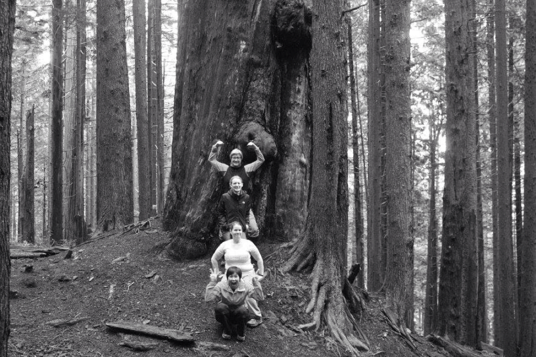
Strike a pose!
Beauty all around...
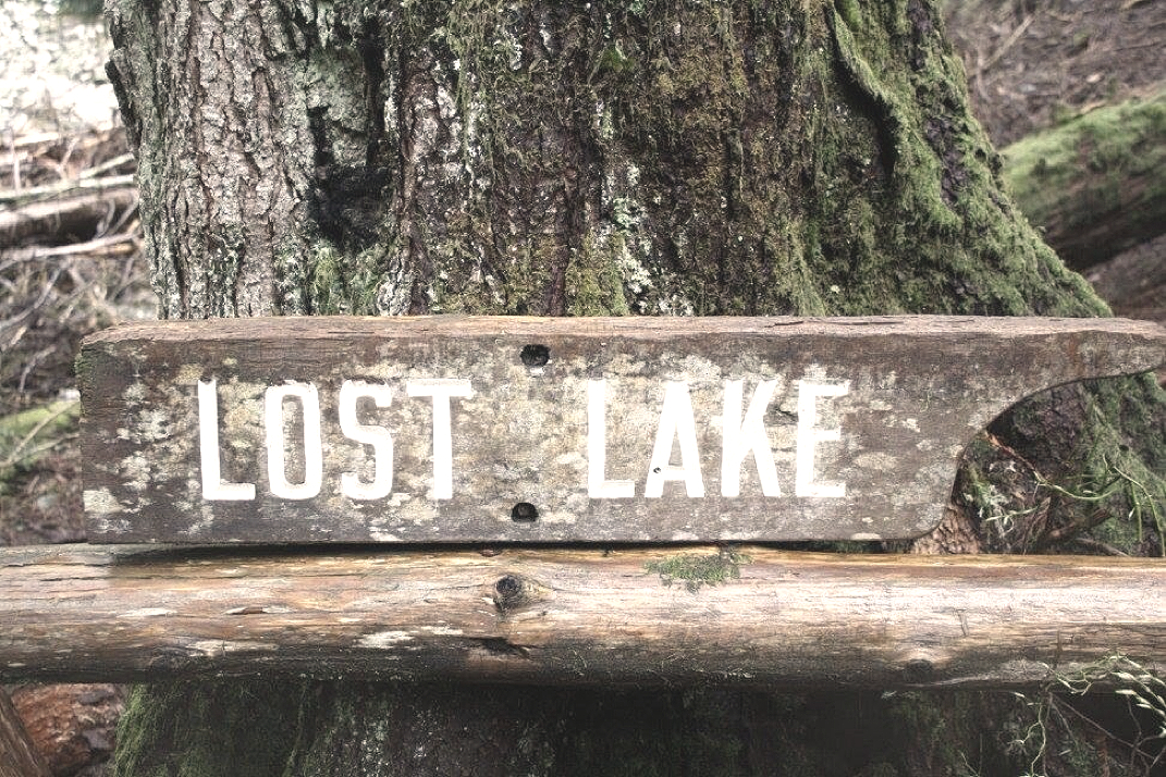
A short trip to a beautiful lake.
Lost Lake
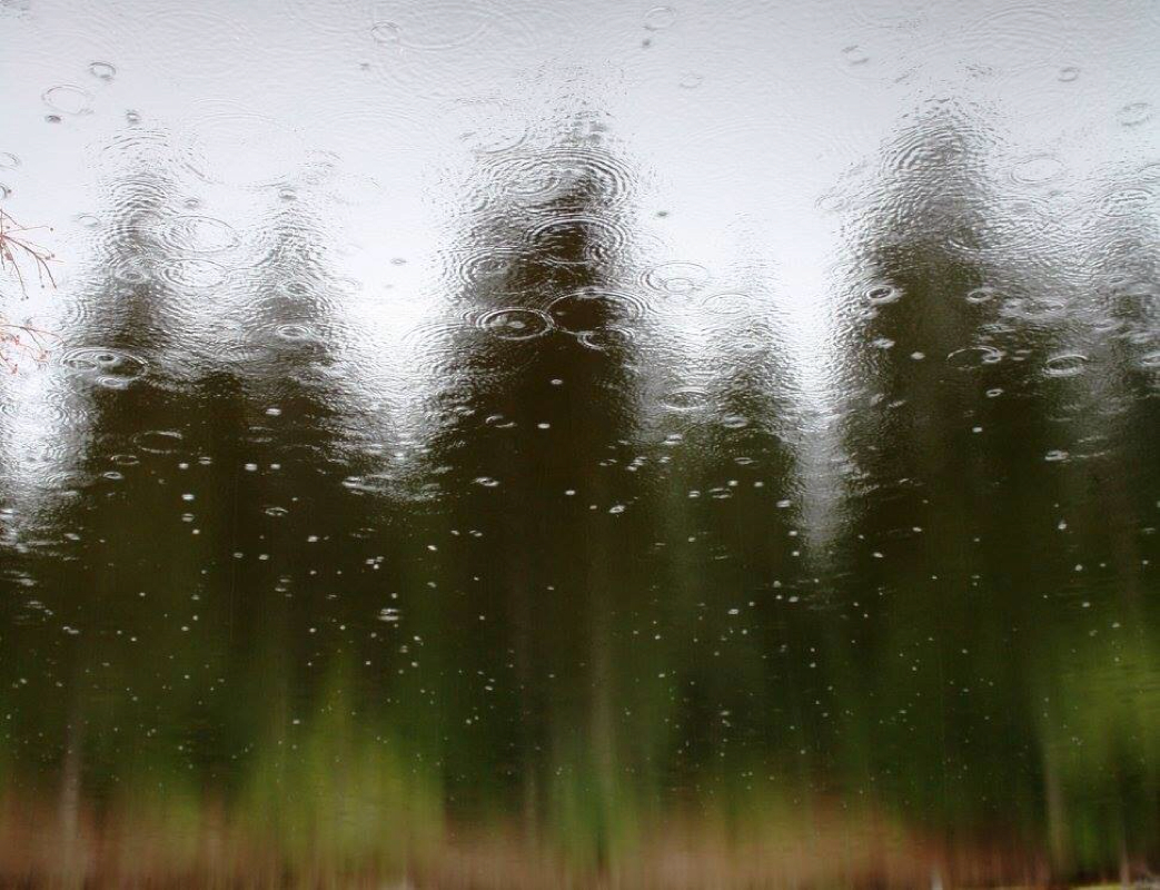
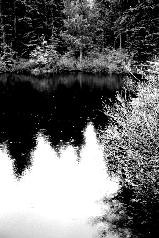
Rain drops on Lost Lake.
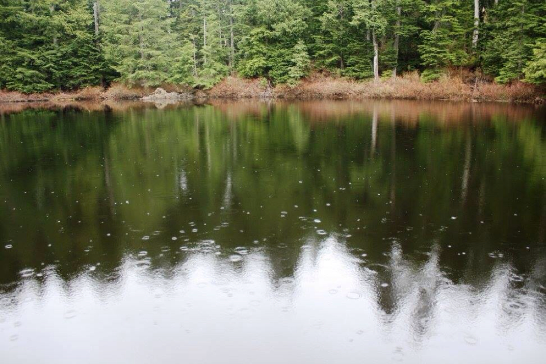
Lost Lake
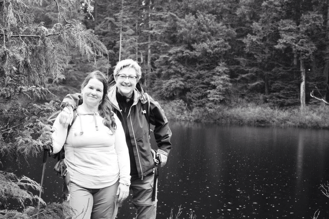
Web & I @ Lost Lake...18 years later, we're still the same!
A beautiful bridge.
A beauty of a trail.
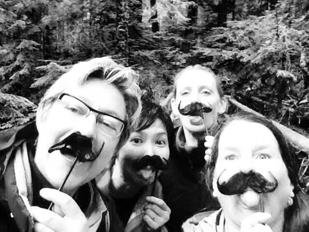
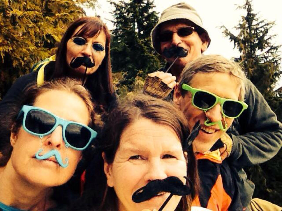
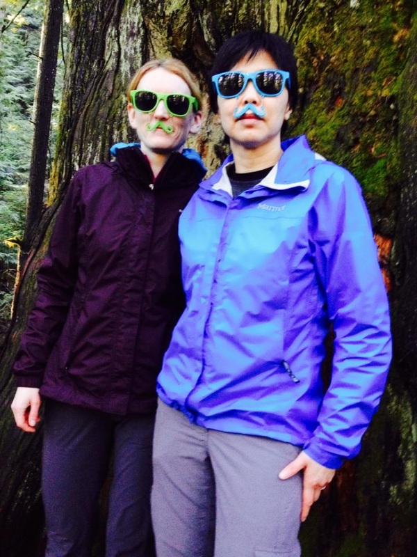
Some mustache fun!
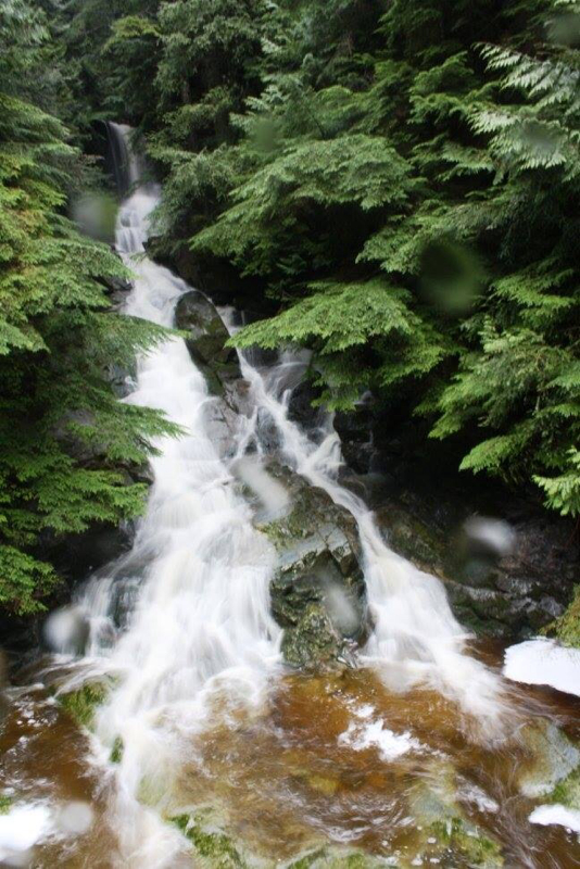
When you walk down the stairs a cascading & powerful waterfall greets you.
Rocks...
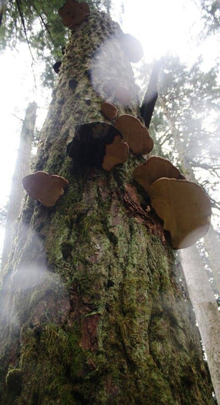
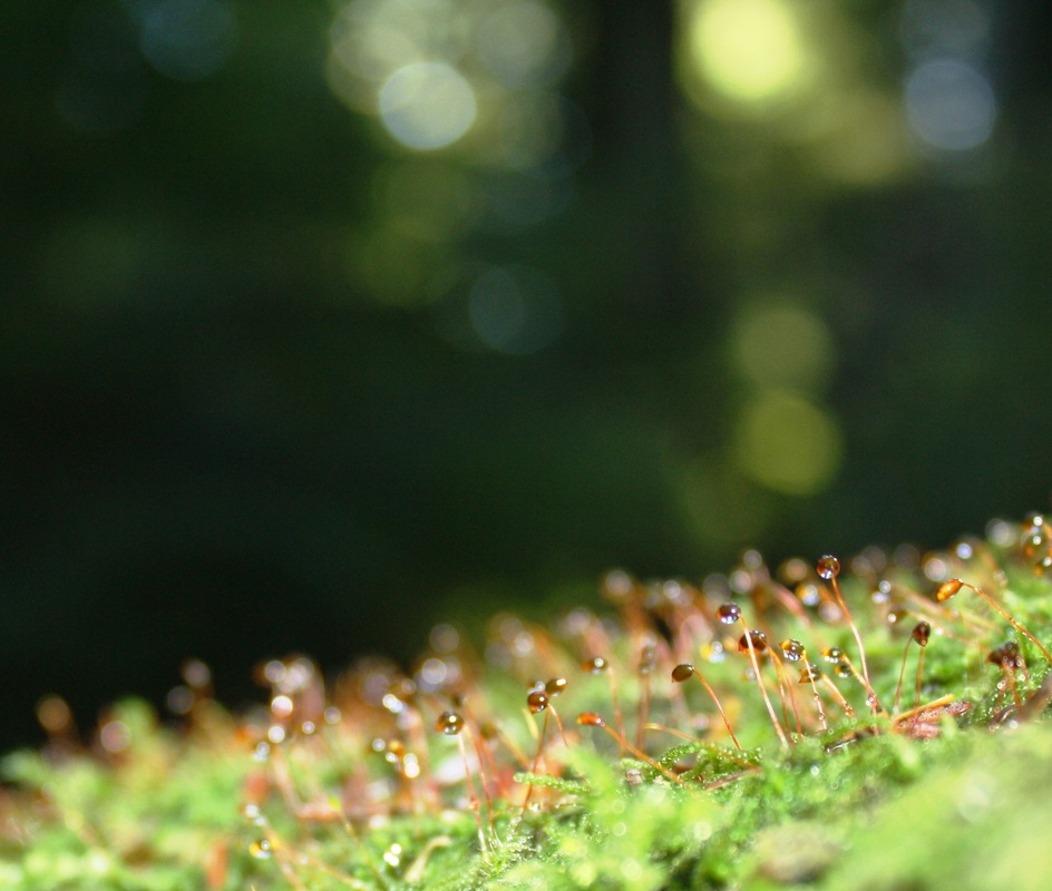
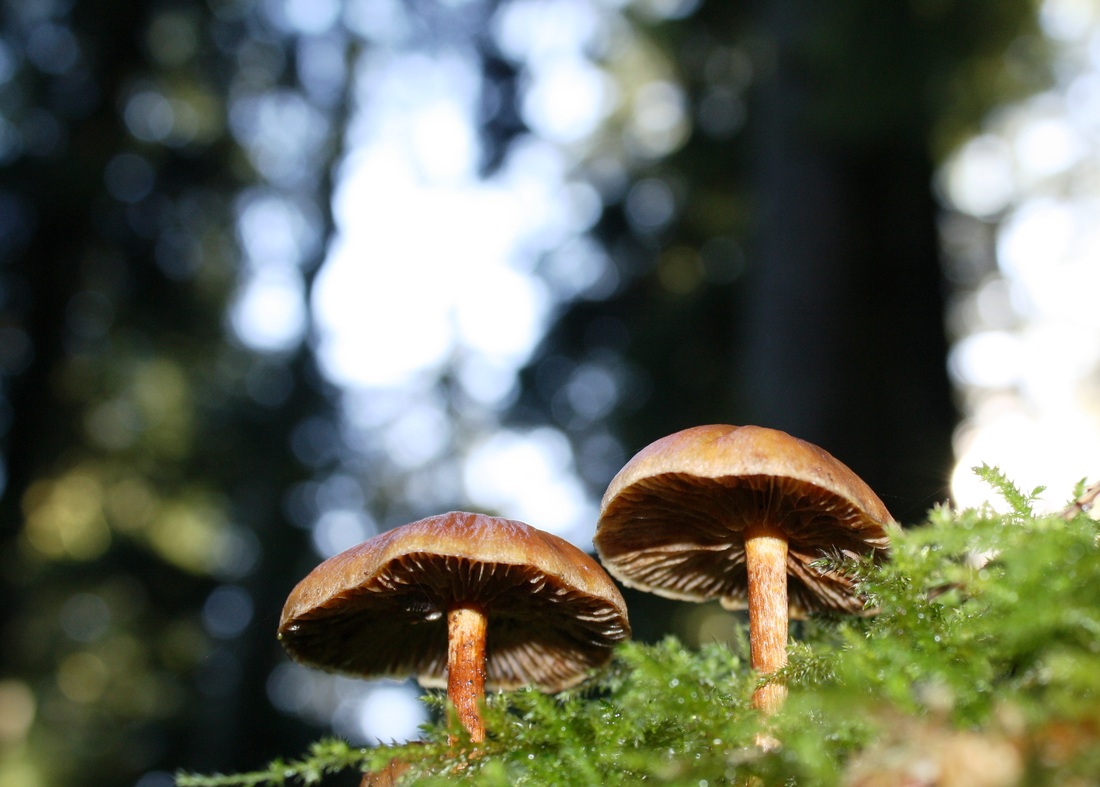
Fungi with rain drops.
Trail Key: M~2~DF~KF~ST~H~V~R~SW No pit toilets 988 meters/12 Km's 2015~You can park your car right off the road and walk the 4 Km's up the FSR but it's quite the trudge or you can drive a bit farther depending on the type of car you have. The roads are not as bad as Mt. Cheam. A 4x4 would be handy however, the walk is pretty with views almost right away. I'll report the way we went...We walked from the roadside. Follow logging road up. There are two branches...the first one we stayed right and the second we stayed left. There is painted rocks as you go indicating your distance. You are going up this road for 4 Km's. It's steep at times but the road is in good condition for a FSR. Soon the actual trail proper is on your left with a sign post. Follow the wide dirt path. Not long after there's another TH sign on your left. Have a stretch and a small snack as this is where the real work begins. The trail now switchbacks up the mountain, each SB steeper than the last. There's trees and rocks along the way to help your footing and balance. You'll see a .5 km wooded painted sign, it's steeper here but keep going. It's worth it and you don't have far now. Take a breather and continue along the ridge where you'll see a peak of the views of what's to come. It goes back in the forest. It's hilly in some parts but the grade is a lot easier, you have done the hard work. It's quite beautiful in here. Almost like an enchanted forest. Nailed in the tree, is a proper sign that says, 1.5 Km's. It's here where you have just a few meters left. The path gets skinny and you'll come out onto an open beautiful spot where to the south: Sleese (sadly, in 1956, a winter storm caused a DC-3 to crash killing all 62 passengers) & to the north: The Cheam range, Foley and Welch are all there to greet you. They are spectacular, proud of their beauty! Happy to share it with you. Once you've stretched, filled your belly and recorded these memories in your camera return the way you came carefully navigating some of the steeper switchbacks on the way down. As a footnote you can carry on from the summit to Williams Ridge. I haven't done this yet but hope to complete it this coming year. Scaredy Cat says it's un-likely you'll loose any of your nine lives. Take it easy at the summit & coming down the switchbacks. Happy & safe hiking. Directions: Drive Hwy One to Chilliwack. Follow signs to Chilliwack Lake Provincial Park. At the Chilliwack River Bridge turn left and follow the river east for about 28.5 kilometres and turn left on the Ford Mountain Forest Service Road. This is just past the 'Ford Mountain Correctional Institution.' Then you'll cross the Chilliwack river one more time and look for the FSR on the left. (Courtesy of Trailpeak) GPS waypoints courtesy: Clubtread Start of trail N49.10879 W121.60584 10U 601749 5440485 Parking N49.10535 W121.60367 10U 601914 5440106 Below rock bluff N49.10928 W121.60291 10U 601962 5440544 Top of rock bluff N49.10930 W121.60126 10U 602082 5440548 Ridge viewpoint N49.10997 W121.59870 10U 602267 5440626 Summit N49.10968 W121.58810 10U 603042 5440608 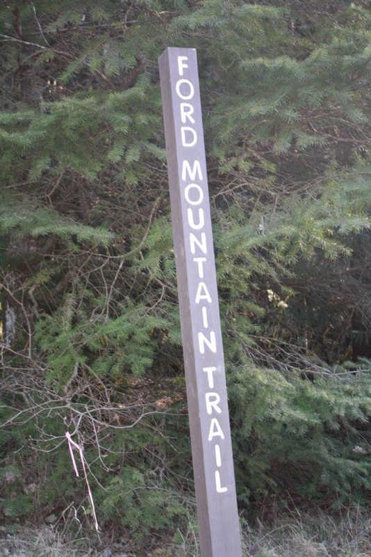
TH sign posts (3 of them)
Where the work really begins but it's short.
I'm embarrassed to say that I'm not exactly sure who this is but I marvel in her beauty.
The summit
The summit
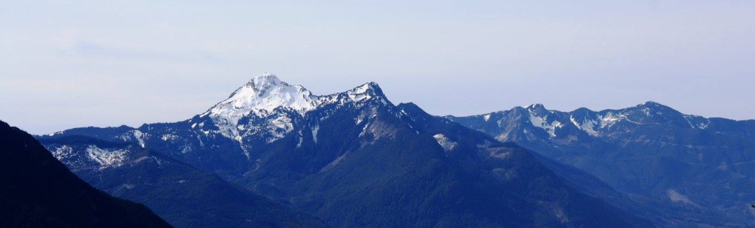
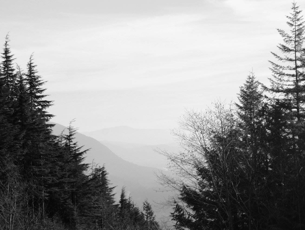
Spectacular vistas for a shorter climb
Continent fills my soul
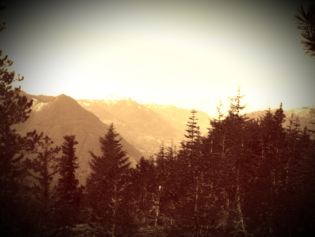
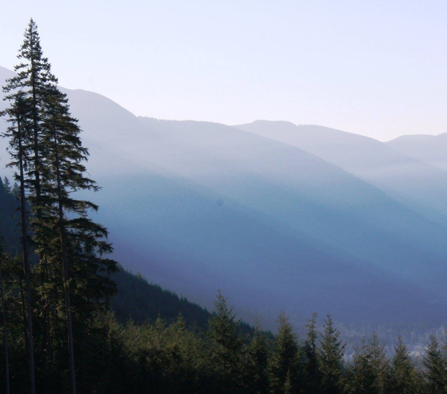
Views on the way up
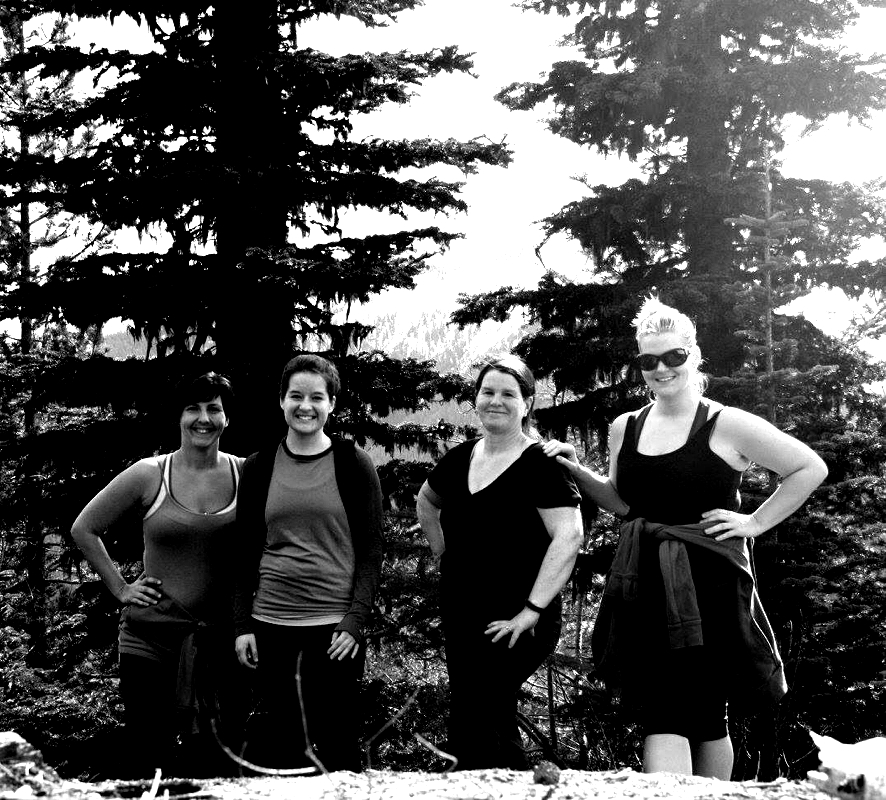
Four happy souls
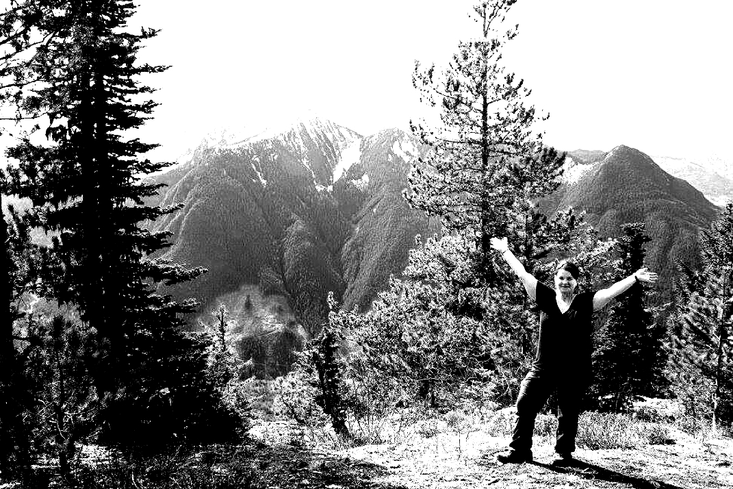
One happy Scaredy Cat
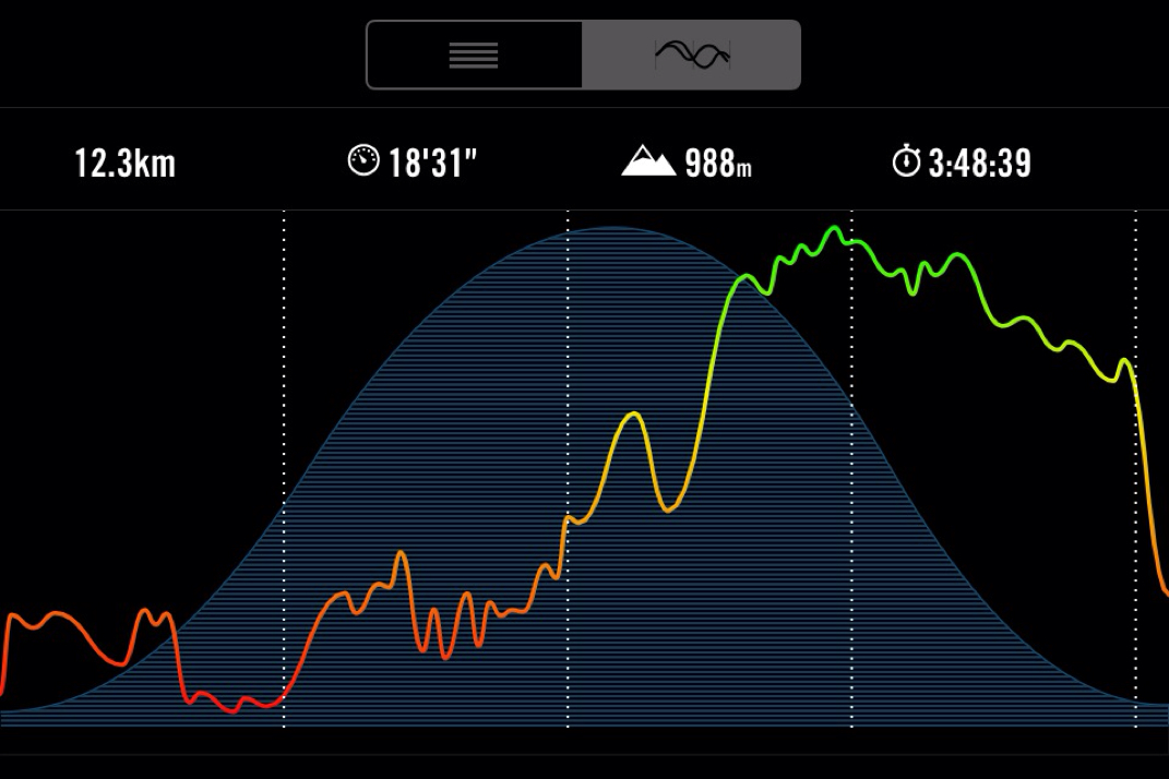
The stats
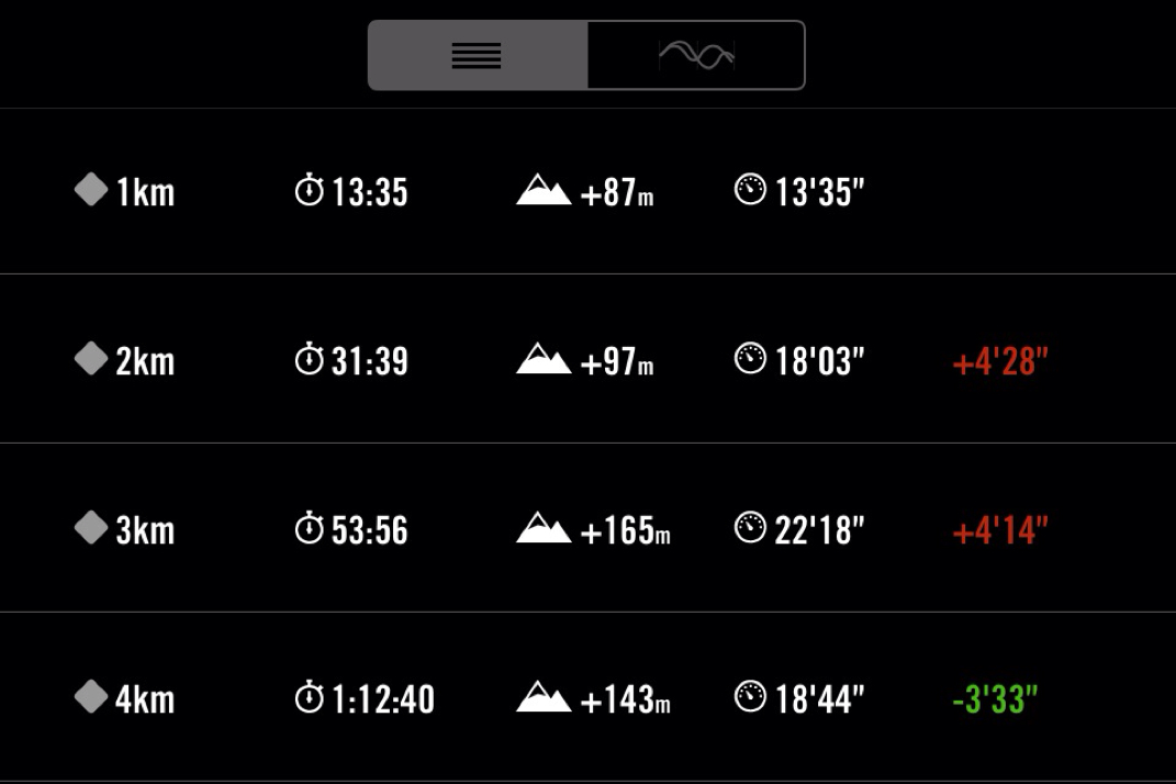
The stats
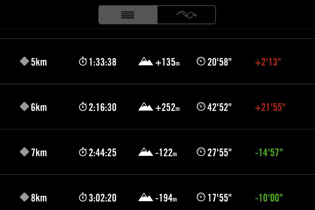
The stats
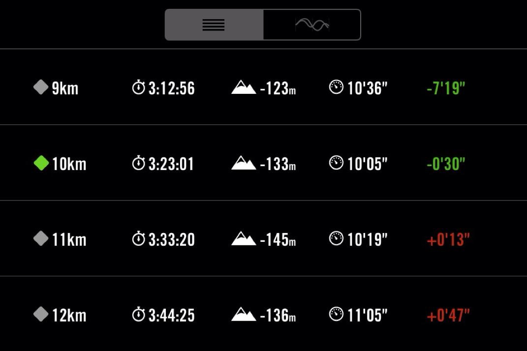
The stats
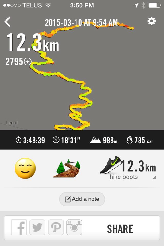
Our route and final calculations
To MacKay Lake (Mt.St. Benedict)
Scaredy Cat says you won't loose any of your nine lives to MacKay Lake. Happy & safe hiking! 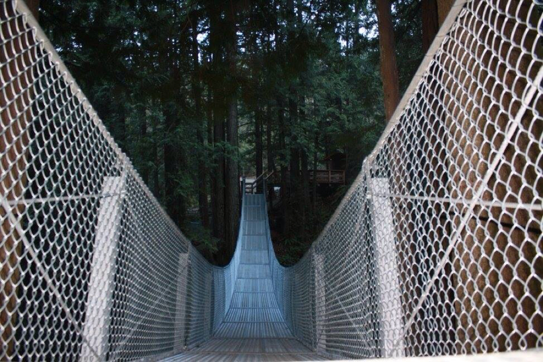
Suspension bridge at Cascade Falls. Not officially open until April 1st, 2015.
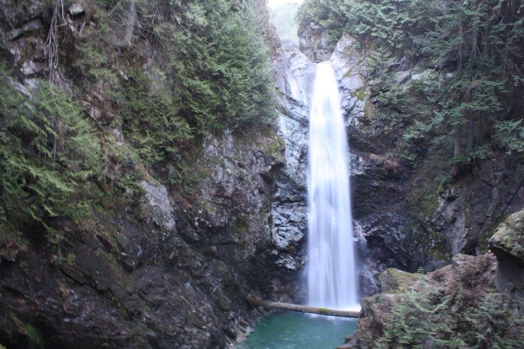
Cascade Falls.
Very beginning trail from where you park. This trail takes you up to the steep logging road.
Rocky and steep logging road to the actual trail start.
Views from the logging road.
Views while trudging up the steep logging road.
Wooden sticks indicating the proper trail head from the logging road...DO NOT take the first TH you see going up the logging road. This is the 2nd one and the proper TH for MacKay Lake and Mt. St. Benedict.
Proper TH to MacKay Lake and Mt. St. Benedict
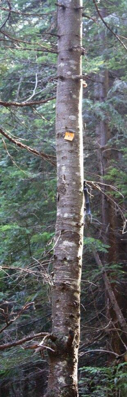
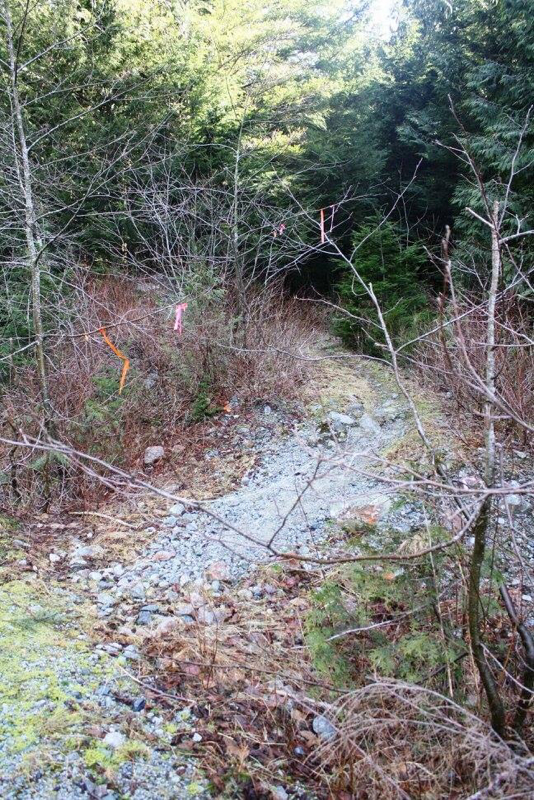
Traditional orange trail markers & some pink flagging tape, keep you on the correct path.
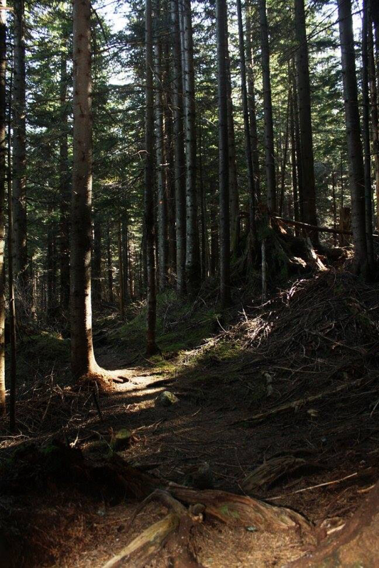
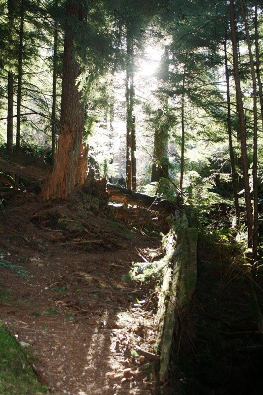
Inside the calming trail to MacKay Lake.
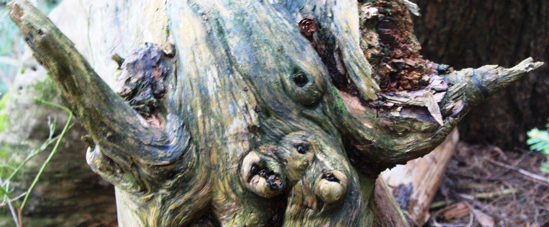
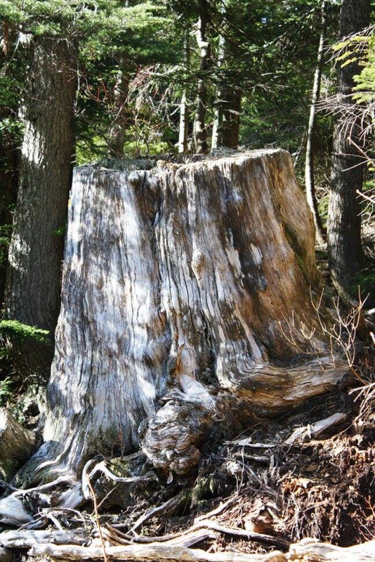
As you walk along certain things look so cool in nature. It's another reason why I like to meander along, bathing in the beauty of it all. In this tired stump, I see a bull.
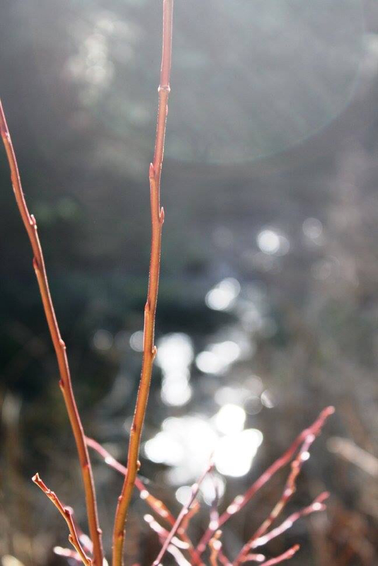
Love this...the colour, the lighting and how it drapes.
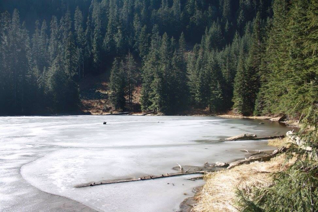
A slightly frozen MacKay Lake. I had this area to myself. Well I shared it with the sounds of the creek and singing birds and perhaps the eyes of a cougar or bear...
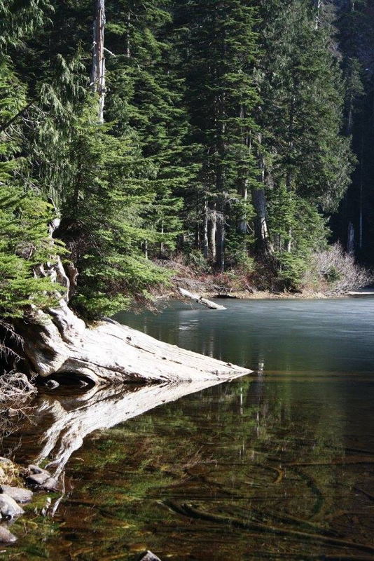
MacKay Lake
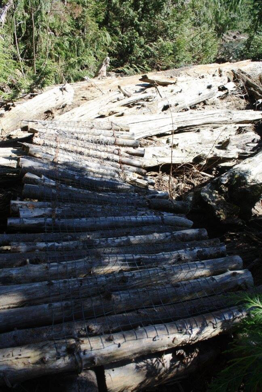
Cross these logs which lie near a creek to go to Mt. St. Benedict's summit.
After you cross the logs go to your left and this stump is the entrance to an obvious trail leading you to Mt. St. Benedict's summit.
A rushing creek far away as you start up the trail to your final destinations.
Not long after MacKay Lake is far below. The trail begins to steepen at this point. This was my summit as I lost my hiking party and daylight hours were nearing the end and I had lots of ground to cover.
Once down and back at MacKay Lake, take this trail back to the logging road. Once there don't forget you still have one more trail from the logging road back to your car. If you miss that trail you can return to your car but it's a long walk.
A footnote: From the logging we took the wrong trail, the first one. I might add so did 5 other people after us. This was an old logging area (logging tape is longer with writing on it. It's not your traditional flagging tape you'd see on a trail) and what I'll call, 'The Dead Forest.' Each time I reached out for a hand from a tree it spoke back to me with the words of, "I'm tired." It's once lively presence now was crumbling in my hands and falling to the ground. As I walked on with my party well ahead there came a time while hugging the mountainside when my gut was no longer whispering the sounds of...this is not right to screaming words of ...This is NOT right. This is not a trail! With my hiking party not impressed with me turning back on my own, they understood and let me go. Believing they had steps to go they carried on in search of MacKay Lake and the summit of Mt. St. Benedict. They would never meet either. As I realized while munching on my lunch at the MacKay Lake. I returned to the logging road and walked about 10 minutes and found the proper TH and was excited to see them at the top. It never happened. They trenched on as the grade became incredibly steeper but with light pouring from in between the trees they still believed they were on route to MacKay Lake. Here's some words of their journey: Christine said, "It was lovely & challenging going up. It was horrific, mind numbing and hell on the way down.. A full body workout. Sticks and twigs dangerously close to my insides. My heart was hurting on the way down.
Redina said..."A gong show. I didn't know I had chest muscles until I woke up this morning in pain. We were literally swinging from the trees...we were spider woman and through it all was Irene the mountain goat, completely happy in her element." I just want to add how experienced and tough these lady hikers are. I'm grateful they got down safely and hope we can get up there again so I can show them how beautiful this hike truly is. What would have I done different yesterday...maybe tried a little harder to get them to come with me to go and find the proper TH or left a note for them saying I was trying to find the correct TH. I had left notes at MacKay Lake and beyond but not helpful when they never made it there. We are trying new things, stepping out of our comfort zones and learning more and more together as we grow in nature. By Harold Wiebe 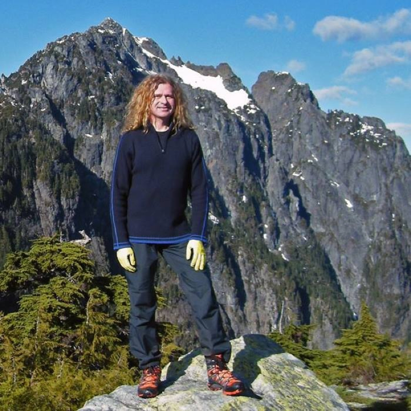
Harold on one of his recent climbs.
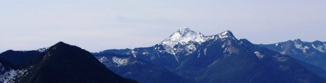
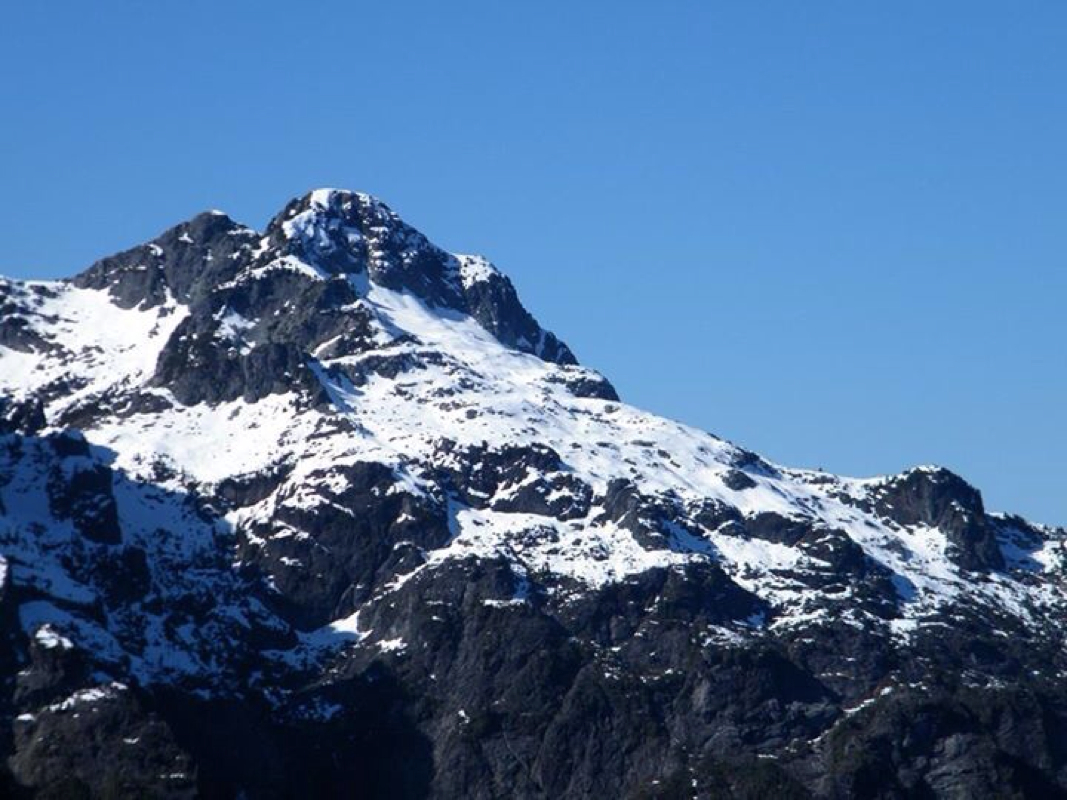
My son James and I went up Mount Nutt today, looking forward to some route finding and GPS work and thinking it was a bushwack all the way but were suprised by a well marked, well maintained, easy to follow steep trail. I had read trip reports of a bushwack starting at the high point of the East Canyon trail up Nutt to a ridge, heading south, crossing over up and down, and then descending down in a loop to a point on the East Canyon Trail again but closer to the parking lot. I had decided to take the nearer leg of the loop, closer to the parking lot, and see how far we could get. We had our maps and compasses and GPS all fired up but were a bit taken aback by all the markers and trail work done in that area. Nevertheless we headed straight up the mountain and made it to what I call the false summit in under 3 hours. Note: not all maps agree on where the summit of Mount Nutt actually is. The Ridge Meadows hiking club had made a nice but steep trail to one of the sub peaks of the Mount Nutt ridge. I had been interested in this ridge because of the vantage points of some old friends that I might get. Old friends like Robie Reid, Judge Howay, Golden Ears, Edge Peak, Blanshard Needle and others. The first part of the trail simply follows the East Canyon Trail a little over a kilometer and then turns right at a sign that says "Mount Nutt Viewpoints-difficult". Head up that and begin to really gain the 1288 m in elevation in a couple of kilometers if you go as far as us, but if you stay at the viewpoints that the Ridge Meadows club has provided you'll still ascend to 1087 m. The trail takes you past 2 minor viewpoints along the way, each to views of parts of Alouette lake that you probably have never seen before. The trail gives you a bit of relief and takes you through old growth forest with a mossy bed. The final 2 views are of Alouette Lake where it narrows, and on the other side of the ridge, a few minutes away, of the whole Golden Ears massif. This last view is noteworthy because you can see laid out before you, side by side, the Alder Flats and Evans Creek scree slopes. I managed to convice James to continue along the ridge, bushwacking our way to the edge of the gap between us and the peak until I could catch a glimpse of Robie Reid. We managed to do that and stay within our turn-around time window to get out of the park before the gate closed. How annoying that closure is! My recomendation: if you're a fan of Golden Ears Park then definitely do this this one to see things from a new perspective. If you generally just like the park and you enjoy a good steep workout with a nice view while you eat you lunch, then go for it too. Elevation gain: 1087m over 4.7 km. James and I hiked there and back in 5 hrs and 10 min. Harold Wiebe is a core music teacher with Surrey Schools. In his spare time he enjoys recording music, spending time with his wife, Bobbie, and his children. Harold comes alive in the mountains and can pretty much name them all. For more information on Mount Nutt check out his FB post here: https://www.facebook.com/harold.wiebe/posts/10152682686131190 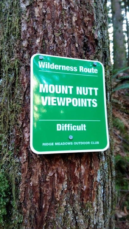
The sign says it all.
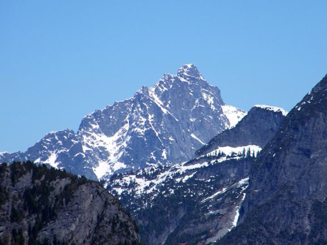
The Judge.
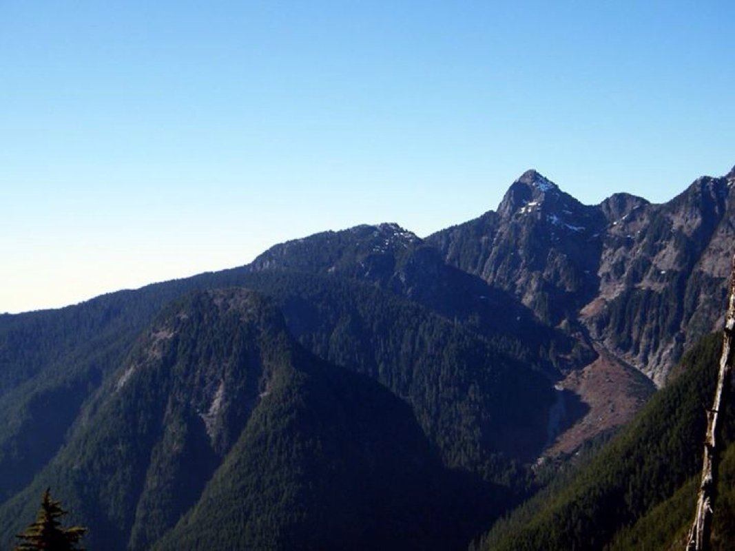
L-R: Evans, Alouette & Blanshard Needle
Golden Ears
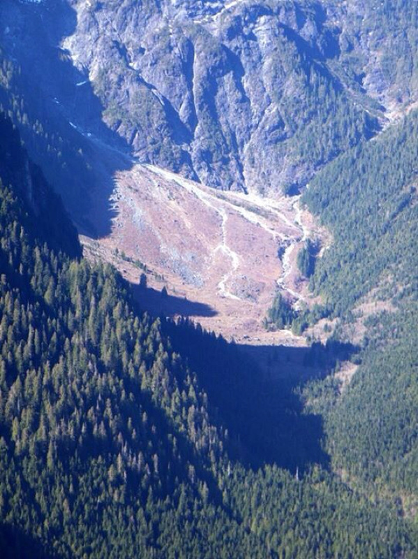
Alder Flats scree slope.
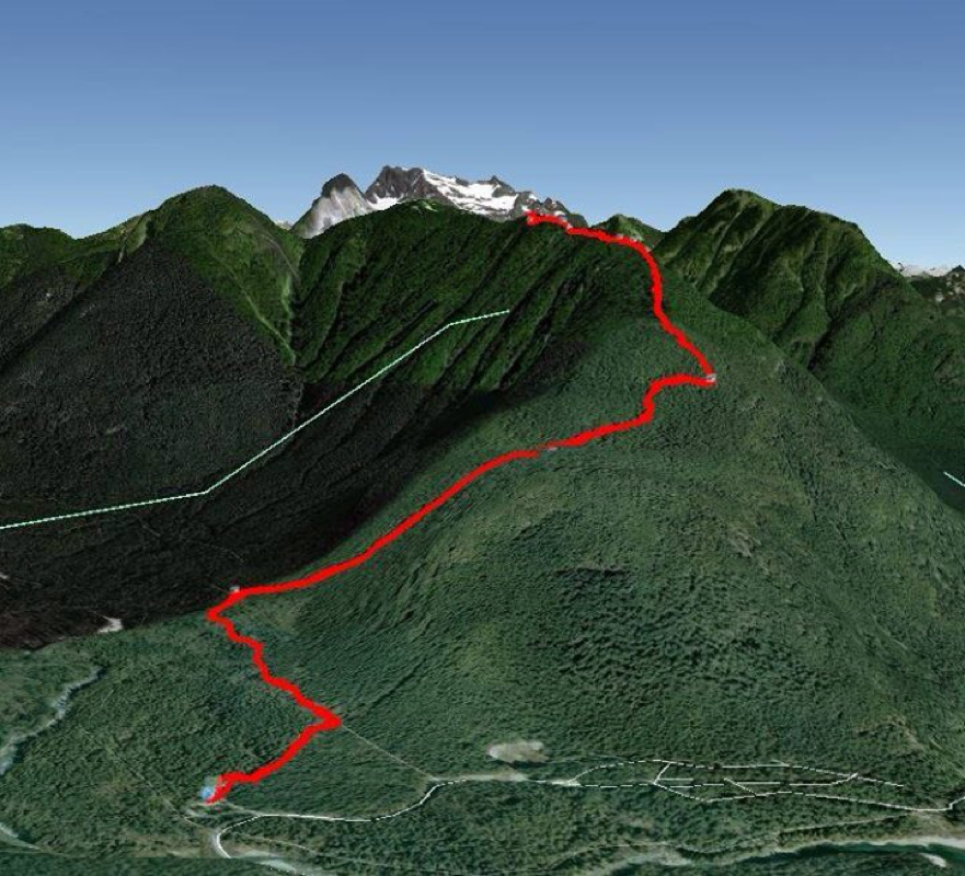
Harold & James route.
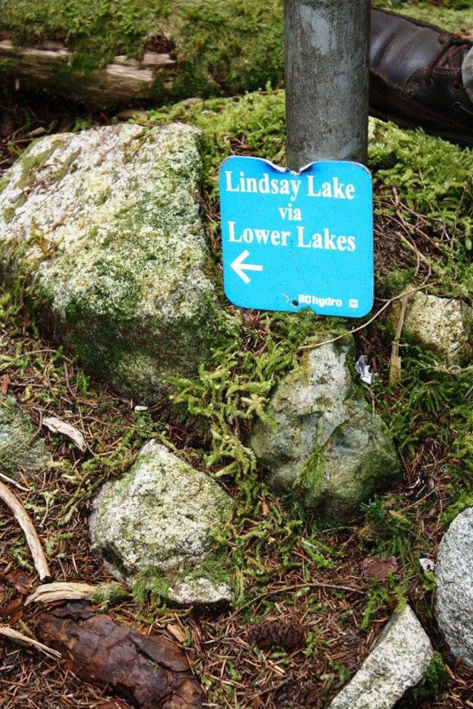
Trail Key: M~2~PT~DF~KF~ST~CC~V~HR~RT 15 Km's~1000 meters elevation gain 2015~As you drive past the store (on your left) and through the gates into Buntzen Lake, a few moments later you'll see a little blue sign on your right, then the first parking lot on your right. This is the lot you need to be at. There's a sign post and a pit toilet in the parking lot. Be aware of the gate closer time. There is no parking outside the gate so you must be back in time as BC Hydro is on time. You will not be able to get your car out until the morning if you don't make it back in time. *Start your hike on the Academy Trail (near the pit toilet). It climbs gradually up the wide, rocky & snaking trail. After about ten minutes the Halvor Lunden Trail is on your right. Turn right...It begins winding it's rocky way up, up & up. You'll come to your first switchback and then the trail snakes again up to your first sign that says, 'Eagle Bluffs Lookout' to your right. There were power lines obstructing the view, it's 800 meters to the lookout. With so many amazing lookouts...I would suggest to see it on your way down if time is not on your side. Keep climbing then you'll come to a creek crossing and a semi flat area. Don't get too comfortable as this trail climbs almost to the end. More switchbacks and a snaky trail as it somewhat climbs again to Polytrichum Lookout. There are views of Buntzen Lake and surrounding mountains. It took is about 1.5 hrs to get to this point. The trail continues to climb again up through a rooty part and over a little wooden bridge. Then a short stretch of another rough part and under a log. Right away you go down and up a creek bed then the trail finally flattens again for a long time. Soon you pop into a bright and opened area with a ravine on your left. If you have a fear of heights forget about looking down. It's really pretty in here. Not long after you're back in the woods. Soon you'll see a sign high in the tree that says, Left: Lindsay lake & Right: **White Rock. Stay left. Finally after what seems like forever you get to the El Paso junction. Going left takes you though the view points and loops back around to this junction or right takes you through the lakes and then the view points and back to the junction. We choose left. Go down the somewhat steep rocky path to a stunning little waterfall with a pool of frothy bubbly water. Once you fill your camera with memories. Keep going, the next section of trail is a little rough. A rock and a chain assist helps in one part. It's rooty & has steep up's and down's and after about 30 minutes you'll be treated to beautiful lookout. Barton Point has everything. Views all the way to Surrey and beyond. It is here where I would suggest to either keep going completing the Lindsay Lake Loop or to head back to the El Paso Junction. The entire loop is about 2.5 hrs depending on your speed. I choose this was my summit as the gates were locked at 5:30 p.m. Make your way back the same way carefully navigating all the steeps sections down. This hike is best done in the summer months where the gates are open later and the days are longer. It's also not a good idea after it has rained as it would be slippery on the roots and rocks. You can also add on Swan Falls but it is longer at 20 Km's. You could loose one of your nine lives so take your time. Happy & safe hiking. Lori aka Scaredy Cat. *You should leave your hiking it itinerary with the Warden's Office. On the map Lindsay Lake Loop says #1 but no where on the trail does it indicate this. However, the trail is well marked with trail markers and has a signs closer to the top of the different points of interest. **White Rock is a real pretty lookout but due to daylight hours we skipped it. We planned on seeing it on the way back but you don't see the sign as easy. If you want to see it I would suggest to see it on the way up. I'm not sure how far in it is and the trail conditions. For more information and directions: https://www.bchydro.com/community/recreation_areas/buntzen_lake_trails.html You can also check Outdoor Vancouver and Vancouver Trails as they too will be posting this hike shortly. 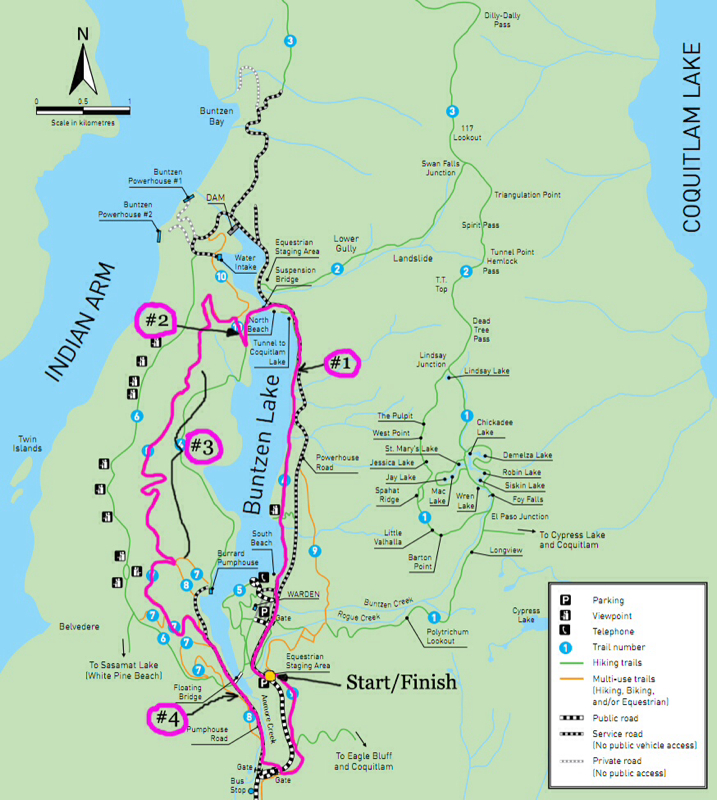
Trail map courtesy of BC Hydro and Buntzen Lake. You are not following the pink line, look for #1 on the map (to your right). The green line...That is the trail you are following.
Polytrichum Lookout
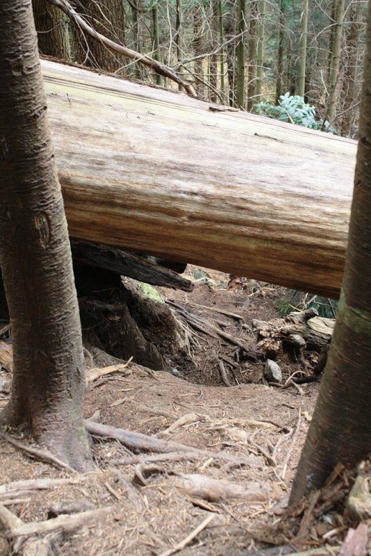
One of the many log crossings. This one we slid under.
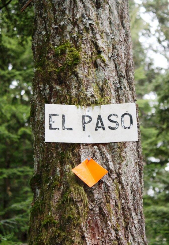
About a 3 hour climb to the El Paso Junction.
At the El Paso junction. This is about a 2-2.5 hour loop. Right takes you through the lakes & viewpoints and back to the junction.
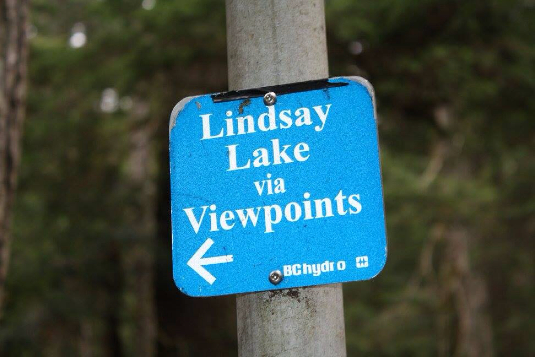
Left takes you to the viewpoints first then through the lakes in the Lindsay Lake 2-2.5 hour loop.
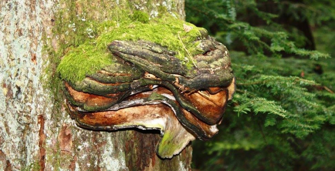
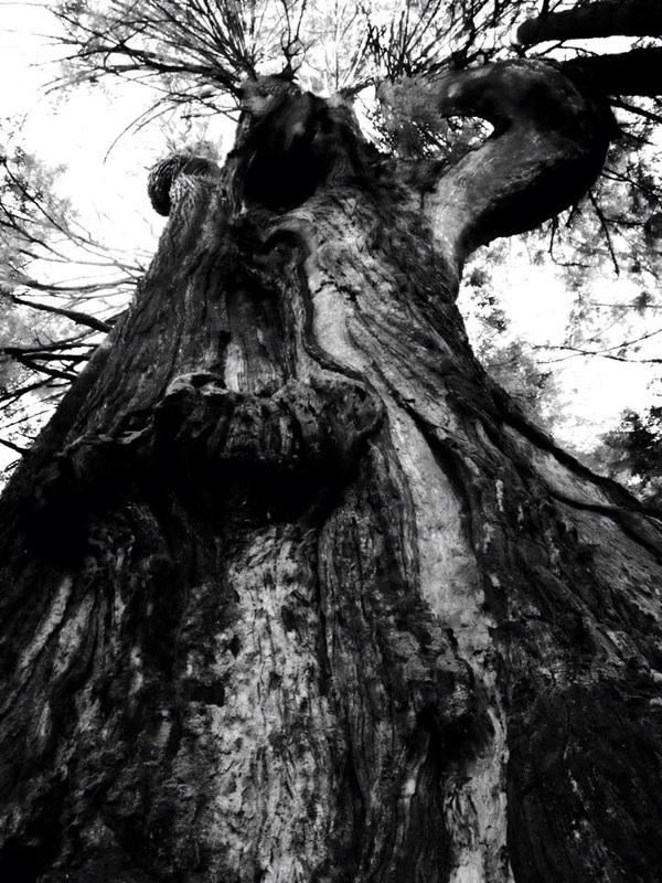
This guy reminded me of the grumpy Cookie Monster on Sesame Street.
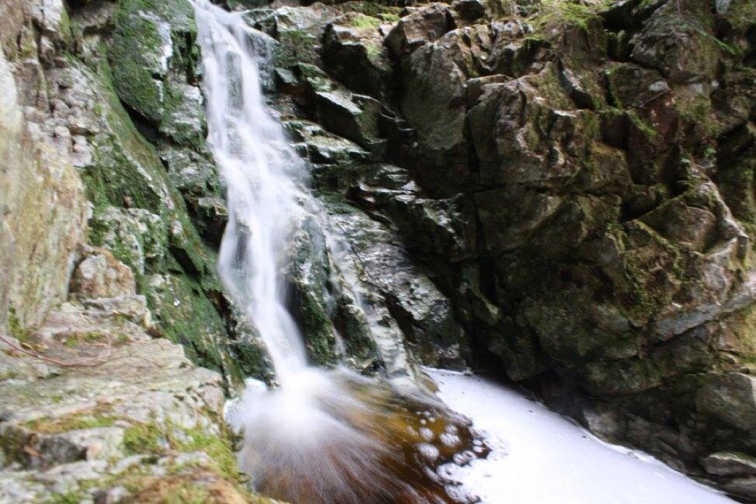
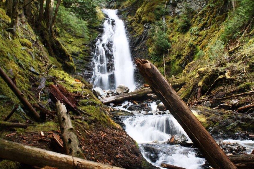
Foy Falls. A magical waterfall with a pool of frothy bubbly water awaits you right after the El Paso junction (viewpoint way).
The first of many rough sections after the El Paso junction.
Barton Point Lookout...one of the first lookouts 30 minutes after the El Paso junction in the Lindsay Lake loop.
A little summit moustaching around at Barton Point.
One, two, three jump! Felix & Bogi. On the way down. This log was in place near the trail...there are no actual log crossings where you need to actually walk on a log.
A waterfall pose...This place makes me happy! Photo credit: Felix H Scharnberg
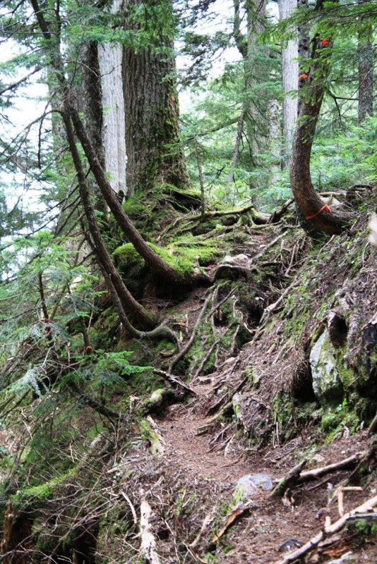
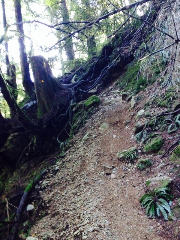
A lot of the trail looks like this...most of it steep.
And like this...
Holly
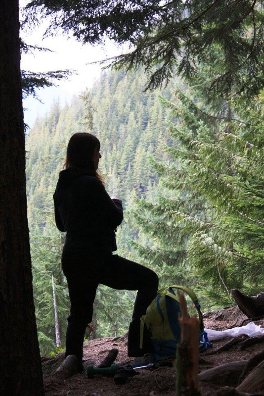
Redina silouette.
Foy Falls
|
Author.I work for Surrey School District as an Education Assistant. In my free time I enjoy hiking, snowshoeing, going off-road, dragon boating, writing & hanging with my huskies. Archives
March 2021
Categories |


 RSS Feed