My BlogGing
|
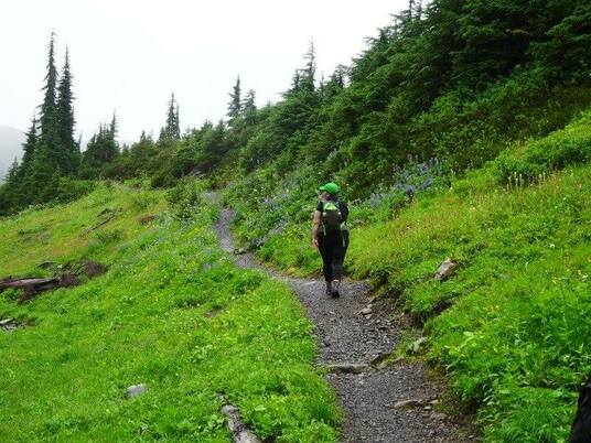
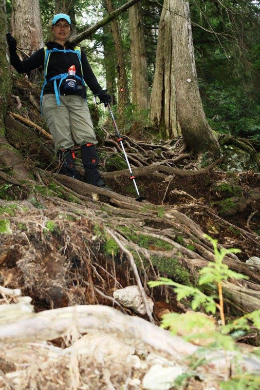
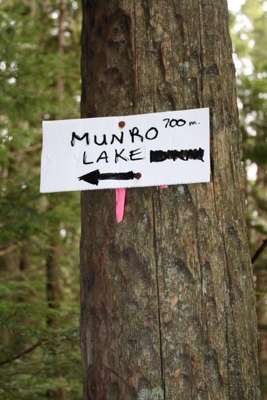
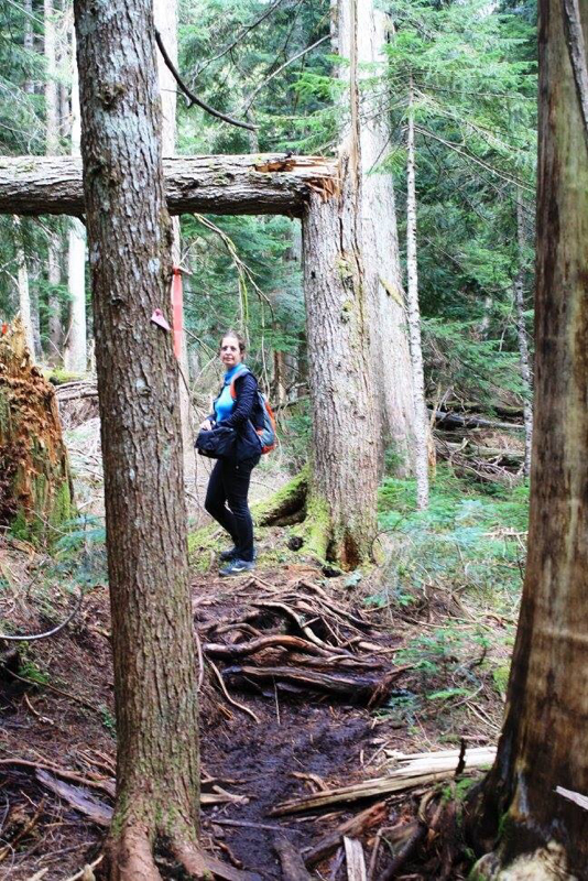
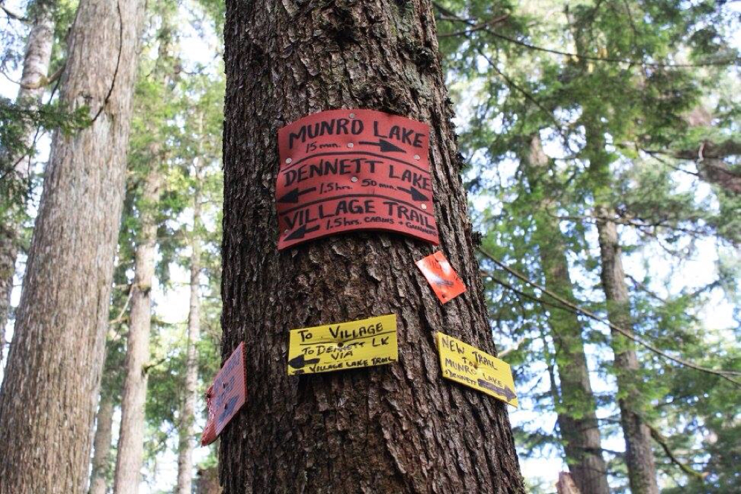
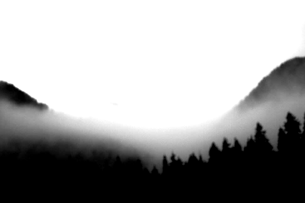
Drive to Minnekhada Park in Coquitlam. The trail head is on Quarry Road just past 3.5 Km's on your GPS and on marker 12 on the left side of the road. There's a small pull out on the right side of the road that fits 2-3 cars max. Walk left up the rocky road, over dead fall and a beaten garbage covered path until you get to the top of the road, go right. The trail is marked with only pink ribbon now...the previous sign has since fallen off. There are no washrooms on this trail. Trail Key: RT~R~St~V~CC~H 2015~Munro Lake is your first of two lakes on this diamond in a ruff hike. It's pretty much a snaky trail that's rooty, rocky and steep. It's up, up and just when you think it levels out, there's more up! You'll come to a small creek crossing then walk up a small creek bed. You are in and out of forest. For most of the hike the markers are tired and old with the odd fresh one hanging. The markings get a little better once nearer to the top. After what seems like forever you'll read a trail marker that reads, 400 meters. You're almost half way. You'll come to a fork-stay left. It soon levels a bit but don't get comfy because for second it climbs again. Another small creek crossings and up and then a short walk in the park. Another fork-stay left. Until now as you've walked along you've seen little views peaking through the trees but now on your right is your fist lookout. See how far you've come with Pitt River below snaking its way through the valley. The trail now snakes with more elevation and you come to a few switchbacks. On your left you'll see a rocky boulder field (Picca's are here) and a right away a nasty log crossing. It's cut for you to get through so some might like it but it wasn't that easy for me being short. The next little bit is really steep (probably the steepest) with a little hand scrambling. Now even though you had glimpses through the trees and a first lookout this is a beautiful second lookout. A perfect spot to rest and have a snack on this rocky bluff. It is a loop lookout that takes you back to the trail to Munro. The trail levels a bit and has some ups and downs. In this section of old growth nature has come through here with a powerful force. Expect blowdown, mud, sticks and branches as you navigate your way along. After a long walk in this section you'll arrive at a junction. It is here you must decide...going left for 1.5 hrs takes you up to Dennett Lake or going right for about 15-30 minutes takes you to Munro Lake and the junction to another way up to *Dennett Lake. We decided to see Munro Lake. As you walk along, the trees thin and Heather appears. Water comes into your view and you're happily delighted until you learn this boggy part is just the appetizer of what's to come. Now it gets a little tricky as it's quite the bushwhacking marked trail expedition finding your way to Munro Lake but when she appears you'll understand why you choose this hike. There's a nice lunch spot or a little private island to explore. The views offer your camera beautiful shots that look professional. You might have heard that there's lots of frogs...being a snow free February, we saw none. Once your done make your way back the way you came. The trek going down will be slow at times as you navigate some of the steeper sections and slippery rocks. I would not recommend this hike on a rainy day...too slippery! You won't loose any of your nine lives. Happy & safe hiking. Lori aka Scaredy Cat. * We never did find the trail head to Dennett Lake from Munro Lake. It might be better from the junction...however it makes for tiring day to continue on that beaten path. This could be done on a separate day. GPS Waypoints (From Trailpeak..May or may not be current) Trailhead N49.32241 W122.68877 10U 522617 5463344 Trail leaves old road N49.32207 W122.69161 10U 522411 5463306 Start of open / bushy forest N49.32396 W122.69189 10U 522389 5463516 End of open / bushy forest N49.32656 W122.69298 10U 522309 5463804 Overgrown viewpoint N49.32998 W122.68993 10U 522529 5464185 South viewpoint N49.33269 W122.69248 10U 522343 5464486 Trail becomes less steep N49.33394 W122.69107 10U 522444 5464625 Trail levels out N49.33738 W122.69158 10U 522406 5465008 Village-Lake Trail junction N49.33952 W122.69103 10U 522445 5465246 Munro Lake N49.34257 W122.68976 10U 522536 5465585 Former site of Munro Lake dam N49.34584 W122.68026 10U 523224 5465951 Junction with side trail to Munro Lake Overlook N49.34833 W122.69587 10U 522089 5466224 Munro Lake Overlook N49.34547 W122.69485 10U 522165 5465906 Dennet Lake N49.35024 W122.69796 10U 521937 5466435 Junction with connector to Village-Lake Trail N49.34934 W122.69984 10U 521800 5466335 Junction with Burke Ridge Trail N49.35101 W122.70685 10U 521291 5466518 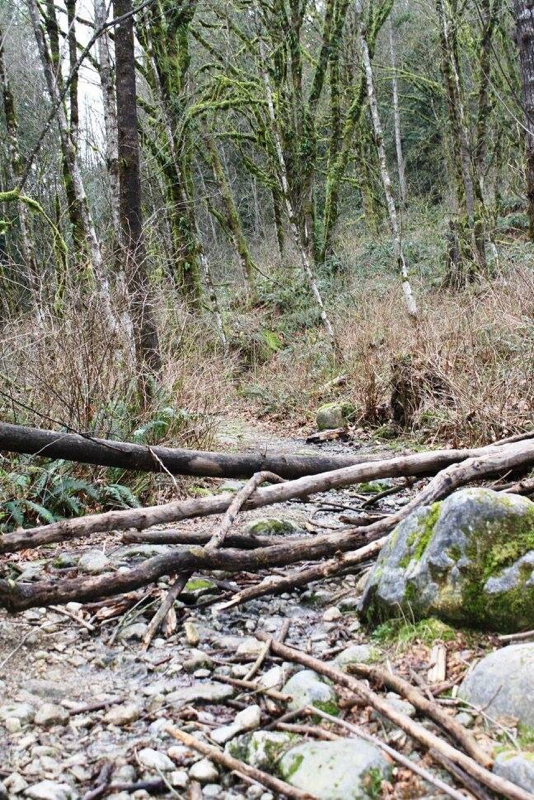
The beginning. Trail up to trail head.
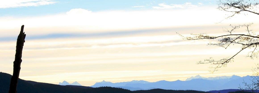
1st lookout

One of the few signs. As your going up keep this thought in your heart...The steeper the climb the longer the Km's feel.
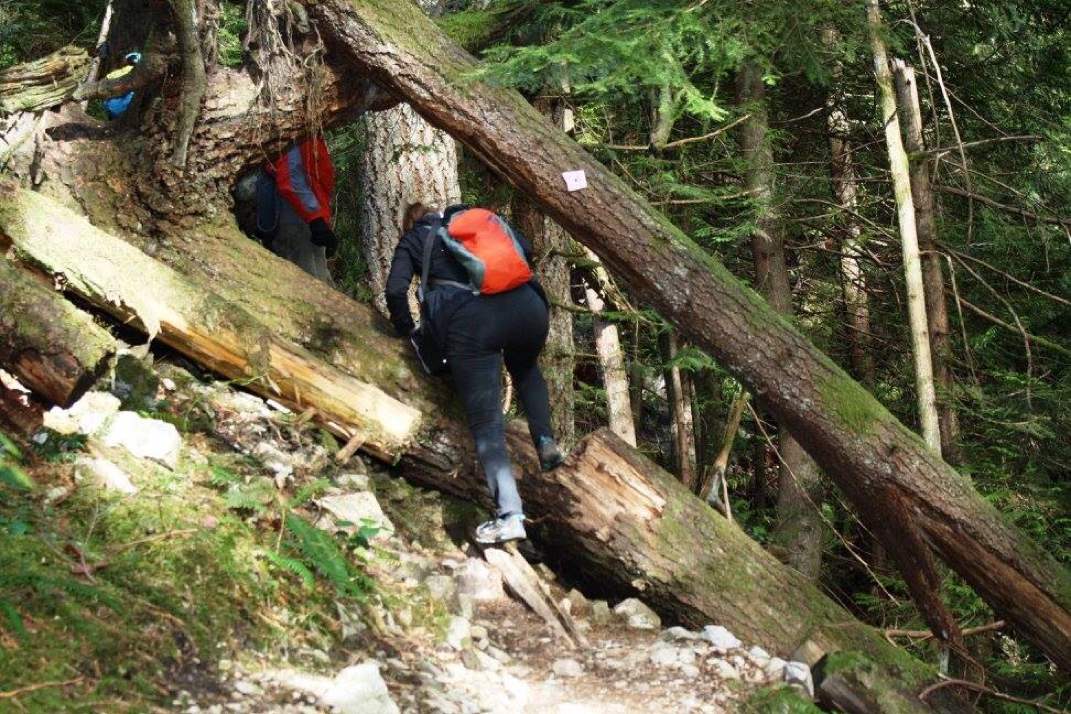
Nasty log crossing.
And then a nasty steep section. A little but if scrambling on your hands. For just a brief moment.
And then this rocky bluff and the 2nd lookout. A beautiful spot for lunch and many photos.
About 300 meters more to go!
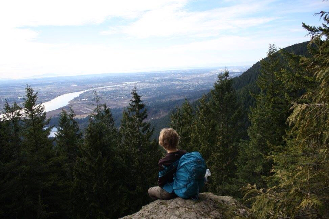
Wendy in her zen moment.
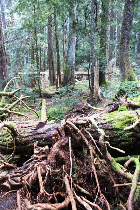
Lots if this in the next section. Far from a leveled walk in the park.
Decision time...
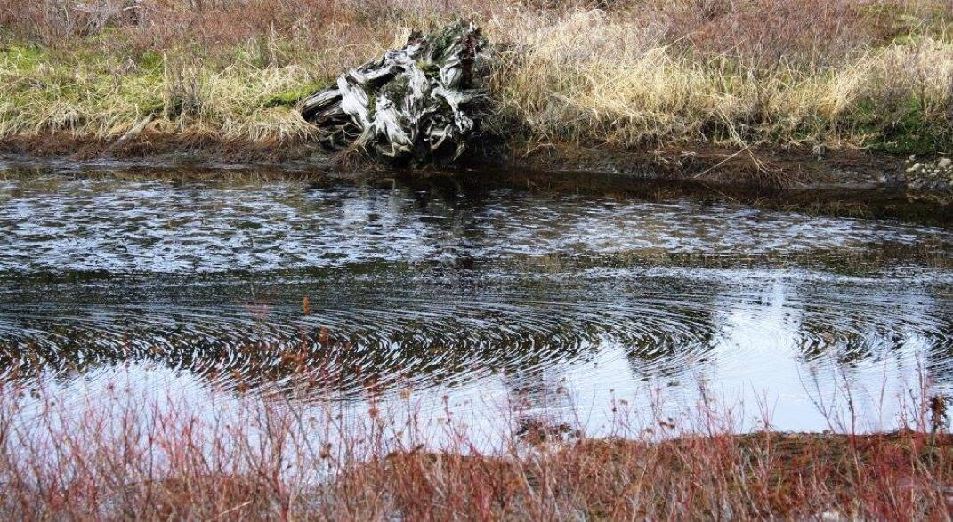
First sight of water through the trees brings you to this boggy area and little pond.
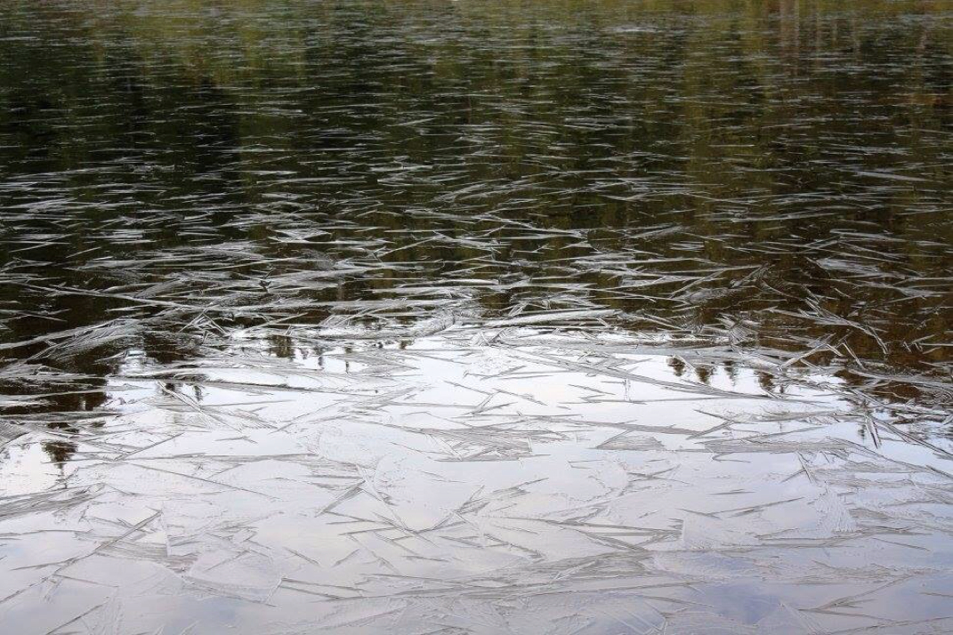
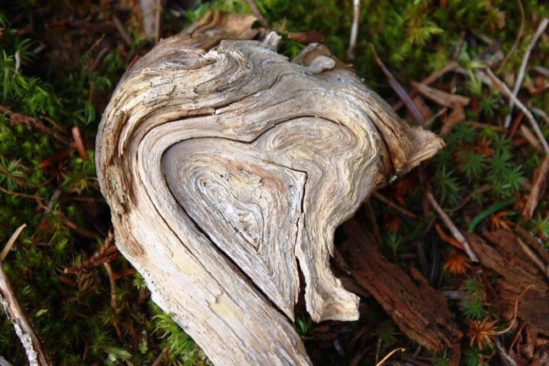
Live what's happening here...ice or pollen? Nature is amazing. I salute her and am blessed to be in her presence.
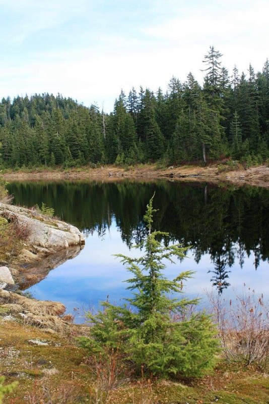
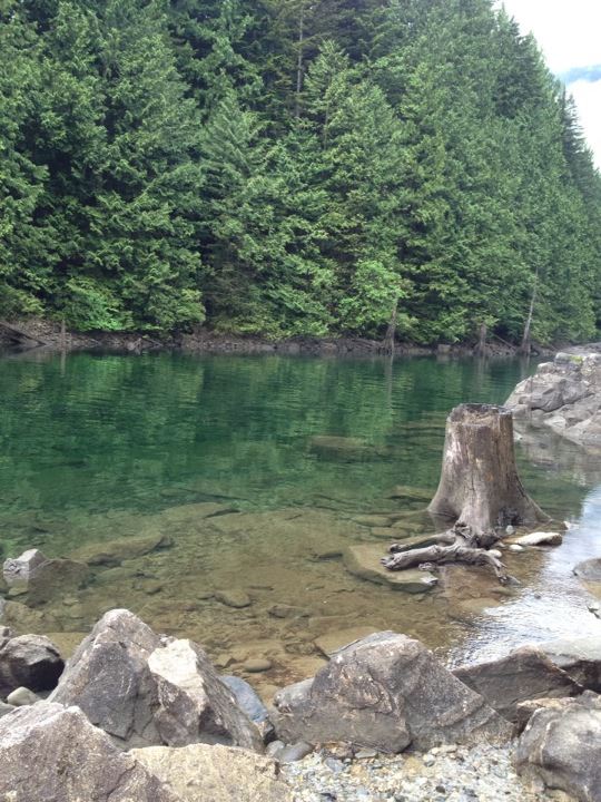
Munro Lake...one jewel on Burke Mountain.
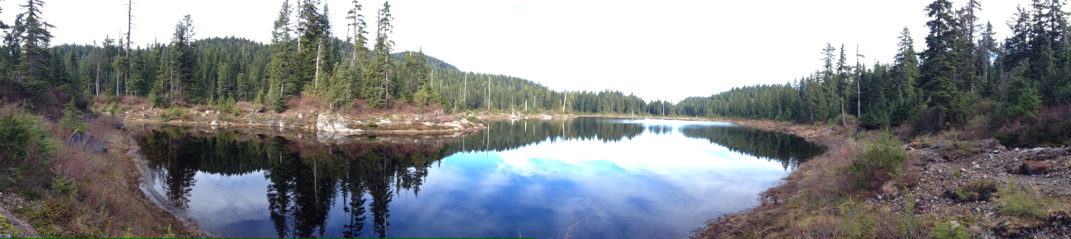
A Munro pano.
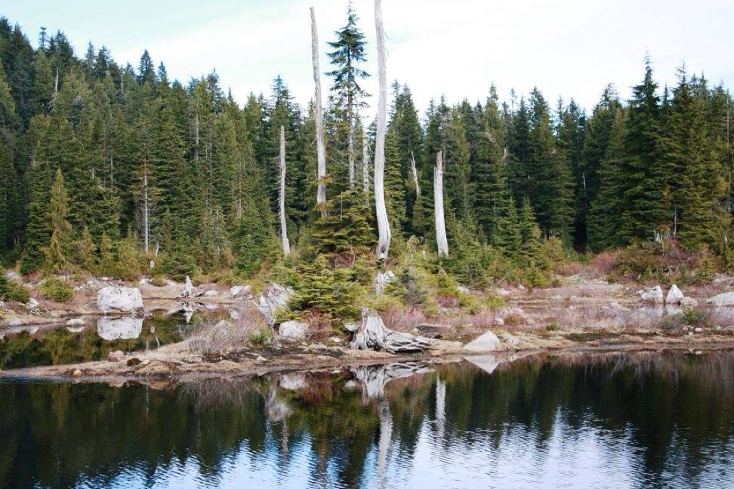
So many pretty moments it's hard to choose a few. Munro Lake.
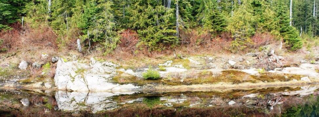
I name this island, Scaredy Cat. It has now been claimed!
Loving my photo memories of today.
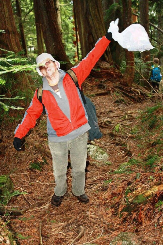
Mr. BoJango collecting garbage along the trail. I feel warmth in my heart for people like him.
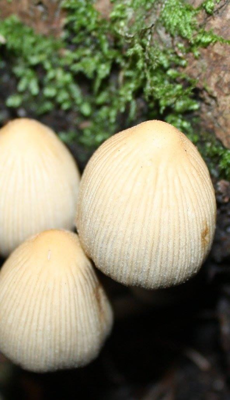
Diggin' this bunch!
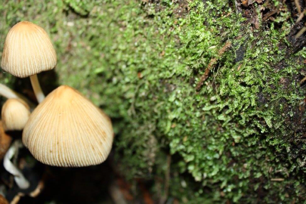
And can't forget these dudes!
"Everyone needs love, love...love is all you need." The Beatles I love nature...An amazing hike that will challenge you but reward your eyes and give your mind joy & happiness!
0 Comments
By Amanada Yanagisawa Elk Mountain is a great intermediate, 7 km hike in Chilliwack, BC with an 800 meter elevation gain. The trail is generally well marked, though I find after the 2nd Km, some trail threading has occurred and you may need to keep your eyes up to find another orange flag to find your next steps. This past week I had a partner (my sister!) available to make an attempt at the sub~peak. It is my fourth attempt. Where the path is steep and a good leg and lung burner, it is sadly the fear of heights that keep me from reaching the top. The unseasonably warm weather allowed us to do this hike unusually early in the year as the trail up was totally free of ice and snow. We went up wearing only our light jackets and enjoying the sunshine. I must say, I was definitely thankful for such a nice day to attempt this hike again. It’s a hike that fills my stomach with a special kind of dread. Will I make it this time? What will my sister think of me when we're done? I have one friend that will no longer hike Elk Mountain with me because of me not 'completing' the hike bothers her too much. Will I have a panic attack on the trail? It's hard to explain to a 'normal' person the feelings of frustration and humiliation one experiences when trying to hike with high up, exposed views. You watch children happily trudge along the trail, many even stopping and exclaiming in delight while you stand there thinking, maybe if I just don’t look it will be ok' (np) So as we near the point of exposure, I stop for a moment to steady my nerves. I take the first few steps up the path and into the glorious sunshine and take in the view. This is where I typically stop. Today, I took my sisters hand and up we went. I took 10 more steps. Stopped. Steadied myself. Allowed my vision to stop spinning. Took another 10 more steps. Can I do this? I am now further than I've ever gone before. Took 10 more steps, getting pretty close! A little more to go and I just about have it! I had to let go of her hand now and sort of pull and scramble up the last bit. I. Have. Made. It. This time I’m happy to report that the goose egg from the scoreboard has gone and the score is now Elk 3 and Amanda ONE!!! Relief and joy overflow my whole body and I hoot and holler! I spent the next 10 minutes hiding in the trees at the top. Taking pictures and enjoying my success. I think the part of my fears that confuse and amaze me the most is how once I'd conquered them, how much easier the hike down was. I still held my sisters hand, but the trip down was quick and easy and without an issue. I doubt that Elk will ever be easy for me and I suspect there will likely be another failure (and maybe another and another) but the joy of this summit will never leave me.... that and this is a hike I will enjoy again and again regardless of that summit. 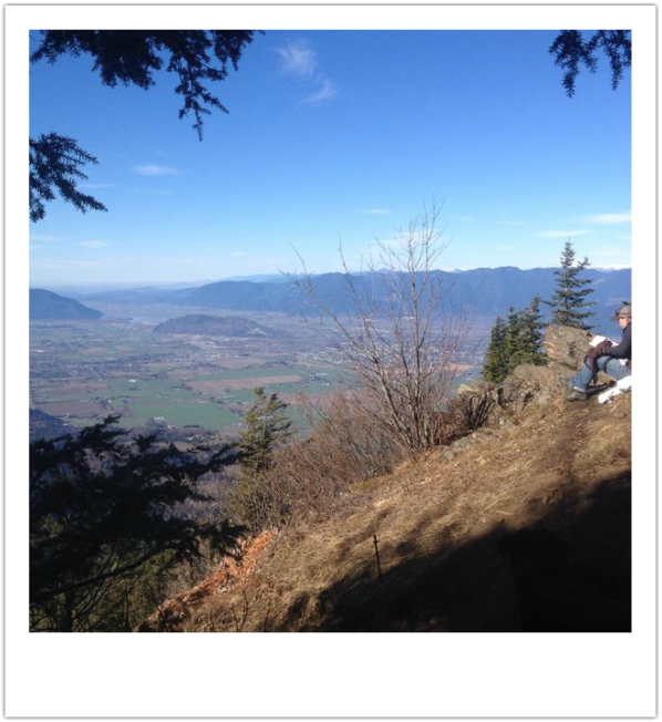
Photo credit: Amanada Yanagisawa
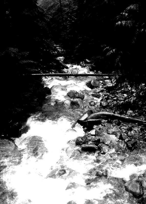
Are you looking for something to do this Valentine's weekend? Why not ask the love of your life out on a date and spend it on the mountains. First you'll need to make a romantic lunch. Cut up some fruit, make some sandwiches and cut them in heart shapes. Don't forget to pack two plastic wine glasses and some sparking juice, a blanket and head off into the wilderness. It's a fantastic & healthy way to spend a sunny day. It's cheaper too! The mountain air and sweet sounds of nature will make you feel alive and bring back the romance that perhaps, has slipped away. These are some of my favorite spots with beautiful vistas in their own-right. -Evan's Creek Trail-Golden Ears Hilly and a quiet 5 Km's (one way) hike brings you to some beautiful views and a rushing creek. This trail is quite unknown so a quiet spot will be easy to find. -Norvan Falls-Lynn Headwaters A flat 7 Km's (one way) brings you to a beautiful Lynn Creek and a cascading Norvan Falls. There are many hidden spots to have a romantic lunch. -Tunnel Bluffs-Lions Bay This steep 6 Km's (one way) hike has many view points that can be the end of your journey whenever you choose making it easier. The spectacular views you'll see is all of Howe Sound. -Diez Vistas-Port Moody This is a longer hike at 15 km's return but can be done as an in out hike. It also has many view points and although rather popular, there are lots of spots where a couple could tuck away for some quiet romantic memories. -Elk Mountain-Chilliwack Although I have yet to make it to the summit of Elk, this steep 5.5 Km's (one way) hike offers great views at the first lookout. It's vistas bring many visitors so finding a quiet spot might be a little more challenging but it sure is pretty. -Minnekhada Park, Coquitlam This is a beautiful 10 km's return hike with many areas that would offer a great spot for some R&R. The park is known for frequent bear visits. Please do not feed the bears. -Killarney Lake, Bowen Island Why not take a romantic ferry ride over to Bowen Island and hike Killarney Lake. It's just 9 km's return and the lake is real pretty. There are also some quaint shops and nice restaurants for an after hike dinner. Quarry Rock, Deep Cove This is quite a popular destination but there are a few spots where you could sit that are hidden. At just 3.8 km's return it's a short and sweet hike. If you go behind the rock and up a short trail you'll find stairs that dip into the forest. There are some romantic mini waterfalls that you could blend in with for your picnic or step into Deep Cove's quaint little town for an after hike snack. -Lindeman Lake, Chilliwack This is a short 3.4 km's return hike to a beautiful greeny lake tucked away in the mountains. There are lots of spots where it's quiet and a couple could share a romantic lunch. You could even carry onto Greendrop Lake but Lindeman is way prettier. -Mount Thom, Chilliwack Although it's getting to be a popular exercise hike the summit is quite pretty. It's 5 km's (one way) and at the top site a bench where you could easily spend time with your sweetheart. -Lower Falls, Golden Ears An easy 3 km's return walk to some pretty falls. The beach areas should find a quiet spot for two. There are lots of trail walks and a few places that might still be covered in snow. For more information check them out here: www.hikingforthescaredycat.com Happy Valentines Day! Lori aka Scaredy Cat... 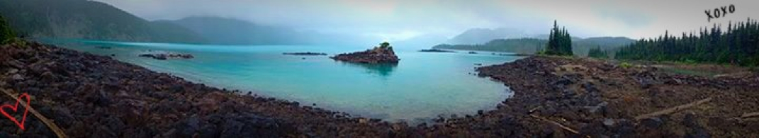 It didn't surprise me when I accidentally got this shot while visiting last summer. I love this hike, my all time favorite. Garibaldi Lake, Whistler Walk along past the pit toilets and over the Lynn Creek Bridge. There's a map and hikers sign in book. Sign in and start your hike to the left. This is a 13.8 Km's hike with minimal elevation. Walk along the wide trail as the rushing creek is on your left side. In the beginning there will be lots of runners and dog walkers. This 1.7 Km's of the trail is called the Cedar Mills Trail. The trail goes up some stairs, rocks and gets narrower as you cross a few streams and end up in a beautiful forest. There will be a fork in the trail, stay left. At 4km with the creek still on your left side you will come out into the open area called, Debris Chute. Walking on a rocky trail continue on your right and the trail picks up on your left. You now have 3 Km's to go and are submerged in the forest. The next few Km's are muddy with many creek crossings. Poles are handy. There is a few sections with a little elevation but minimal. Soon you'll hear Lynn Creek again and it will get louder and louder. On your right you'll see the sign for Coliseum Mtn. This trail is closed in the winter months. Carry on and right away you'll see a steel suspension bridge high above a rushing Lynn Creek. Cross the bridge and this is the summer route through Hanes Valley to Grouse Mountain. Another route that's closed during the winter months. The suspension bridge is pretty & fun to cross but your real treat is 200 meters to your right. Follow the creek up as Norvan Falls soon will become visible. You can walk down to the creek beach area and snap some great pictures. You can also go up higher and closer to the falls along the trail. Be mindful as it can be slippery on the rocks. The beach area is a perfect spot for lunch. Once you're done head back the way you came. Once back at the opening you can go left and loop the other way back to the parking lot or you can continue on the way you came. Sign back in the hikers book, cross over the bridge and head back to your car. Happy & safe hiking. Lori aka Scaredy Cat Directions: Norvan Falls is in Lynn Headwaters Regional Park in North Vancouver. Take Highway #1 to the Lynn Canyon Exit and follow Lynn Valley Road northbound for several blocks and through the park and narrow road. There's a couple of parking lots. The farthest one is the smallest. If it's full backtrack to the larger parking lot. 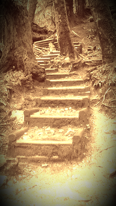
Stairs along the way. Photo credit: Susan Ottewell
Debris Chute
On the suspension bridge over looking Lynn Creek. Photo credit: Susan Ottewell

Norvan Falls from the beach area.
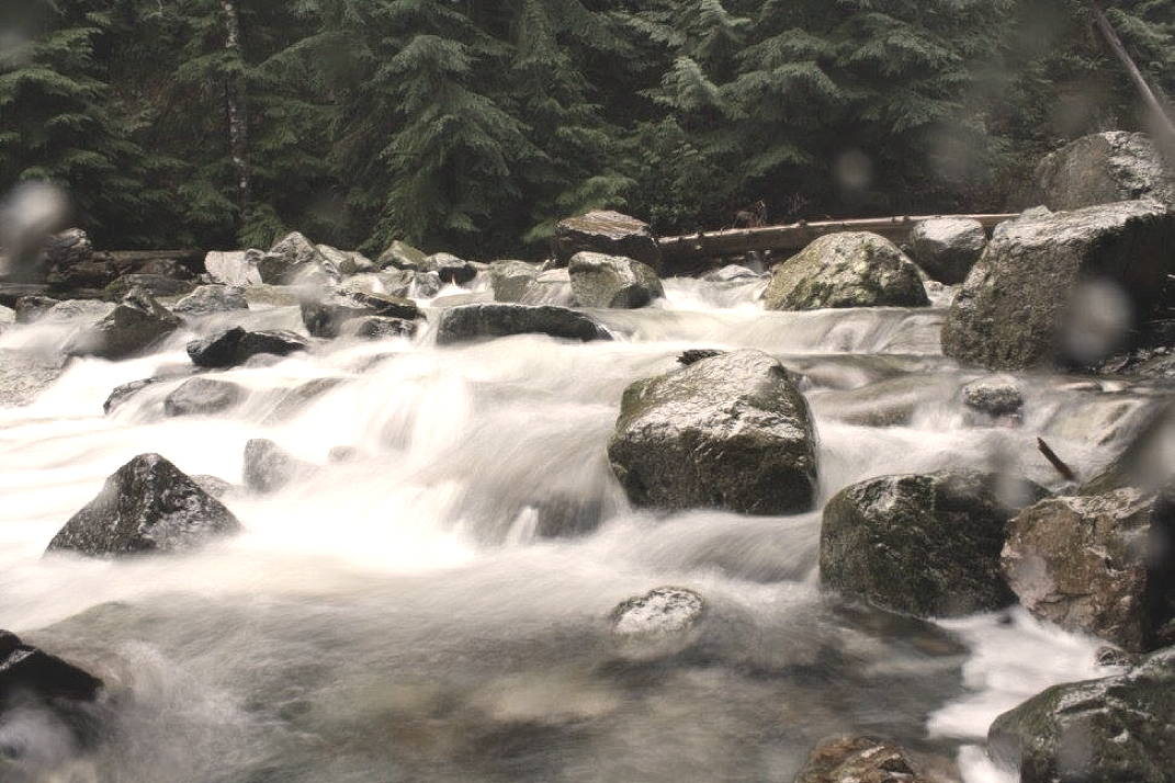
Lynn Creek cascading down from Norvan Falls.
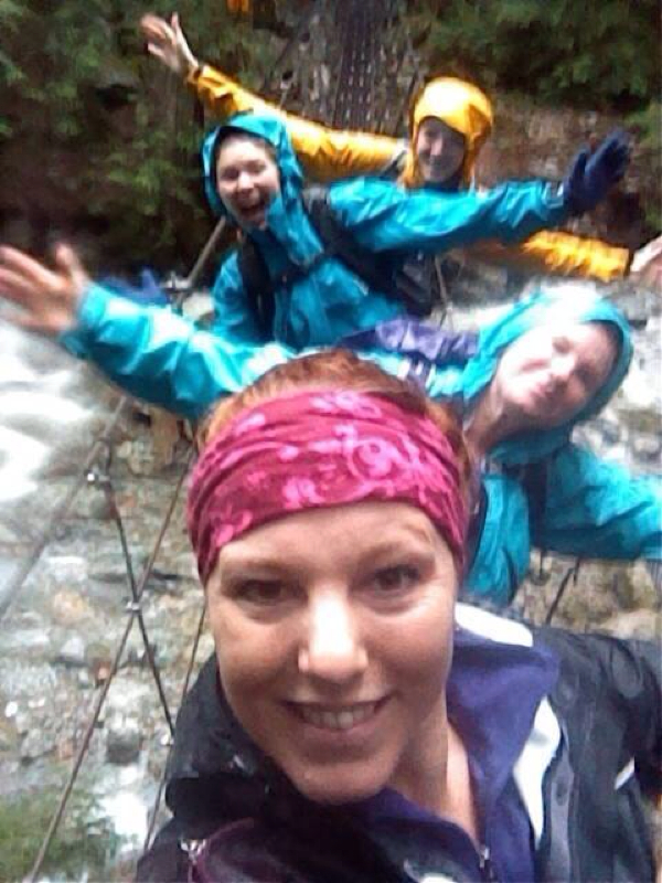
Fun times on the suspension bridge. Photo credit: Susan Ottewell
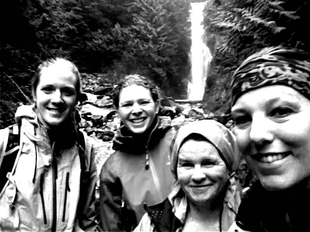
As the monsoon started...four happy but wet ladies. At Norvan Falls. Photo credit: Susan Ottewell
1) Lightning Lakes: Go past the Manning Park Lodge and turn right after the lodge. Follow the road and when you see a fork, stay left. Park at the parking lot. There are pit toilets here. Cross the dam bridge and you'll see, Frosty Mountain sign. Go right and follow the lower trail...save Frosty for a nice summer day or a fall hike to see the Golden Larches (see that hike under, My Hikes). This can be a loop trail that follows the lake along. You are in the trees. Soon you come to a bridge named, Rainbow Bridge. You can go across the bridge and go to your right to loop back to the parking lot. You can also carry on to the neighboring lakes, Strike and Thunder. However, this will make your SS a lot longer (14 km's). Today we were breaking trail so we decided to make it a shorter loop. That's the great thing about this as a SS...you can turn around at any point. The trail is easy to find in the summer but with fresh snow we lost the trail a few times and ended up on the cross country skiing road. They can be a little nasty so we quickly found the trail again and got off the road, LL Day Use (see picture). We followed this unbroken snow trail down a path and along the lake. Soon the parking lot was in our view. Today we did 10 km's with an elevation gain of 160 meters. Scaredy Cat says you won't loose any of your nine lives. Happy & safe snowshoeing. 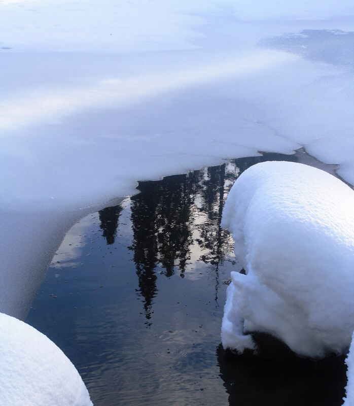
2) Strawberry Flats & Three Falls Drive to Manning Park Lodge and turn right. Follow the road until it forks and go right about 3 km's to the Strawberry Flats parking area. Park your car and go to the left down a little hill. There's a pit toilet here. A big sign says, Snow Shoe Trail or if you prefer you can walk along the cross country ski trail. If you choose this route, proper etiquette says stay off the cross country skiing tracks and not in the middle of the road. Stay to the side. Keep walking on the wide road and soon you'll come to fork in the road. Either way it's a Strawberry Flats Road loop. After a short time you'll see a Three Falls sign on your right. You can go up here or across the ski run. Just stay out of the way. If you choose the Snowshoeing Trail you'll walk in the forest, which is a groomed trail that has beauty at every turn. Keep walking along for 2 km's to the edge of the ski run. To change it up you can go on the way along the road and on the way back through the forest... To get to Three Falls...Go up the hill and to your left is this side trail, it's un-marked. Now your in the woods as you walk along a skinny trail. Sometimes it pops into the open and sometimes it's back in the trees as you make your way to Shadow Falls at 3.1 km's, your first of three falls. Just a little descent into a lookout and you'll see Shadow Falls far below. This is a perfect spot for a snack or to return later for lunch. Carry on along the trail and soon you'll come to Nepopekum Falls, at 3.2 km, and the descent to Derek Falls, at 4.5 km's. The third of the Three Falls is the prettiest. The trail here is a skinny trail that's open on one side. Not my favorite trail but most wouldn't bat an eye at it. To return back to your car you go back the same way. It is a 9 km SS. I don't think you'd loose any of your nine lives...however be careful when at Derek Falls. It's quite steep here. 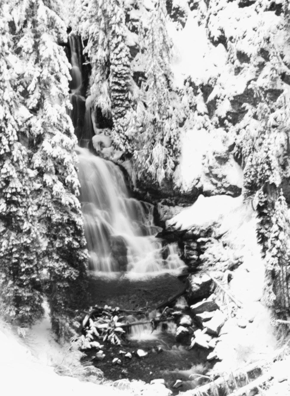
Derek Falls..the last of three falls and the end of your trail.
3) Fat Dog Winter Trail Fat Dog & Cambie Creek-700 meters & 15 Km's (Winter route only...closed in the summer months) Directions: drive on Highway 1 to Manning Park. Fat Dog is east of Allison Pass. If you get to Manning Park Lodge, you've gone too far. The parking lot is on the left side. There's a pit toilet here and a big parking lot. There is a loop along the route, this is Cambie Creek. We didn't try this but walked past it. It seemed un-touched and said closed. We followed the Fat Dog trail sign post. Trail Key: M~2~KF~DF~ST~H~V~PT 2015~Start at the sign post and follow the trail along the snow covered trees and long flat path. Go right at fork, with the sounds of a rushing creek on your right side. Cross a bridge with the cascading river now under you. Keep going, now the switches to your left side. The sound is a blessing to your ears. Follow the 5 Km's sign post to the right. It gets a little hilly now as you leave the trickling sounds of rushing water. Next sign post says left Cambie Creek and right Fat Dog...go right. There are no more sign posts after this one but the trail is easy to follow. First steep up hill grunt but it's short. A short flat spot and downhill as the trail winds around. Little hill then a short flat spot and cross over a small creek. Then another uphill grunt that goes on forever then it finally flattens out. Then you come to a short grunt up. Then it is flat again for sometime. The last few Km's climb uphill gradually as the trees get thinner and thinner. Soon you are in an open area and on a clear day you'll see Three Brothers, The North Cascades and Frosty Mountain. There is nothing scary about this winter trail. It has many beautiful views. Scaredy Cat says you won't loose any of your nine lives on this in-out trail. 
4) Windy Joe Drive past the Manning Resort and not too far along the road, just after the bridge and before the parking lot is a pull out to park on your right. There’s a big Manning Park sign and a Windy Joe Lookout sign post. This mark’s the start of your hike. It's 16 km’s return/654 meters. Right from the start there is dead fall but it’s easy to navigate. For the beginning of the hike it’s flat in old growth forest. This goes on for about 2 km’s. The trail forks/junction: stay right & follow sign to Windy Joe Lookout Trail. If you go left it’s the Pacific Crest Trail (that’s the trail that takes you through the USA and ends in Mexico.) Or this also goes to Frosty Mountain. Today it’s Windy Joe… Here it starts to climb gradually up a wide, rocky road. Just before 5 Km's there’s another junction (stay left) going right takes you to Pacific Crest Trail & Frosty Mtn. After about 5 minutes you'll see a 5 Km's Windy Joe trail marker high in the trees…3 km’s to go! Keep going as the trail snakes around with gradual elevation Soon a lookout of Frosty appears on your left, it's not far now. The pit toilet will be your first sign that you are steps away from The Windy Joe Hut. There's a picnic table and vistas everywhere your eyes can see. Don’t let anyone tell you the trees cover the views. It is spectacular! You have arrived, your summit for today. Check out the hut. Upstairs there are pictures of all the mountain ranges. It’s a piece of history…Scaredy Cat says you won’t loose any of your nine lives. This could very well be one of my most favorite hikes. It’s a great workout and nothing scary. Windy Joe Fire Tower: The original ranger station was here and only a tent. It was here where in the 1948 rangers used this lookout for spotting fires. In 1950 this hut was built and for the next 13 summer’s rangers used this tower to spot fires. Now-a-days fires are spotted by planes and a ranger is still at Monument 83 (a larger tower built in 1963) during high fire season. This tower is left as a reminder of our history. This lookout was named after Joe Hilton, who worked in the park from 1946-1975 and who is responsible for laying out many of the hiking trails we enjoy today. Pacific Crest Trail: I just started reading the book, Wild, by Cheryl Strayed. It’s about her quest to complete this hike solo after loosing herself. It’s quite the read...The Pacific Crest Trail, PCT, is a long-distance hiking trail. It passes through the Sierra Nevada and Cascade mountain ranges. The trail starts in Mexico and ends in Canada’s, Manning Park. The Pacific Crest Trail is 4,286 km long and ranges in elevation from just above sea level at the Oregon–Washington border to 4,009 meters. The route passes through 25 national forests and 7 national parks. It was completed in 1993. It is estimated that 300 people complete the trail each year. On average, the trail takes 5 months to complete. Happy & safe snowshoeing. Lori aka Scaredy Cat 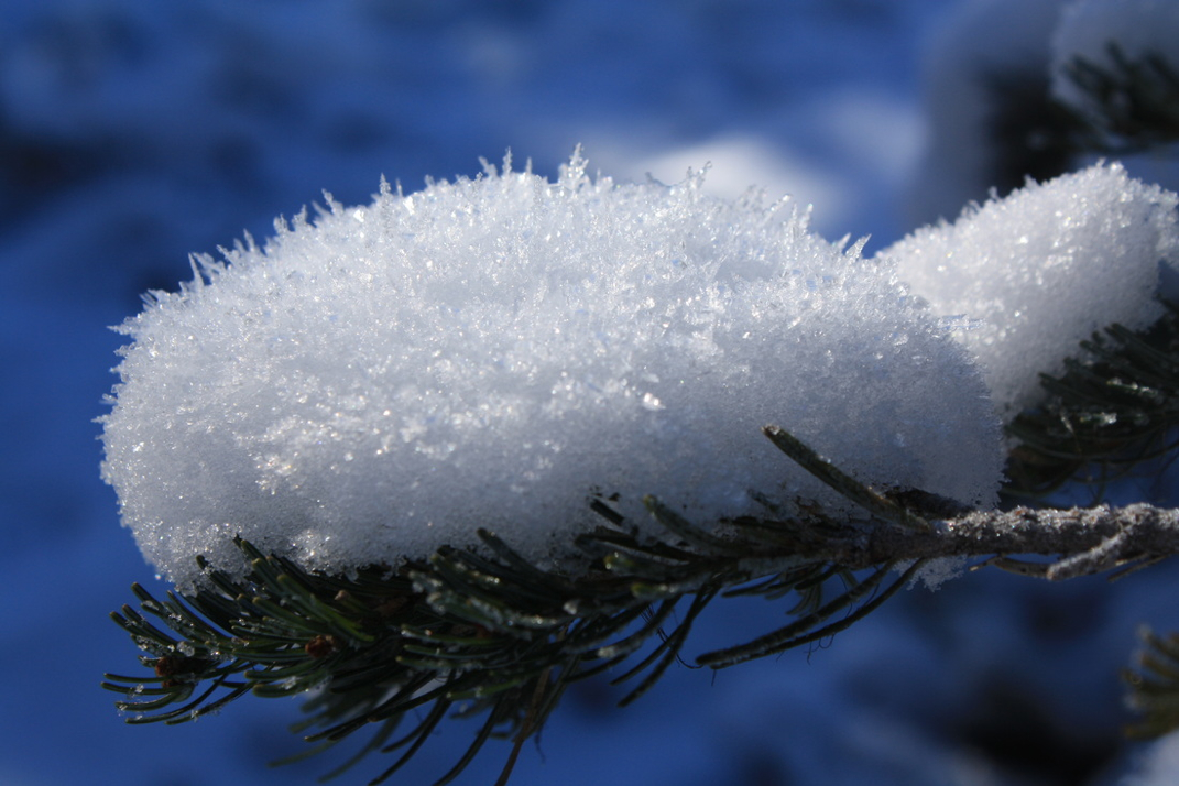
At the top Windy Joe.
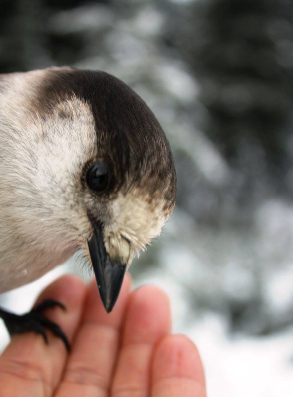
"Nature gives us time to re-group, calm our soles and ready ourselves for the week ahead." Lori Pederson Whiskey Jack aka Grey Jay

On the right is how I look on my way to my mountain adventure and on the left is how I look on my way home...
Fat Dog & Cambie Creek-700 meters & 15 Km's (Winter route only...closed in the summer months) Directions: drive on Highway 1 to Manning Park. Fat Dog is east of Allison Pass. If you get to Manning Park Lodge, you've gone too far. The parking lot is on the left side. There's a pit toilet here and a big parking lot. There is a loop along the route, this is Cambie Creek. We didn't try this but walked past it. It seemed un-touched and said closed. We followed the Fat Dog trail sign post. Trail Key: M~2~KF~DF~ST~H~V~PT 2015~Start at the sign post and follow the trail along the snow covered trees and long flat path. Go right at fork, with the sounds of a rushing creek on your right side. Cross a bridge with the cascading river now under you. Keep going, now the switches to your left side. The sound is a blessing to your ears. Follow the 5 Km's sign post to the right. It gets a little hilly now as you leave the trickling sounds of rushing water. Next sign post says left Cambie Creek and right Fat Dog...go right. There are no more sign posts after this one but the trail is easy to follow. First steep up hill grunt but it's short. A short flat spot and downhill as the trail winds around. Little hill then a short flat spot and cross over a small creek. Then another uphill grunt that goes on forever then it finally flattens out. Then you come to a short grunt up. Then it is flat again for sometime. The last few Km's climb uphill gradually as the trees get thinner and thinner. Soon you are in an open area and on a clear day you'll see Three Brothers, The North Cascades and Frosty Mountain. There is nothing scary about this winter trail. It has many beautiful views. Scaredy Cat says you won't loose any of your nine lives on this in-out trail. Happy & safe SS'ing. Lori aka Scaredy Cat GPS Waypoints: Trailhead N49.11133 W120.84325 10U 657393 5442072 Cambie Loop Trail forks N49.11233 W120.83903 10U 657698 5442192 Bridge N49.11596 W120.83452 10U 658015 5442605 Inner Cambie Loop junction N49.11811 W120.83235 10U 658167 5442848 Outer Cambie Loop / Fat Dog junction N49.12176 W120.82866 10U 658424 5443262 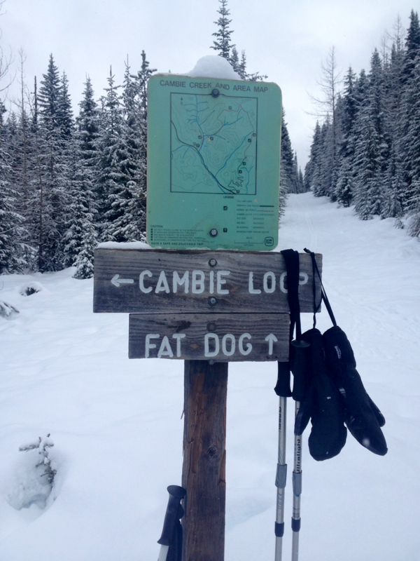 The final sign post...5 Km's to go! 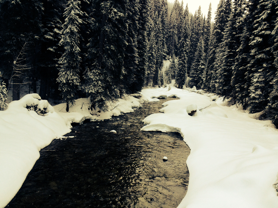 Standing on the bridge watching this beautiful rushing creek. The sounds & smells were blessings to my senses.  Mr. Hawk...There's something spiritual about these birds. They are simply beautiful. 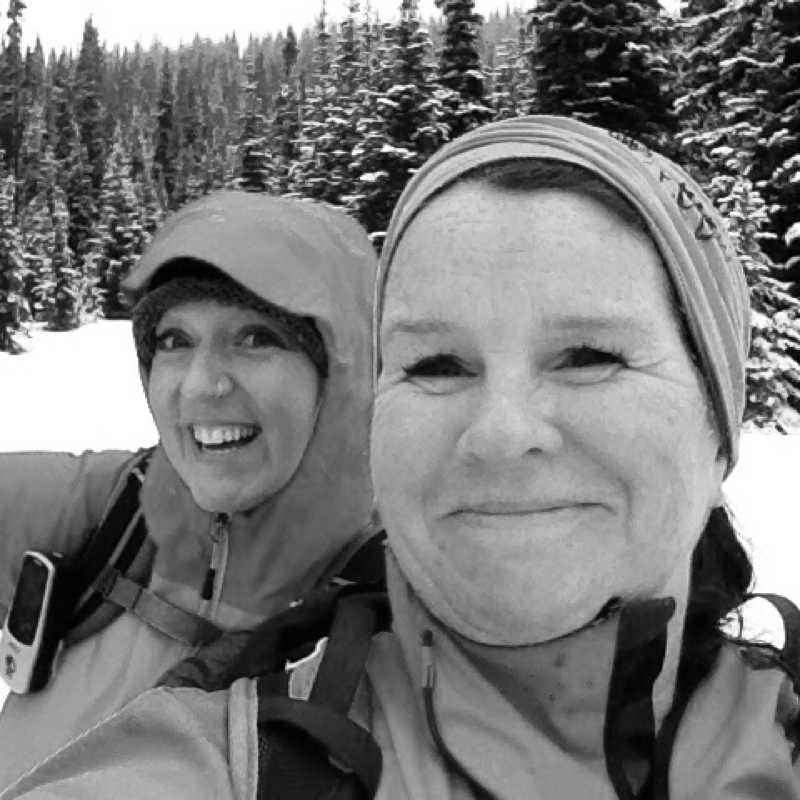 Danielle & I having loads of fun! 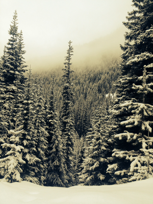 Beauty at every turn. 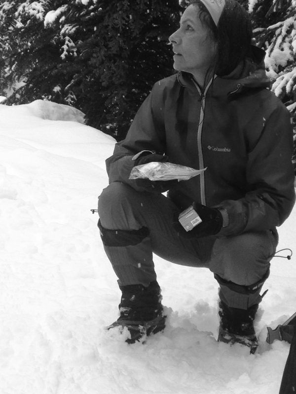 Ingrid in her zen moment...Nature gives us this time to re-group and calm our soles for the week ahead. 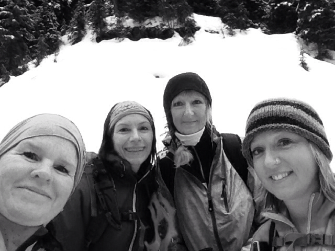 Four ladies having the time of our lives...Danielle, Em, Ingrid and me...a non-Scaredy Cat. 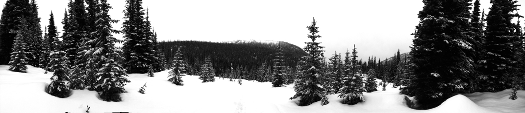 Panorama worthily. 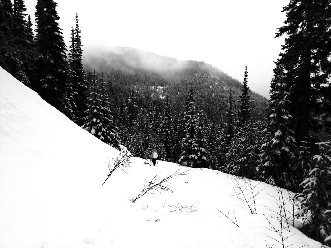 I recommend this snowshoe...a great workout with many beautiful sights and sounds. 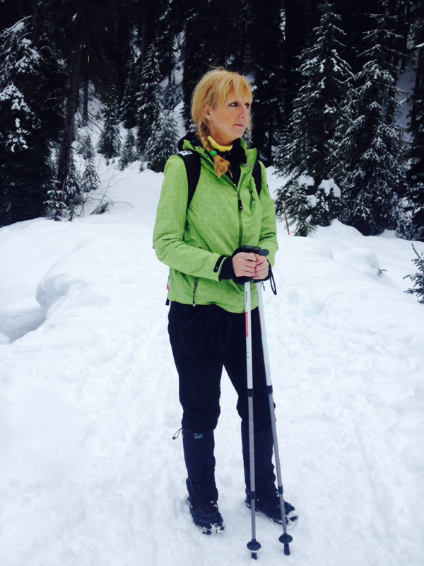 Em enjoying the sights and sounds of a rushing river... 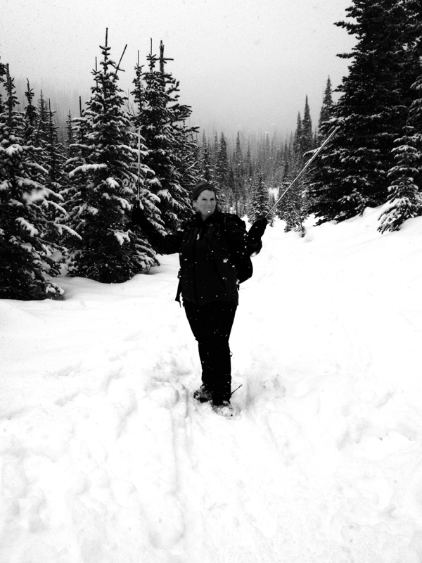 The snows really coming down now...photo credit: Danielle Joyce Photography. 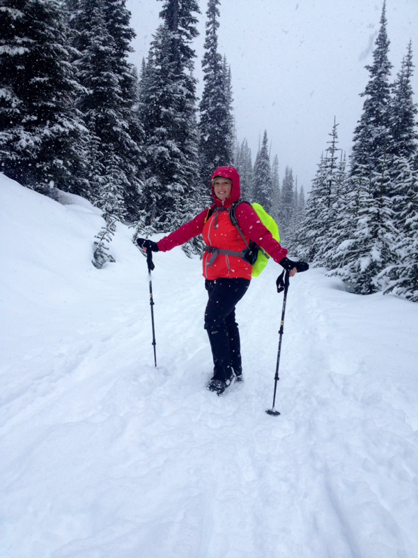 Snow makes this lady smile...A very happy Danielle in spite of a sore ankle & hip! 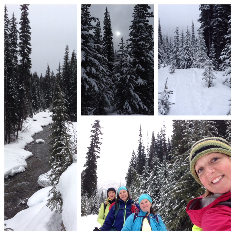 Our eyes smiled the entire way. Photo credit: Danielle Joyce Photography. 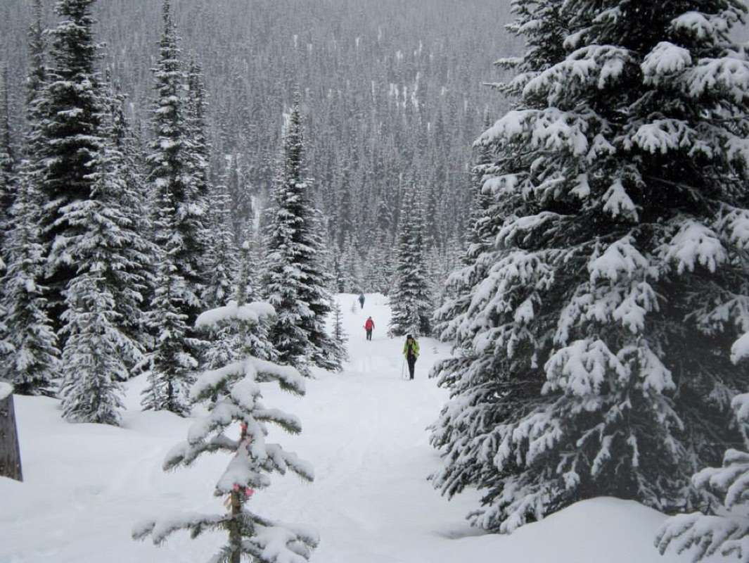 Ingrid ahead of us...Shows how small we are in this big beautiful world. Em, Danielle & myself...Photo credit: Ingrid Kilde 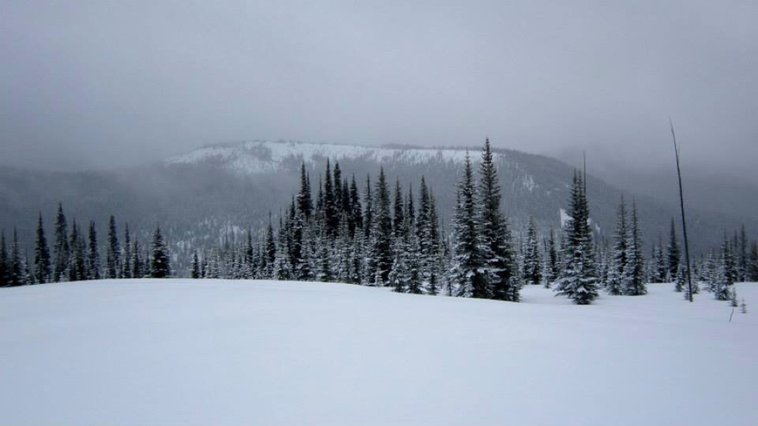 At the top...photo credit: Ingrid Kilde  In the meadow near the turn around point. Photo credit: Ingrid Kilde |
Author.I work for Surrey School District as an Education Assistant. In my free time I enjoy hiking, snowshoeing, going off-road, dragon boating, writing & hanging with my huskies. Archives
March 2021
Categories |


 RSS Feed