Hiking for The Scaredy Cat: Hikes in and around Vancouver, B.C. Canada
  • Trail Information
    • The Hiking Trails & Safety Information >
      • Abby Grind: Abbotsford
      • Alder Flats: Golden Ears
      • Alouette Mtn: Golden Ears Provincial Park
      • Ancient Cedars Trail
      • Al's Habrich Ridge Trail: Sea to Sky Gondola
      • B.C.M.C. Grouse Mountain
      • Bear Mtn: Mission, BC
      • Big Cedar & Kennedy Falls: Mount Fromme
      • Blue Mountain:Coquitlam
      • Bosumarne Falls: Chilliwack, BC
      • Bowen Lookout:Cypress Mountain
      • Bridal Falls Lookout: Chilliwack-Agassiz
      • Brother's Creek: North Vancouver
      • Community Forest: Chilliwack
      • Community Forest-Gloria Lookout-Mt. Thurston-Elk Mtn-Chilliwack
      • Coquitlam Crunch: Coquitlam
      • Cheakamus Lake: Whistler
      • Crystal Falls: Coquitlam, BC
      • Dewdney Grind: Mission
      • Diez Vistas: Buntzen Lake
      • Dragon's Back: Hope, BC
      • East-West Connector Bridge Trail~Golden Ears Provincial Park
      • Eaton Lake: Hope
      • Elfin Lakes: Squamish
      • Elk Mountain: Chilliwack
      • Evan's Creek: Golden Ears Provincial Park
      • First Peak: Seymour Mountain
      • Ford Mtn: Chilliwack
      • Grouse Grind: West Vancouver
      • Garibaldi Lake: Squamish
      • Harrison Grind/Campbell Lake: Fraser Valley
      • Harrison Lookout/Fire Tower
      • Heather Trail: Manning Park
      • High Note Trail: Whistler
      • Hillkeep: Chilliwack
      • Hope Lookout Trail
      • Horne Lake Caves Provincial Park: Vancouver Island
      • Jacobson's Lake to Palmer Pond
      • Joffre Lakes: Pemberton
      • Jug Island: Belcarra Regional Park
      • Ladner Creek Train Trestle: Coquihalla Hwy
      • Killarney Lake: Bowen Island
      • Lake Lovely-Squamish
      • Larch Meadows: Manning Park
      • Levette Lake Loop: Squamish
      • Lewx Qwo:m (luhw KWOM): Chilliwack
      • Lindeman & Greendrop Lakes: Chilliwack
      • Lightning Lakes: Manning Park
      • Lindsay Lake Loop: Buntzen Lake
      • Little Douglas Lake: Coquihalla Summit
      • Lower Falls-East Canyon Parking Lot: Golden Ears
      • Lynn Loop: Lynn Headwaters Regiona Park
      • Lower Hollyburn: Cypress Mtn
      • Lynn Peak: Lynn Headwaters Regional Park
      • McKee Peak-Cliffside Caves
      • Mehatl Falls
      • Menzies: Golden Ears Provincial Park
      • Minnekhada Park: Coquitlam
      • Mount Cheam: Chilliwack
      • Mount Fromme: North Van
      • Mount Sleese to Memorial Plaque: Chiliwack
      • Mount St. Benedict: Mission
      • Mount Strachan: Mount Seymour
      • Mt. Thom: Chilliwack
      • Mt. Gardner: Bowen Island
      • Mt. Woodslide
      • Munro & Denette Lakes: Coquitlam
      • Mystery Lake: Mount Seymour
      • Needle Peak/Flatiron: Coquihalla Highway
      • Norvan Falls: Lynn Headwaters Regional Park
      • Othello Tunnels-Nicola Valley Loop
      • Parkhurst Ghost Town: Whistler
      • Panorama Ridge: Squamish
      • Petgill Lake: Howe Sound
      • Poland Lake-EC Manning Park
      • Quarry Rock: Deep Cove
      • Ravens Bluff-Mission
      • Red Mountain: Mission
      • Salmon Ridge Trail: Chilliwack, BC
      • Sandy Cove Trail: Harrison Hot Springs
      • Sasquatch Caves: Hope
      • Sea to Summit: Sea to Sky Gondola
      • Skyline: Grouse Mountain
      • Skyline 1: Manning Park
      • Spirit Caves-Yale, BC
      • St. Mark's: Cypress Mountain
      • Statlu Lake
      • The Stawamus Chief: Squamish
      • Tikwalus Trail: Spuzzum
      • Trickle Creek Treehouse
      • Thacker Mountain Trail: Hope
      • Tunnel Bluffs: Howe Sound
      • Vedder: Chilliwack
      • Watersprite Lake: Squamish
      • Wedgemont Lake: Whislter
      • Wells Peak
      • Widgeon Falls
      • Williams Peak
      • Windy Joe: Manning Park
      • Woodland Walk to Sawblade Falls
      • Zoa Peak: Coquihallia Hwy
    • The Snowshoe Trails & Safety Info >
      • Artist Point
      • Bowen Lookout
      • Dog Mountain: Day
      • Callaghan Valley
      • Dog Mountain: Night
      • Eagle Bluffs
      • Elfin Lakes to Red Heather Hut >
        • Fat Dog
        • First Pump
        • Hollyburn
        • Lightning Lakes Loop
        • Rainbow Lake
        • Sasquatch Mountain Snowshoe: Hemlock Valley
        • SS Grind
        • Stawberry Flats
        • Zoa
    • The U.S.A. Hikes >
      • Blue Lake: Northern Cascades
      • Chain Lakes
      • Damfino Lakes
      • Deception Pass State Park: Washington, USA
      • Oyster Dome
      • Yellow Aster Butte
    • The Trail Walks >
      • Aldergrove Regional Park: Aldergrove
      • Blue Heron Reserve: Chilliwack
      • Brae Island: Fort Langley
      • Burn's Bog: Delta
      • Burnaby Lake Loop: Burnaby
      • Campbell Valley: Langley
      • Cathederal Grove: MacMillian Provincial Park:
      • Delta Watershed
      • East Sector Lands: Harrison Hot Springs
      • Elgin Park: Surrey, BC
      • Green Timbers: Surrey
      • High Knoll Park: Surrey
      • Houston Trail: Fort Langley
      • Katzie Marsh Loop: Pitt Meadows
      • Lower Falls: Golden Ears: Maple Ridge
      • Lower Seymour Conservation: North Vancouver
      • Lighthouse Park: West Vancouver
      • Mud Bay: Surrey
      • Redwood Park: Surrey
      • Reifel Bird Santuary: Delta
      • Rice Lake: North Vancouver
      • Richmond Nature Park: Richmond
      • Rolley Lake: Mission
      • Ruth Johnson Park: White Rock
      • Sasamat Lake: Port Moody
      • Spirea Trail: Golden Ears
      • Sunnyside Urban Forest: Surrey
      • Serpentine Bird Santuary
      • Shoesmith East Trail Loop: Maple Ridge
      • Spirit Trail: Ladner
      • Stanley Park Seawall: Vancouver
      • Sye'xw Cho'teqw Adventure Park
      • The Jetti: Iona Beach, Richmond
      • Tynehead
      • Yew Lake
  • My Blogging
  • Jorullo Bridge Hiking Tour Puerto Vallarta, Mexico
  • Mt. Kilimanjaro
  • In the River Valley Hikes
  • West Coast Trail
  • Peru
  • Hiking Snapshots
    • Thru Hikes
    • Bears & Cougars +
    • Proper Hiking Footwear
    • Trail Etiquette
  • Blog

My  BlogGing

Picture

Bear Mountain: Mission by Corinne        McConnell Janzen

8/4/2015

1 Comment

 
Meet my guest blogger, Corinne. I was sitting here thinking now where did I meet her. Then I remembered she posted on a Chilliwack hiking page that she wanted to go snow shoeing. I invited her that night and sure enough the next morning she was SS'ing with us at Zoa Peak. I'll tell you that I liked her instantly. You'd think when you met her she is really not a hiker as she shows up cuter than anything, lip gloss in tote but she has navigation skills that will get you out if any back country, is a little bit of a mountain goat, doesn't complain and is super fun to hike with. She is kind hearted and is giving of one of the things we might not think of...her time! Her energy is upbeat and always finds good in everything and everyone. If you're lucky enough to be friends with Corinne you are truly blessed. 
This is Corinne's recent journey to Bear Mountain. Now there are two Bear Mountain's, this one is the trail in Mission. 
Psst...she doesn't want me to call myself Scaredy Cat any longer as she thinks it is hindering my growth so I'll say...Lori. 

Picture
Corinne at the top of Eagle Bluffs: Howe Sound Photo credit: Su Postill

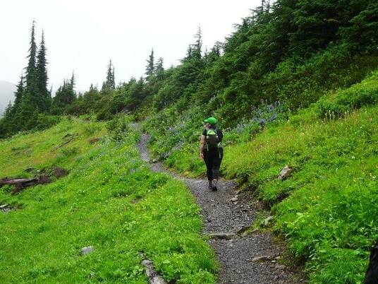
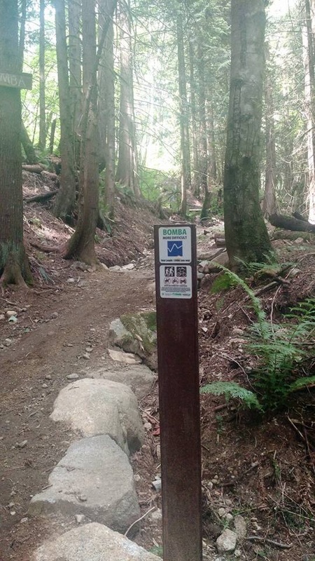
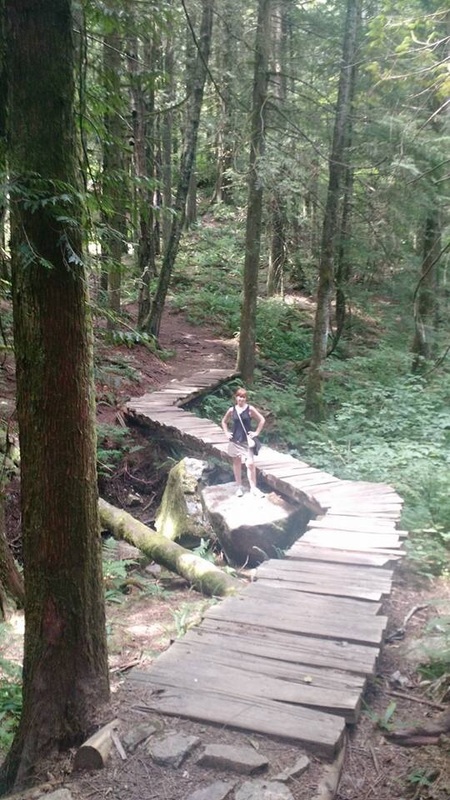
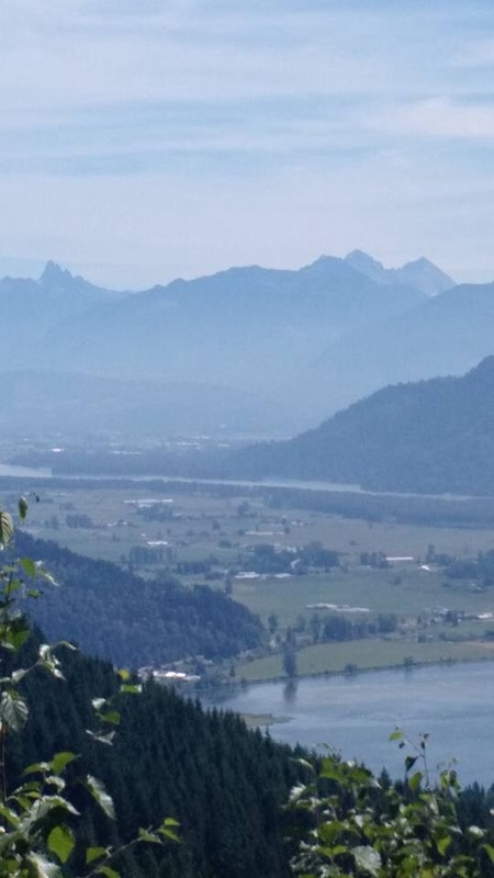
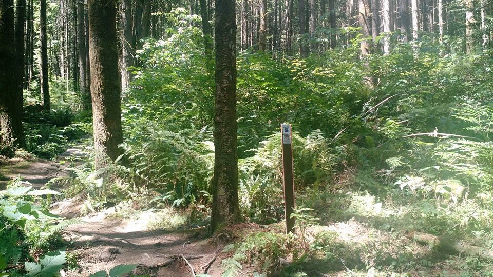
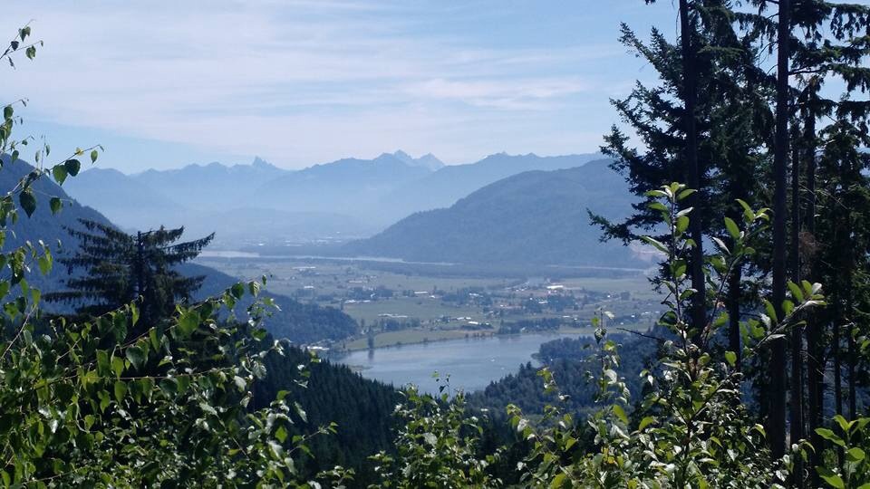
Bear Mountain

A lovely little hike with a surprise view at the top.  The trail up Bear Mountain is also sometimes known as Pioneer Trail however we didn’t find any signage to that effect the day we went nor any pioneers for that matter.  What you will find are all kinds of mountain biking trails that we thought doubled really well as hiking trails.


Directions: Head east on the Lougheed Highway and turn left at Dewdney Trunk Road where there’s a Co-Op gas station on the corner.  The road bends and curves and eventually you will drive by Westminster Abbey.  Shortly after turn right on Stave Lake Street.  Soon you come to an intersection where you have to turn right to stay on Stave.  Don’t turn, keep going straight.  The road is now Doyle.  When you get to an intersection with Richards Street, continue straight.  It’s a dead end and this is the trail head.  There’s a house on the right so don’t block their driveway.  

There’s no sign but enter the forest at the trail head. Right away there’s a Y intersection.  Stick to the left and cross and short wooden bridge.  Continue on this trail up through the forest.  You’ll know it’s a bike trail because of the curved/banked corners but we didn’t meet anyone else on the trail.  The bottom part has a few steeper sections but they’re short and flatten out quickly.  At one point we saw a sign on a tree for another trail named Cranks which headed down to the left a bit.  Just stay on the path and keep going up.  There’s minimal trail tape but you’ll cross a lot of little wooden bridges.  The forest is really beautiful and open and you see the sky peeking through almost the whole time so you think you must be almost near the top.  Eventually you will come to an intersection for a two trails called Corduroy (easy) and Bomba (more difficult). Turn right here and head up Bomba. It’s a little bit rockier than the rest of the trail but only for a very short distance … nothing to worry about.  All through the forest there are jumps and platforms for the mountain bikers.  Stay on Bomba and eventually you’ll come out of the forest at a sign that says Back Door (most difficult).  This is your marker to find your way back onto the trail.  Turn left and head up the gravel road for only about -300M to the top where it flattens out and you are rewarded with a beautiful view of the end of Hatzic Lake, the Fraser River, Sumas Mountain, Matsqui Prairie, and way off in the distance Mt. Baker, Slesse, and even Elk and Thurston!  The whole hike including a 20 min. stop up top was only 2 ½ hours.  There are other entrances to this mountain where you can find other ways to the top so it’s difficult to estimate the exact amount of elevation but the directions we had said it was 200M and 2.4kms return.  I can tell you for sure it was probably double that length and felt like we gained more than 200M.

Once you’re back down you’ll have time to head over to Cascade Falls to complete a really great day!


1 Comment

Yak Peak:  Coquihalla Highway by Carolyn Putt

8/3/2015

0 Comments

 
Picture
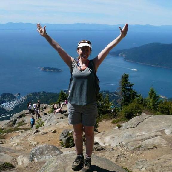
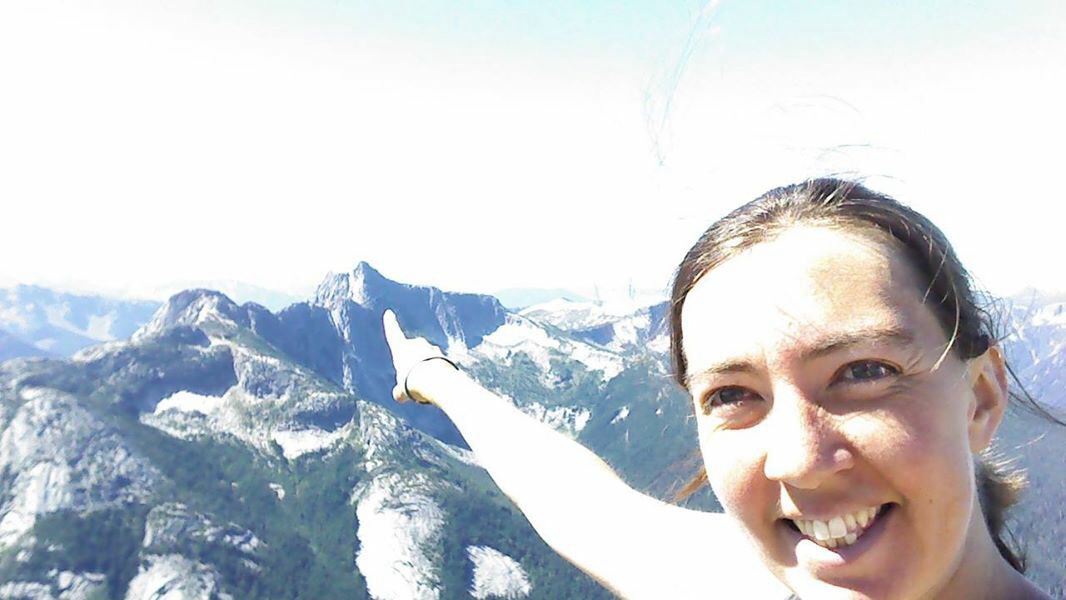
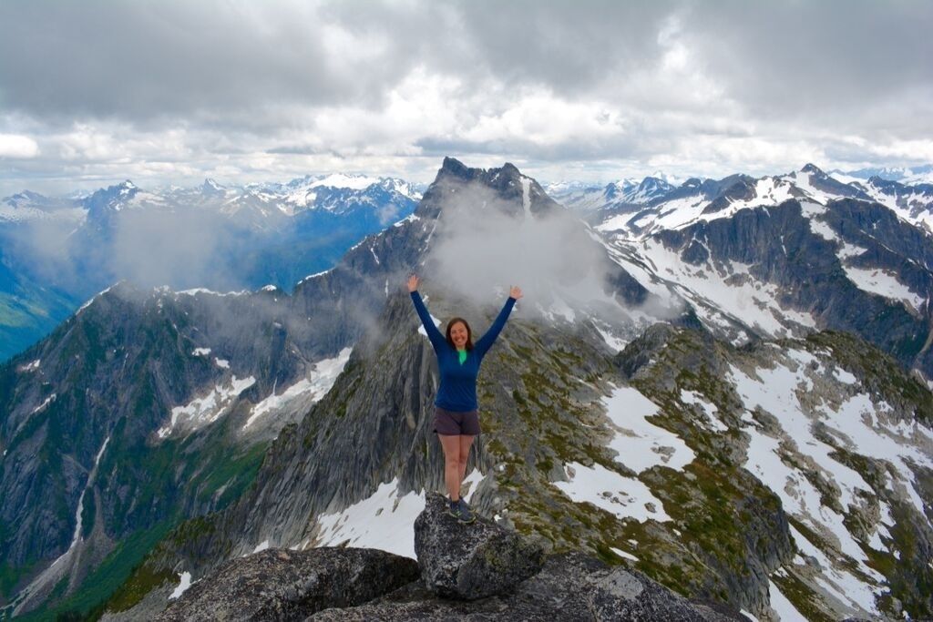
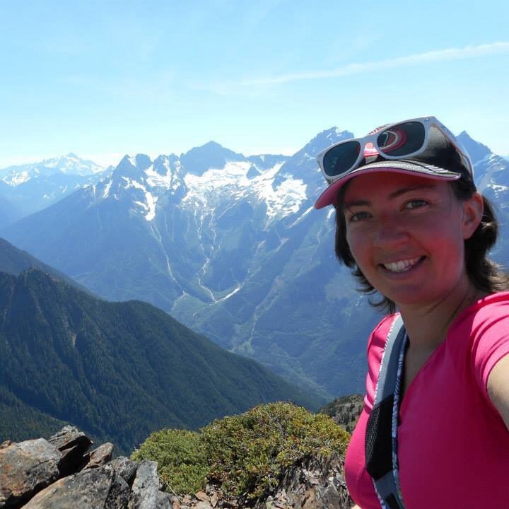
"Hiking from the bottom to the top of some of the highest mountains I've ever climbed has given me the confidence to climb many more." Carolyn Putt
Meet Carolyn Putt. She's my guest blogger...If I was to tell you about Carolyn this would be my description: She's a mountain goat, has a zest for life, a positive attitude, is friendly, educated, a peak seeker, has goals, photographer, writer and is involved in making her community, Chiliwack,  a better place. I have met Carolyn just once while I had lunch on the Flatiron/Needle Peak Trail. Her all time favorite hike...I had been following her adventures through a Chilliwack hiking page we are both part of. I'm thrilled & grateful to have her as my guest blogger...Here's her adventure at Yak Peak!
Lori aka Scaredy Cat

By Carolyn Putt~

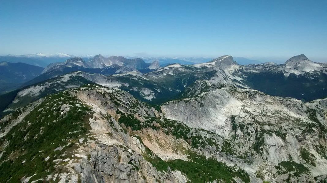
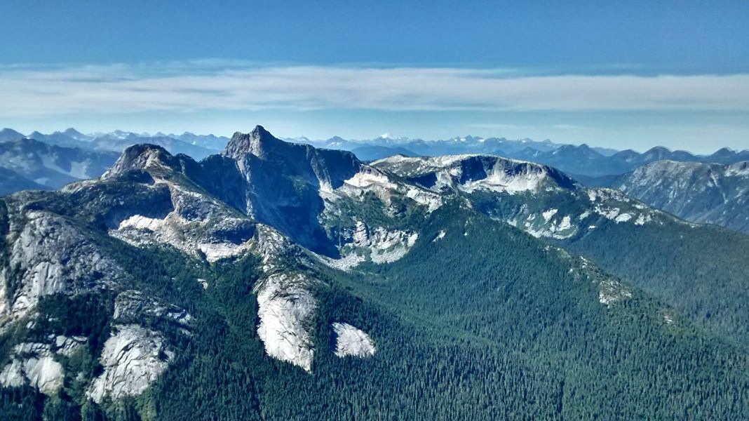
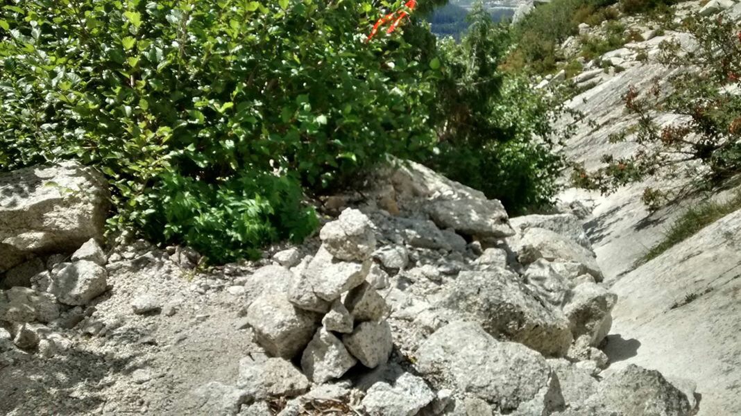
5.5-6hrs? I scoffed as I started heading down from Yak Peak. Ha. Who gave those time estimates? I’ll be done in 4 hours, and that’s with a 45minute break at the summit! All those hiking sites always over-estimate timings. 
Right? Or not. Turns out that 2 hours up, 45minutes at the top, and 3 hours down, puts me right in their time estimate.  Here’s hoping that if you’re reading this, you can learn from my mistakes, and NOT take 3 hours to get down, when 1.5hrs should really suffice!
I had attempted to hike Yak Peak back in the Spring, but only made it about half way, as snow and icy conditions got in the way (and made for a whole lotta slips on the way back down).
This time round, jet lag woke me up nice and early on a Saturday morning, and so since I’d been out of the country for a few weeks, busily visiting people, and missing my mountains, I took off for a solo hike (yes, yes, I did let someone know where I was going and what my plan was!).
Parking at the truck stop at Zopkios (same exit as for Needle Peak), I walked East up the off ramp of the highway. Other posts I read said to county 5 lamp posts from when you hit the highway at the start of the off ramp….. I counted 8, and then on your left you should spot a pretty dilapidated traffic cone that marks the start of the trail. It’s pretty overgrown down to where you cross a little stream (which was an awesomely perfect place to cool off at the end of the hike!!), and then head into the forest.
The trail goes up for the first 30min ish, nice and steep to get your heart going right off the bat. A few parts of the trail were blocked with tree fall, but it was always easy enough to find a way around, and though I went off the main path a couple times, always ended up back on the real trail soon enough – just keep heading up!
Breaking out of the trees, you hit a nice little boulder field, with very well-marked cairns showing you the path of least resistance up. The exit is right at the top middle of the boulder field, and then suddenly you’re at the base of the mammoth slab of rock that is Yak Peak! I heard voices as I made my way through the boulders, and at this point, realized they were coming from 3 guys scaling the rock face. Glad I wasn’t taking that way up!
Turning right, the trail skirts along the base of the rock face, and then up along the side of it, over rocks and weaving in and out of some tree patches.  This part of the trail is “exposed” as in you can definitely look down and see all the way down to the highway below you, but not exposed in the sense that if you fall you’re going to tumble to your death. It all felt pretty safe, but perhaps not for someone with a fear of heights.
Soon you hit a couple sheer rock sections you get to climb up – one has a nice sturdy rope to help climb, and the other actually has a trail that goes into the trees so you can avoid it if you want to. (On the way down, as you reach this section again, when you hit the sheer rock face and think “wait a second, I have to slide down that???”, look to your right and remember that there is a trail in the trees that gets you around it nice and safe!!).  You may be tempted (as the couple in front of me did) to leave your poles behind here, as hands become very handy in the next section of rocks…… but if you can fold your poles up, do so, as they will be very useful further up on your way down!
After a bit of steepness, the trail opens up completely, with no trees left, just lots of rock and little bushes along the ground (wild blueberries!!!!!!). This part of the trail doesn’t look steep, but as you move along it, your legs will make you realize that you are in fact still gaining a good chunk of elevation! Lose rock and pebbles take over here, which is fine on the way up, but coming back down it is NOT as fun, which is where poles would come in quite handy. This was probably the sketchiest part of the trail, with lots of slipping and sliding.
The trail is very easy to follow the whole way along, and brings you to a small col between the false peak (which you were probably thinking, as I was, was the real peak that whole hike up), to you left, and the real summit to your right. Visit both, as neither are very far!! The peak itself is actually HUGE, with lots of rocks and views to explore – and unlike Needle Peak over on the other side of the highway, not many people seem to visit it! The one other couple I saw only went to the false peak, and then I didn’t see anyone else till I was on my way down from the peak….. So I had it all to myself for a good 45 minutes of lunching and lying on a perfect flat rock.
The views at the top were AMAZING!!! A really neat new perspective of Needle Peak, and views out over Alpaca and Vicuna and hundreds of other peaks I couldn’t name.
The trek down, though slippery on the gravel, started off well. I was actually thinking about what I was going to write in this blog post, about how well-marked and easy to follow the trail was, when I suddenly realized I was stuck. I had made my way back to “the” boulder field, or so I thought…..but as I started down it, I soon hit a bunch of trees and brush and forest, which I tried to bushwack down through and across, figuring I must be just off the main boulder field somehow. Eventually I hit another boulder field, and made my way across it, looking for markers, but finding none. That boulder field ended, and I was out in the open, back at the base of the rock face. Not knowing whether I had gone too far, or not far enough. It was getting pretty hot out, and I was feeling pretty tired, as I’d spent the last hour bush-wacking and boulder hopping in the sun. I headed back East-ward, hoping I would see some tape, or recognize part of the trail. I got to the point where I had turned down into the boulder field….cause it looked like a really obvious trail…..just clearly the wrong one! I kept heading back and eventually spotted a guy in the distance, who had gone up after me. I was super relieved and figured I would wait for him and follow him down. BUT In the time it took me to text my friend to let her know I was saved, the guy disappeared!!!! NOOOOOOOOO.
My chance of rescue was lost. Ok, so that’s obviously a bit over dramatic, as I wasn’t really lost. I could see my car this whole time, I just couldn’t figure out how to get down to it! Plus, there were still a good 8hrs of daylight left, AND I had cell service.
I kept following the rock face over in the direction of where the guy was, and then, finally, saw some marking tape! And right there, was a little entrance into the bush that led to THE boulder field!!  It can definitely be easily missed if you aren’t really watching for it, and for the marking tape. I built a quick little cairn to hopefully help  anyone who may follow in my footsteps. It isn’t a huge one though cause I was really needing to find some shade and so didn’t want to stay any longer than necessary in the sun!
All was nice and easy from there on down, boulders, forest, STREAM and then back to the parking lot.
So without any detours, the trail can be done at a moderate (I was not going fast) pace in 4.5hrs no problem, even with a nice long break at the top.  Stats wise, Club Tred tells me the hike is 5.5kms return, with 825m elevation gain, which explains why my quads were feeling sore the next day 😉
I definitely felt like I deserved my nice big Frosty at Wendy’s after this.
0 Comments

    Author.

    I work for Surrey School District as an Education Assistant. In my free time I enjoy hiking, snowshoeing, going off-road, dragon boating, writing & hanging with my huskies.

    Archives

    March 2021
    November 2020
    October 2019
    September 2019
    March 2019
    September 2018
    December 2017
    October 2017
    September 2015
    August 2015
    June 2015
    April 2015
    March 2015
    February 2015
    January 2015
    December 2014
    November 2014
    October 2014
    August 2014
    July 2014
    June 2014
    May 2014
    April 2014
    March 2014
    October 2013
    September 2013
    July 2013
    June 2013

    Categories

    All

    RSS Feed

Proudly powered by Weebly
Photos used under Creative Commons from breyeschow, A Chilling Soul, iwona_kellie, CarbonNYC, simonov
  • Trail Information
    • The Hiking Trails & Safety Information >
      • Abby Grind: Abbotsford
      • Alder Flats: Golden Ears
      • Alouette Mtn: Golden Ears Provincial Park
      • Ancient Cedars Trail
      • Al's Habrich Ridge Trail: Sea to Sky Gondola
      • B.C.M.C. Grouse Mountain
      • Bear Mtn: Mission, BC
      • Big Cedar & Kennedy Falls: Mount Fromme
      • Blue Mountain:Coquitlam
      • Bosumarne Falls: Chilliwack, BC
      • Bowen Lookout:Cypress Mountain
      • Bridal Falls Lookout: Chilliwack-Agassiz
      • Brother's Creek: North Vancouver
      • Community Forest: Chilliwack
      • Community Forest-Gloria Lookout-Mt. Thurston-Elk Mtn-Chilliwack
      • Coquitlam Crunch: Coquitlam
      • Cheakamus Lake: Whistler
      • Crystal Falls: Coquitlam, BC
      • Dewdney Grind: Mission
      • Diez Vistas: Buntzen Lake
      • Dragon's Back: Hope, BC
      • East-West Connector Bridge Trail~Golden Ears Provincial Park
      • Eaton Lake: Hope
      • Elfin Lakes: Squamish
      • Elk Mountain: Chilliwack
      • Evan's Creek: Golden Ears Provincial Park
      • First Peak: Seymour Mountain
      • Ford Mtn: Chilliwack
      • Grouse Grind: West Vancouver
      • Garibaldi Lake: Squamish
      • Harrison Grind/Campbell Lake: Fraser Valley
      • Harrison Lookout/Fire Tower
      • Heather Trail: Manning Park
      • High Note Trail: Whistler
      • Hillkeep: Chilliwack
      • Hope Lookout Trail
      • Horne Lake Caves Provincial Park: Vancouver Island
      • Jacobson's Lake to Palmer Pond
      • Joffre Lakes: Pemberton
      • Jug Island: Belcarra Regional Park
      • Ladner Creek Train Trestle: Coquihalla Hwy
      • Killarney Lake: Bowen Island
      • Lake Lovely-Squamish
      • Larch Meadows: Manning Park
      • Levette Lake Loop: Squamish
      • Lewx Qwo:m (luhw KWOM): Chilliwack
      • Lindeman & Greendrop Lakes: Chilliwack
      • Lightning Lakes: Manning Park
      • Lindsay Lake Loop: Buntzen Lake
      • Little Douglas Lake: Coquihalla Summit
      • Lower Falls-East Canyon Parking Lot: Golden Ears
      • Lynn Loop: Lynn Headwaters Regiona Park
      • Lower Hollyburn: Cypress Mtn
      • Lynn Peak: Lynn Headwaters Regional Park
      • McKee Peak-Cliffside Caves
      • Mehatl Falls
      • Menzies: Golden Ears Provincial Park
      • Minnekhada Park: Coquitlam
      • Mount Cheam: Chilliwack
      • Mount Fromme: North Van
      • Mount Sleese to Memorial Plaque: Chiliwack
      • Mount St. Benedict: Mission
      • Mount Strachan: Mount Seymour
      • Mt. Thom: Chilliwack
      • Mt. Gardner: Bowen Island
      • Mt. Woodslide
      • Munro & Denette Lakes: Coquitlam
      • Mystery Lake: Mount Seymour
      • Needle Peak/Flatiron: Coquihalla Highway
      • Norvan Falls: Lynn Headwaters Regional Park
      • Othello Tunnels-Nicola Valley Loop
      • Parkhurst Ghost Town: Whistler
      • Panorama Ridge: Squamish
      • Petgill Lake: Howe Sound
      • Poland Lake-EC Manning Park
      • Quarry Rock: Deep Cove
      • Ravens Bluff-Mission
      • Red Mountain: Mission
      • Salmon Ridge Trail: Chilliwack, BC
      • Sandy Cove Trail: Harrison Hot Springs
      • Sasquatch Caves: Hope
      • Sea to Summit: Sea to Sky Gondola
      • Skyline: Grouse Mountain
      • Skyline 1: Manning Park
      • Spirit Caves-Yale, BC
      • St. Mark's: Cypress Mountain
      • Statlu Lake
      • The Stawamus Chief: Squamish
      • Tikwalus Trail: Spuzzum
      • Trickle Creek Treehouse
      • Thacker Mountain Trail: Hope
      • Tunnel Bluffs: Howe Sound
      • Vedder: Chilliwack
      • Watersprite Lake: Squamish
      • Wedgemont Lake: Whislter
      • Wells Peak
      • Widgeon Falls
      • Williams Peak
      • Windy Joe: Manning Park
      • Woodland Walk to Sawblade Falls
      • Zoa Peak: Coquihallia Hwy
    • The Snowshoe Trails & Safety Info >
      • Artist Point
      • Bowen Lookout
      • Dog Mountain: Day
      • Callaghan Valley
      • Dog Mountain: Night
      • Eagle Bluffs
      • Elfin Lakes to Red Heather Hut >
        • Fat Dog
        • First Pump
        • Hollyburn
        • Lightning Lakes Loop
        • Rainbow Lake
        • Sasquatch Mountain Snowshoe: Hemlock Valley
        • SS Grind
        • Stawberry Flats
        • Zoa
    • The U.S.A. Hikes >
      • Blue Lake: Northern Cascades
      • Chain Lakes
      • Damfino Lakes
      • Deception Pass State Park: Washington, USA
      • Oyster Dome
      • Yellow Aster Butte
    • The Trail Walks >
      • Aldergrove Regional Park: Aldergrove
      • Blue Heron Reserve: Chilliwack
      • Brae Island: Fort Langley
      • Burn's Bog: Delta
      • Burnaby Lake Loop: Burnaby
      • Campbell Valley: Langley
      • Cathederal Grove: MacMillian Provincial Park:
      • Delta Watershed
      • East Sector Lands: Harrison Hot Springs
      • Elgin Park: Surrey, BC
      • Green Timbers: Surrey
      • High Knoll Park: Surrey
      • Houston Trail: Fort Langley
      • Katzie Marsh Loop: Pitt Meadows
      • Lower Falls: Golden Ears: Maple Ridge
      • Lower Seymour Conservation: North Vancouver
      • Lighthouse Park: West Vancouver
      • Mud Bay: Surrey
      • Redwood Park: Surrey
      • Reifel Bird Santuary: Delta
      • Rice Lake: North Vancouver
      • Richmond Nature Park: Richmond
      • Rolley Lake: Mission
      • Ruth Johnson Park: White Rock
      • Sasamat Lake: Port Moody
      • Spirea Trail: Golden Ears
      • Sunnyside Urban Forest: Surrey
      • Serpentine Bird Santuary
      • Shoesmith East Trail Loop: Maple Ridge
      • Spirit Trail: Ladner
      • Stanley Park Seawall: Vancouver
      • Sye'xw Cho'teqw Adventure Park
      • The Jetti: Iona Beach, Richmond
      • Tynehead
      • Yew Lake
  • My Blogging
  • Jorullo Bridge Hiking Tour Puerto Vallarta, Mexico
  • Mt. Kilimanjaro
  • In the River Valley Hikes
  • West Coast Trail
  • Peru
  • Hiking Snapshots
    • Thru Hikes
    • Bears & Cougars +
    • Proper Hiking Footwear
    • Trail Etiquette
  • Blog