My BlogGing
|
By Harold Wiebe 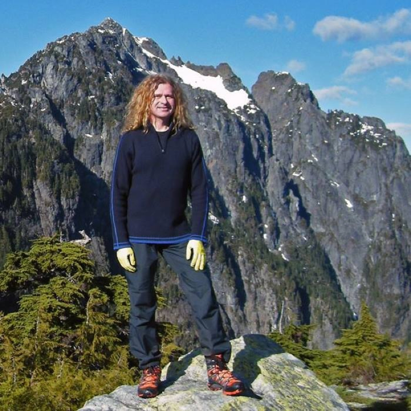
Harold on one of his recent climbs.
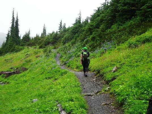
My son James and I went up Mount Nutt today, looking forward to some route finding and GPS work and thinking it was a bushwack all the way but were suprised by a well marked, well maintained, easy to follow steep trail. I had read trip reports of a bushwack starting at the high point of the East Canyon trail up Nutt to a ridge, heading south, crossing over up and down, and then descending down in a loop to a point on the East Canyon Trail again but closer to the parking lot. I had decided to take the nearer leg of the loop, closer to the parking lot, and see how far we could get. We had our maps and compasses and GPS all fired up but were a bit taken aback by all the markers and trail work done in that area. Nevertheless we headed straight up the mountain and made it to what I call the false summit in under 3 hours. Note: not all maps agree on where the summit of Mount Nutt actually is. The Ridge Meadows hiking club had made a nice but steep trail to one of the sub peaks of the Mount Nutt ridge. I had been interested in this ridge because of the vantage points of some old friends that I might get. Old friends like Robie Reid, Judge Howay, Golden Ears, Edge Peak, Blanshard Needle and others. The first part of the trail simply follows the East Canyon Trail a little over a kilometer and then turns right at a sign that says "Mount Nutt Viewpoints-difficult". Head up that and begin to really gain the 1288 m in elevation in a couple of kilometers if you go as far as us, but if you stay at the viewpoints that the Ridge Meadows club has provided you'll still ascend to 1087 m. The trail takes you past 2 minor viewpoints along the way, each to views of parts of Alouette lake that you probably have never seen before. The trail gives you a bit of relief and takes you through old growth forest with a mossy bed. The final 2 views are of Alouette Lake where it narrows, and on the other side of the ridge, a few minutes away, of the whole Golden Ears massif. This last view is noteworthy because you can see laid out before you, side by side, the Alder Flats and Evans Creek scree slopes. I managed to convice James to continue along the ridge, bushwacking our way to the edge of the gap between us and the peak until I could catch a glimpse of Robie Reid. We managed to do that and stay within our turn-around time window to get out of the park before the gate closed. How annoying that closure is! My recomendation: if you're a fan of Golden Ears Park then definitely do this this one to see things from a new perspective. If you generally just like the park and you enjoy a good steep workout with a nice view while you eat you lunch, then go for it too. Elevation gain: 1087m over 4.7 km. James and I hiked there and back in 5 hrs and 10 min. Harold Wiebe is a core music teacher with Surrey Schools. In his spare time he enjoys recording music, spending time with his wife, Bobbie, and his children. Harold comes alive in the mountains and can pretty much name them all. For more information on Mount Nutt check out his FB post here: https://www.facebook.com/harold.wiebe/posts/10152682686131190 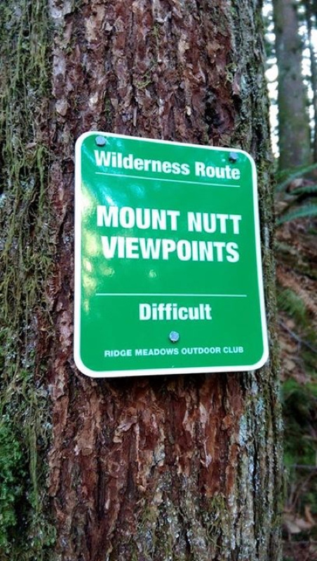
The sign says it all.
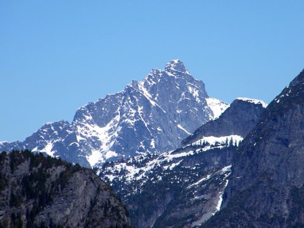
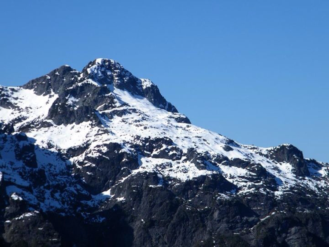
The Judge.
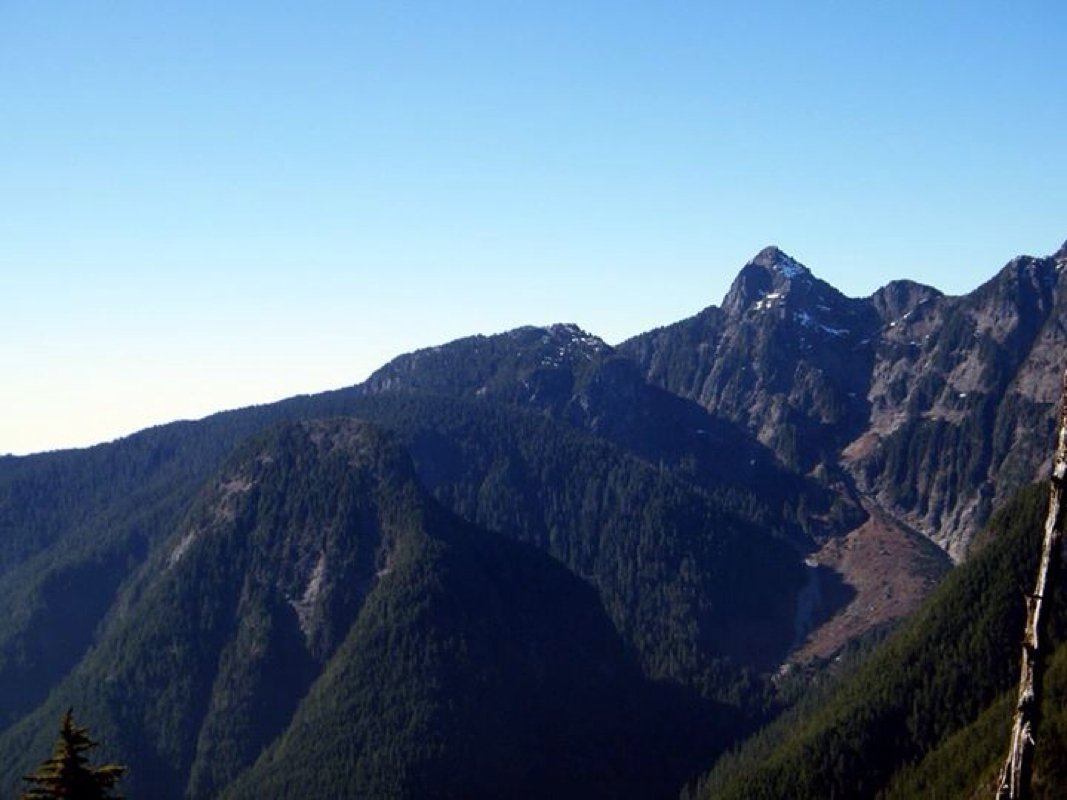
L-R: Evans, Alouette & Blanshard Needle
Golden Ears
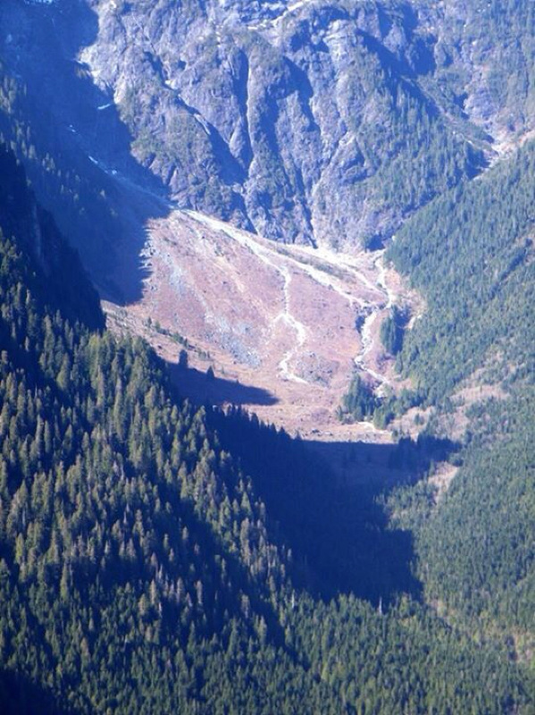
Alder Flats scree slope.
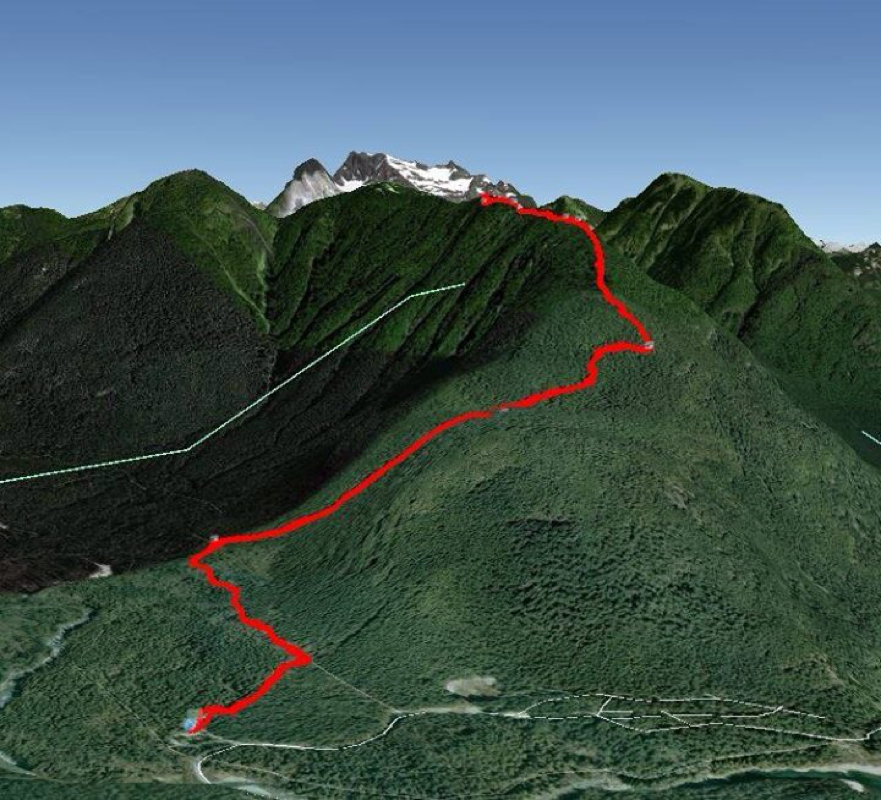
Harold & James route.
0 Comments
Leave a Reply. |
Author.I work for Surrey School District as an Education Assistant. In my free time I enjoy hiking, snowshoeing, going off-road, dragon boating, writing & hanging with my huskies. Archives
March 2021
Categories |
 RSS Feed